Appendix - Phase 1 Fish Passage Assessment Data and Photos
| Location and Stream Data |
|
Crossing Characteristics | – |
|---|---|---|---|
| Date | 2022-08-14 | Crossing Sub Type | Bridge |
| PSCIS ID | 6731 | Diameter (m) | 12 |
| External ID | – | Length (m) | 5 |
| Crew | MW | Embedded | – |
| UTM Zone | 10 | Depth Embedded (m) | – |
| Easting | 532823 | Resemble Channel | – |
| Northing | 6072543 | Backwatered | – |
| Stream | Tributary to Anzac River | Percent Backwatered | – |
| Road | Chuchinka-Colbourne FSR | Fill Depth (m) | – |
| Road Tenure | Resource Demographic | Outlet Drop (m) | – |
| Channel Width (m) | – | Outlet Pool Depth (m) | – |
| Stream Slope (%) | – | Inlet Drop | – |
| Beaver Activity | – | Slope (%) | – |
| Habitat Value | – | Valley Fill | – |
| Final score | 0 | Barrier Result | Passable |
| Fix type | – | Fix Span / Diameter | – |
Photos: PSCIS ID 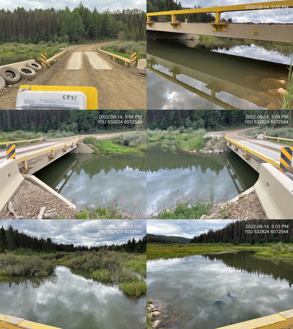 . From top left clockwise: Road/Site Card, Barrel, Outlet, Downstream, Upstream, Inlet.6731 . From top left clockwise: Road/Site Card, Barrel, Outlet, Downstream, Upstream, Inlet.6731
|
|||
| Comments: Bridge was recently installed since 2019. 16:57 |
| Location and Stream Data |
|
Crossing Characteristics | – |
|---|---|---|---|
| Date | 2022-08-14 | Crossing Sub Type | Round Culvert |
| PSCIS ID | 6824 | Diameter (m) | 1.6 |
| External ID | – | Length (m) | 14 |
| Crew | MW AI | Embedded | No |
| UTM Zone | 10 | Depth Embedded (m) | – |
| Easting | 536665 | Resemble Channel | No |
| Northing | 6076345 | Backwatered | Yes |
| Stream | Tributary to Anzac River | Percent Backwatered | 100 |
| Road | Chuchinka-Crocker FSR | Fill Depth (m) | 1.2 |
| Road Tenure | Resource Demographic | Outlet Drop (m) | 0 |
| Channel Width (m) | 3 | Outlet Pool Depth (m) | 0.6 |
| Stream Slope (%) | 0.5 | Inlet Drop | No |
| Beaver Activity | Yes | Slope (%) | 1.5 |
| Habitat Value | Medium | Valley Fill | Deep Fill |
| Final score | 21 | Barrier Result | Barrier |
| Fix type | Replace with New Open Bottom Structure | Fix Span / Diameter | 15 |
Photos: PSCIS ID 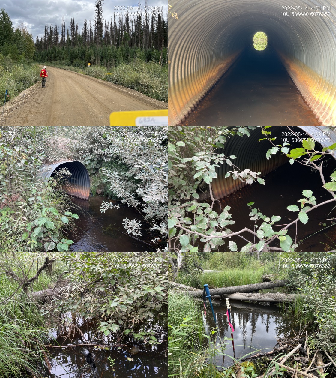 . From top left clockwise: Road/Site Card, Barrel, Outlet, Downstream, Upstream, Inlet.6824 . From top left clockwise: Road/Site Card, Barrel, Outlet, Downstream, Upstream, Inlet.6824
|
|||
| Comments: Channel with and gradient estimated. Culvert is fully backwatered due to beaver dams at this time and passable but might be a good idea to assess flow velocities in the spring at higher flows. Habitat confirmation could be conducted to get an idea of fish values and habitat values to inform if are an issue. 15:54 |
| Location and Stream Data |
|
Crossing Characteristics | – |
|---|---|---|---|
| Date | 2022-08-16 | Crossing Sub Type | Round Culvert |
| PSCIS ID | 124963 | Diameter (m) | 1 |
| External ID | – | Length (m) | 12 |
| Crew | AI MW | Embedded | No |
| UTM Zone | 10 | Depth Embedded (m) | – |
| Easting | 559940 | Resemble Channel | No |
| Northing | 6046827 | Backwatered | No |
| Stream | Tributary to Parsnip River | Percent Backwatered | – |
| Road | Chuchinka-Arctic FSR | Fill Depth (m) | 0.5 |
| Road Tenure | Resource Demographic | Outlet Drop (m) | 0.2 |
| Channel Width (m) | 2.7 | Outlet Pool Depth (m) | 0.6 |
| Stream Slope (%) | 1.5 | Inlet Drop | No |
| Beaver Activity | No | Slope (%) | 3 |
| Habitat Value | Medium | Valley Fill | Deep Fill |
| Final score | 31 | Barrier Result | Barrier |
| Fix type | Replace with New Open Bottom Structure | Fix Span / Diameter | 15 |
Photos: PSCIS ID 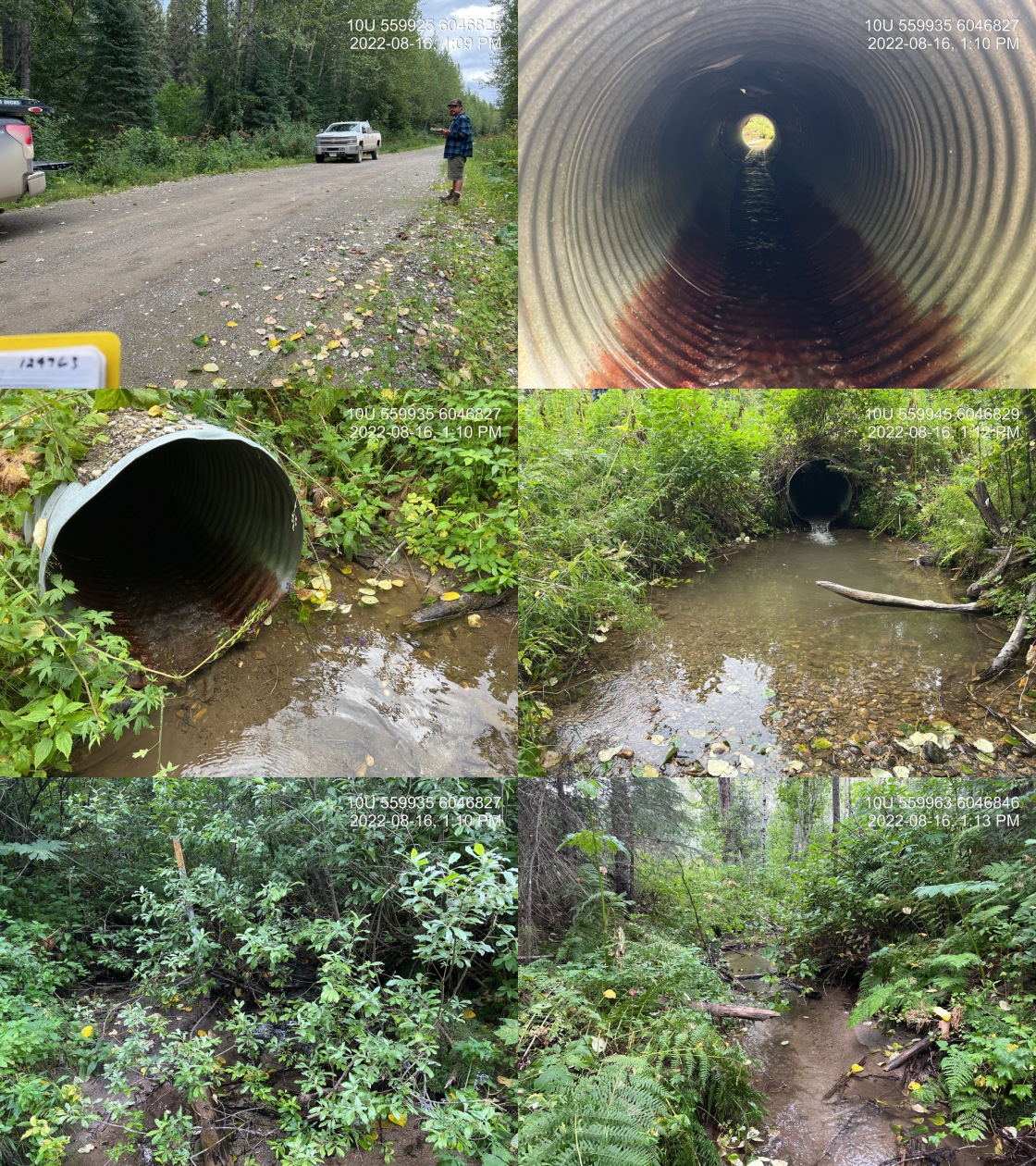 . From top left clockwise: Road/Site Card, Barrel, Outlet, Downstream, Upstream, Inlet.124963 . From top left clockwise: Road/Site Card, Barrel, Outlet, Downstream, Upstream, Inlet.124963
|
|||
| Comments: 0.54236111111111118 |
| Location and Stream Data |
|
Crossing Characteristics | – |
|---|---|---|---|
| Date | 2022-08-15 | Crossing Sub Type | Round Culvert |
| PSCIS ID | 125000 | Diameter (m) | 1.5 |
| External ID | – | Length (m) | 18 |
| Crew | MW AI | Embedded | No |
| UTM Zone | 10 | Depth Embedded (m) | – |
| Easting | 577540 | Resemble Channel | No |
| Northing | 6038199 | Backwatered | No |
| Stream | Tributary to Parsnip River | Percent Backwatered | – |
| Road | Chuchinka-Arctic FSR | Fill Depth (m) | 2.5 |
| Road Tenure | Resource Demographic | Outlet Drop (m) | 0.6 |
| Channel Width (m) | 4.52 | Outlet Pool Depth (m) | 2 |
| Stream Slope (%) | 1.5 | Inlet Drop | No |
| Beaver Activity | No | Slope (%) | 2 |
| Habitat Value | Medium | Valley Fill | Deep Fill |
| Final score | 34 | Barrier Result | Barrier |
| Fix type | Replace with New Open Bottom Structure | Fix Span / Diameter | 15 |
Photos: PSCIS ID 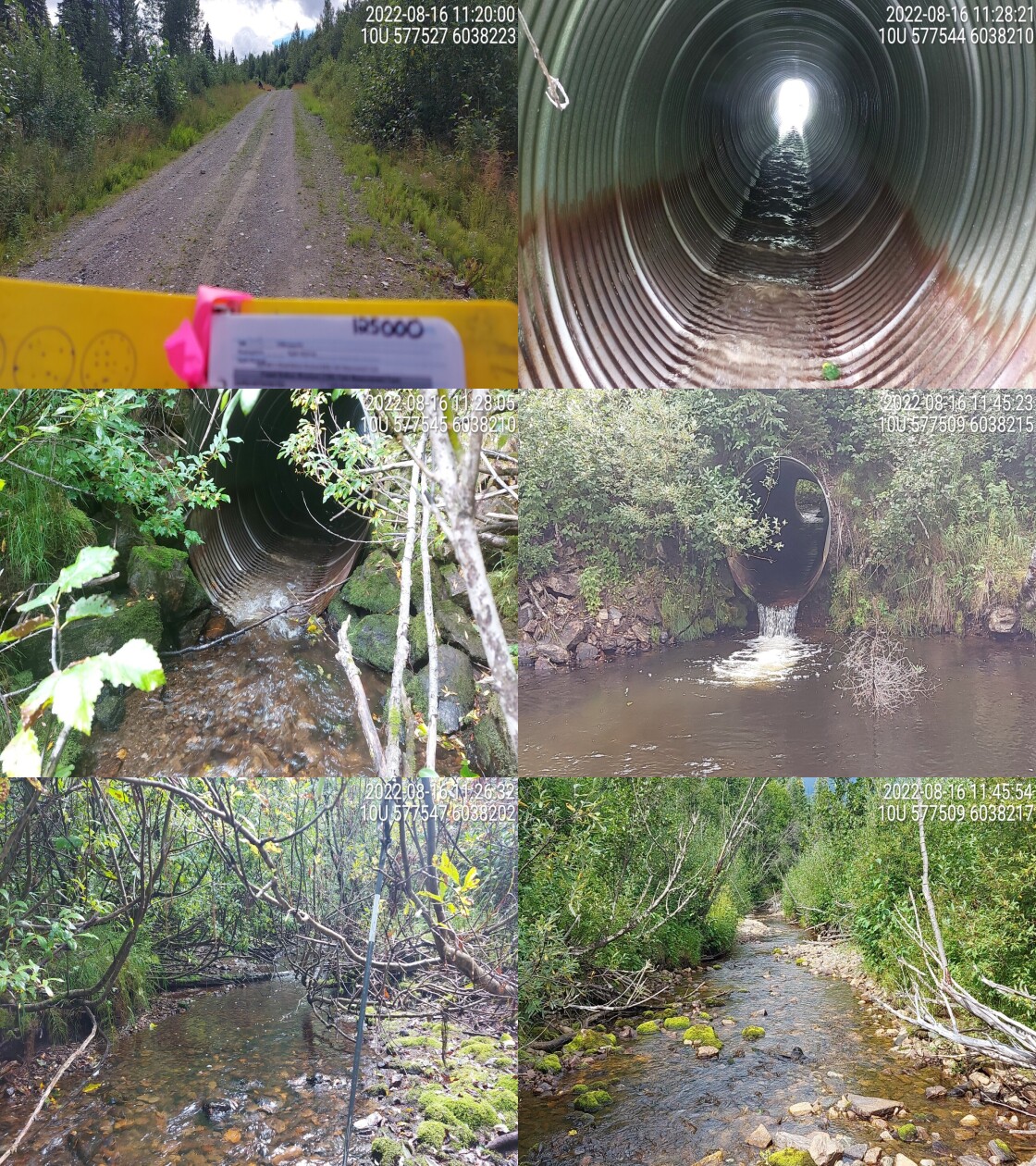 . From top left clockwise: Road/Site Card, Barrel, Outlet, Downstream, Upstream, Inlet.125000 . From top left clockwise: Road/Site Card, Barrel, Outlet, Downstream, Upstream, Inlet.125000
|
|||
| Comments: Habitat survey done with drone. 11:15:00 AM |
| Location and Stream Data |
|
Crossing Characteristics | – |
|---|---|---|---|
| Date | 2022-08-16 | Crossing Sub Type | Bridge |
| PSCIS ID | 125179 | Diameter (m) | 12.5 |
| External ID | – | Length (m) | 4 |
| Crew | AI | Embedded | – |
| UTM Zone | 10 | Depth Embedded (m) | – |
| Easting | 570307 | Resemble Channel | – |
| Northing | 6052836 | Backwatered | – |
| Stream | Tributary to Missinka River | Percent Backwatered | – |
| Road | Chuchinka-Missinka FSR | Fill Depth (m) | – |
| Road Tenure | Resource Demographic | Outlet Drop (m) | – |
| Channel Width (m) | – | Outlet Pool Depth (m) | – |
| Stream Slope (%) | – | Inlet Drop | – |
| Beaver Activity | – | Slope (%) | – |
| Habitat Value | – | Valley Fill | – |
| Final score | 0 | Barrier Result | Passable |
| Fix type | – | Fix Span / Diameter | – |
Photos: PSCIS ID 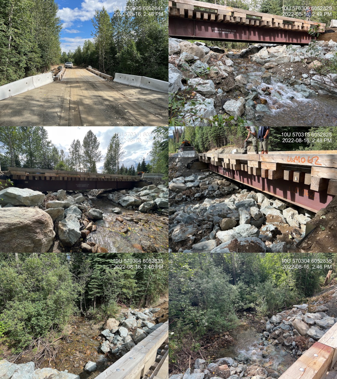 . From top left clockwise: Road/Site Card, Barrel, Outlet, Downstream, Upstream, Inlet.125179 . From top left clockwise: Road/Site Card, Barrel, Outlet, Downstream, Upstream, Inlet.125179
|
|||
| Comments: Riprap is 6.7m wide on east and 4.7m wide on west. Riprap cascade downstream of structure ~5m. |
| Location and Stream Data |
|
Crossing Characteristics | – |
|---|---|---|---|
| Date | 2022-08-14 | Crossing Sub Type | Bridge |
| PSCIS ID | 198320 | Diameter (m) | 15.3 |
| External ID | 16603769 | Length (m) | 5 |
| Crew | AI MW | Embedded | – |
| UTM Zone | 10 | Depth Embedded (m) | – |
| Easting | 537168 | Resemble Channel | – |
| Northing | 6075496 | Backwatered | – |
| Stream | tributary to Anzac River | Percent Backwatered | – |
| Road | Fern Valley | Fill Depth (m) | – |
| Road Tenure | – | Outlet Drop (m) | – |
| Channel Width (m) | – | Outlet Pool Depth (m) | – |
| Stream Slope (%) | – | Inlet Drop | – |
| Beaver Activity | No | Slope (%) | – |
| Habitat Value | – | Valley Fill | – |
| Final score | 0 | Barrier Result | Passable |
| Fix type | – | Fix Span / Diameter | – |
Photos: PSCIS ID 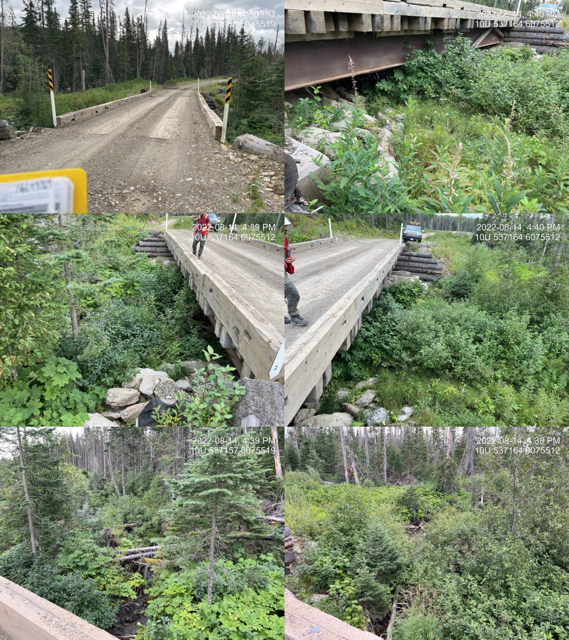 . From top left clockwise: Road/Site Card, Barrel, Outlet, Downstream, Upstream, Inlet.16603769 . From top left clockwise: Road/Site Card, Barrel, Outlet, Downstream, Upstream, Inlet.16603769
|
|||
| Comments: Bridge, overgrown vegetation at inlet and outlet. 16:35:00 |
| Location and Stream Data |
|
Crossing Characteristics | – |
|---|---|---|---|
| Date | 2022-08-15 | Crossing Sub Type | Ford |
| PSCIS ID | 198321 | Diameter (m) | – |
| External ID | 16601271 | Length (m) | – |
| Crew | AI | Embedded | – |
| UTM Zone | 10 | Depth Embedded (m) | – |
| Easting | 535101 | Resemble Channel | – |
| Northing | 6068381 | Backwatered | – |
| Stream | Fern Creek | Percent Backwatered | – |
| Road | Spur | Fill Depth (m) | – |
| Road Tenure | Unclassified | Outlet Drop (m) | – |
| Channel Width (m) | – | Outlet Pool Depth (m) | – |
| Stream Slope (%) | – | Inlet Drop | – |
| Beaver Activity | No | Slope (%) | – |
| Habitat Value | – | Valley Fill | – |
| Final score | 0 | Barrier Result | Unknown |
| Fix type | – | Fix Span / Diameter | – |
Photos: PSCIS ID 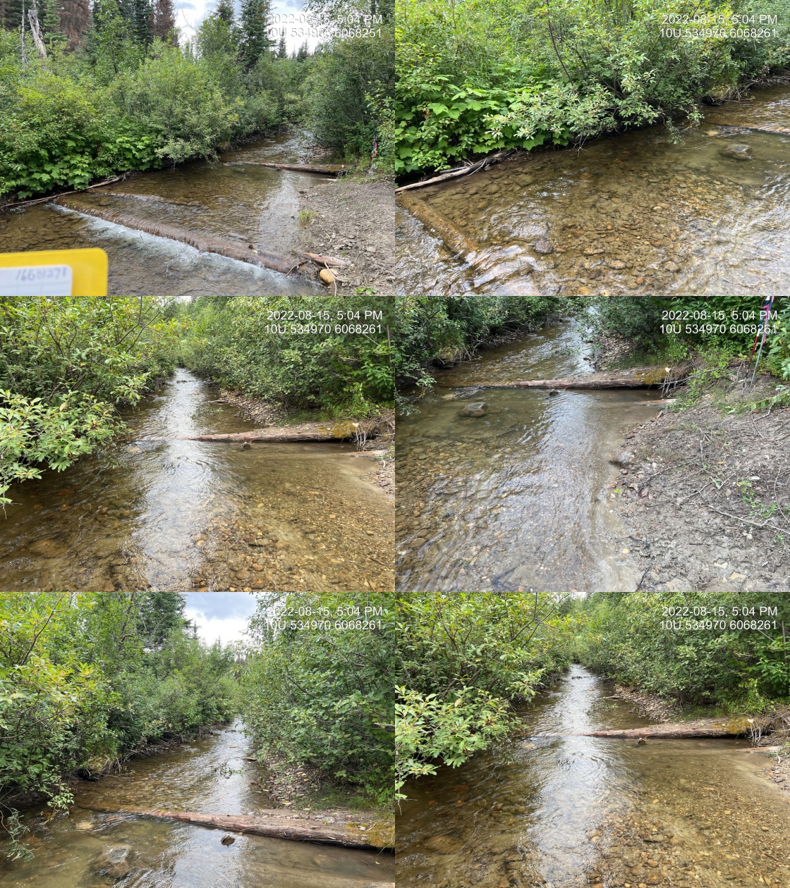 . From top left clockwise: Road/Site Card, Barrel, Outlet, Downstream, Upstream, Inlet.16601271 . From top left clockwise: Road/Site Card, Barrel, Outlet, Downstream, Upstream, Inlet.16601271
|
|||
| Comments: No ford or crossing. This appears to be the end of the accessible remnants of this rough ATV road. 17:06 |
| Location and Stream Data |
|
Crossing Characteristics | – |
|---|---|---|---|
| Date | 2022-08-17 | Crossing Sub Type | Ford |
| PSCIS ID | 198322 | Diameter (m) | – |
| External ID | 2022081750 | Length (m) | – |
| Crew | MW AI | Embedded | – |
| UTM Zone | 10 | Depth Embedded (m) | – |
| Easting | 575104 | Resemble Channel | – |
| Northing | 6051021 | Backwatered | – |
| Stream | tributary to Missinka River | Percent Backwatered | – |
| Road | Chuchinka-missinka FSR | Fill Depth (m) | – |
| Road Tenure | Unclassified | Outlet Drop (m) | – |
| Channel Width (m) | – | Outlet Pool Depth (m) | – |
| Stream Slope (%) | – | Inlet Drop | – |
| Beaver Activity | Yes | Slope (%) | – |
| Habitat Value | – | Valley Fill | – |
| Final score | 0 | Barrier Result | Unknown |
| Fix type | – | Fix Span / Diameter | – |
Photos: PSCIS ID 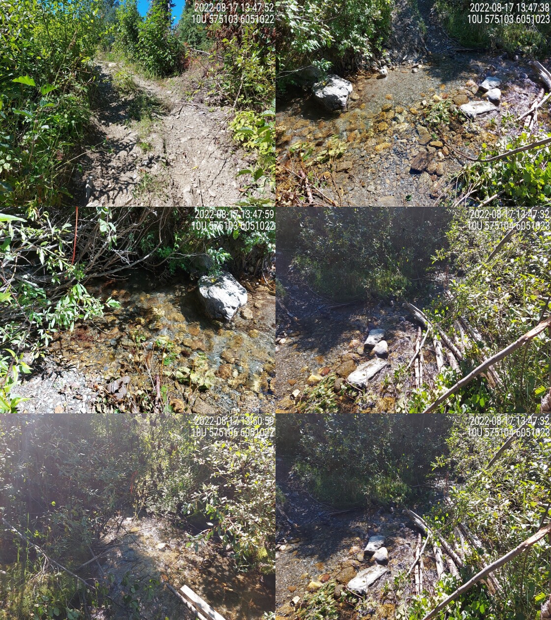 . From top left clockwise: Road/Site Card, Barrel, Outlet, Downstream, Upstream, Inlet.2022081750 . From top left clockwise: Road/Site Card, Barrel, Outlet, Downstream, Upstream, Inlet.2022081750
|
|||
| Comments: Located at a quad trail. 13:53 |