Waterfall Creek - 198116 & 198117 & 198115 - Appendix
Site Location
PSCIS crossing 198116 is located on Waterfall Creek, in the town of New Hazelton, BC. on Highway 16. Waterfall Creek is a tributary to Station Creek (a.k.a Mission Creek) with the Waterfall/Station confluence located approximately 4km downstream of the 10th avenue/Highway 16 crossing. The stream has been labelled in Donas (2022b) as North Waterfall Creek however this name has not been assigned in the freshwater atlas. The subject stream is mapped incorrectly in the BC freshwater atlas which documents it as a small drainage originating on the north side of Highway 16. In reality, the stream flows from an area south of town, through New Hazelton in a northern direction crossing under numerous road crossings and two CN railway crossings before joining with Station Creek (Figure 5.20). Due to the large size of the stream in the areas surveyed and the small stream size of Waterfall Creek documented in PSCIS at crossing 124456 the subject stream should be labelled Waterfall Creek in the freshwater atlas.
During 2022 field surveys, three previously un-assessed stream crossings located upstream of the upper most railway culverts (PSCIS 124423) were surveyed for fish passage (PSCIS 198117 on 9th avenue, 198116 on Highway 16/10th avenue and 198115 on 13th avenue). Downstream of these three crossings the stream flows through six more road/rail crossings before it’s confluence with Station Creek. A small bridge (modelled crossing 24704553 - a.k.a Mile 48) is located under the CN Railway approximately 875m upstream of the highway and at the time of reporting, there was an un-assessed crossing (1803294) on the subject tributary just upstream of it’s confluence with Waterfall Creek. Site surveys downstream in Waterfall Creek in 2021 along with review of aerial imagery indicate that modelled crossing 1803294 likely does not exist as the stream appears to run adjacent to the railway at this location and not cross the road. The location of modeled crossing 1803294 would need to be accessed from the west by crossing the CN Railway or from the east via a private road located behind gates to the New Hazelton sewage treatment facility.
Although the habitat confirmation assessment in this memo is detailed as for crossing 198116, the assessment conducted also covered areas downstream of 198117 and upstream of crossing 198115 so has significance for informing remediation of those culverts as well. The crossing locations were prioritized for follow up after field reconnaissance indicated that Waterfall Creek was mapped incorrectly in the BC Freshwater Atlas stream network and likely contained significant quantities of high value habitat for coho spawning and rearing.
As the subject tributary to Waterfall Creek was not mapped in the freshwater atlas at the location of these crossings at the time of reporting, there were no road stream crossings modeled as present in bcfishpass. As there were no crossings modeled, the software generated no estimates of fish habitat quantity. Crossing 198116 on Highway 16/10th avenue is the responsibility of the Ministry of Transportation and Infrastructure while crossings 198117 on 9th avenue and 198115 on 13th avenue are the responsibility of the District of New Hazelton.
my_caption = 'Map of Station Creek and Watershed Creek watersheds. Pink line indicates sections of tributary to Waterfall Creek that were surveyed and that at the time of reporting were not mapped correctly in the freshwater atlas.'

knitr::include_graphics('fig/waterfall.png')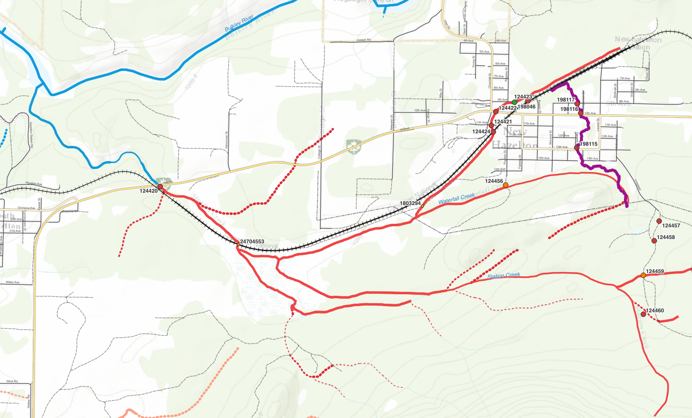
Figure 5.20: Map of Station Creek and Watershed Creek watersheds. Pink line indicates sections of tributary to Waterfall Creek that were surveyed and that at the time of reporting were not mapped correctly in the freshwater atlas.
Background
In 2021, fish passage and habitat confirmation assessments were conducted on Waterfall Creek downstream of the upper railway crossing (PSCIS 124423) as well as on Station Creek at Highway 16 (PSCIS 124420). Details of these assessments can be referenced in Irvine (2022) located here. Wilson and Rabnett (2007) report that the crossing structure located on Highway 16 and Station Creek (PSCIS 124420) has been the subject of numerous assessments and designs with respect to the rehabilitation of fish passage, and they rated this crossing as the highest priority for rehabilitation in the Bulkley River watershed. Gitxsan Watershed Authority reports that Xsan Xsagiibil was a fishing site located at the mouth of Station Creek (Xsi Gwin Sagiiblax) (Wilson and Rabnett 2007). Identified as a high priority for additional assessments by Rabnett and Williams (2004), SKR Consultants Ltd. (2006) conducted a detailed inspection, offered rehabilitation design options and identified the natural limits of potential fish distribution to support rehabilitation efforts. At the time of reporting, a design for remediation utilizing a retrofit of the existing structure to backwater the pipe was being drafted (Sean Wong, Environmental Programs Manager - Ministry of Transportation and Infrastructure pers. comm.).
A trap and truck operation led by the Chicago Creek Society moves coho from a fence set up near the confluence with the Bulkley River to upstream of Highway 16 on Waterfall Creek annually. Houlden, Houlden, and Donas (2001) report that the coho stocks in the system were wiped out in the late 1970s by the improper installation of PSCIS crossing 124420 located on Highway 16 west of New Hazelton. The Waterfall Creek Stream Rehabilitation Project began in 1990 to reintroduce coho to the stream with surplus stocks transplanted from Toboggan Creek near Smithers. In 1993 the Hazelton Elementary Streamkeepers program was developed to assist with the project and in 1995 the Chicago Creek Community Environmental Enhancement Society was incorporated to develop a hatchery nearby. The hatchery no longer operates but operations were considered successful with coho runs between 65 to over 1800 fish documented between 1998 - 2020 Donas (2022a).
There is a rich history of past assessment and restoration work in the watershed that is summarized in Donas (2022a). Work has included stream/habitat surveys, construction of spawning pads, riparian planting, construction of walkways/bridges and juvenile assessments (Donas 2022a; Nortec Consulting 2000). Donas (2022a) is a watershed recovery plan for the greater Station Creek watershed that was submitted to Fisheries and Oceans Canada in March of 2022. The report details coho escapement information for 2002 - 2021 gathered from the “Mission Creek” fence noting numbers have fallen below the target of 400 in 10 out of 20 years. They summarize juvenile overwintering study results indicate a decline in catch per unit effort over the last 10 years with condition of juveniles noted as declining. The document lays out a list of threats affecting coho recovery in the system which among others include connectivity, habitat degradation, loss of riparian cover, beaver dam removals and potential water quality issues. Finally, the recovery plan lays out goals, objectives and recommended activities to stop and reverse the decline of coho in the watershed.
At crossing 198116, Waterfall Creek is a second order stream. Upstream of crossing 198116, coho, cutthroat trout, rainbow trout and dolly varden have previously been recorded (Donas 2022a; MoE 2020b; Norris 2020). A map of the watershed is provided in map attachment 093M.107.
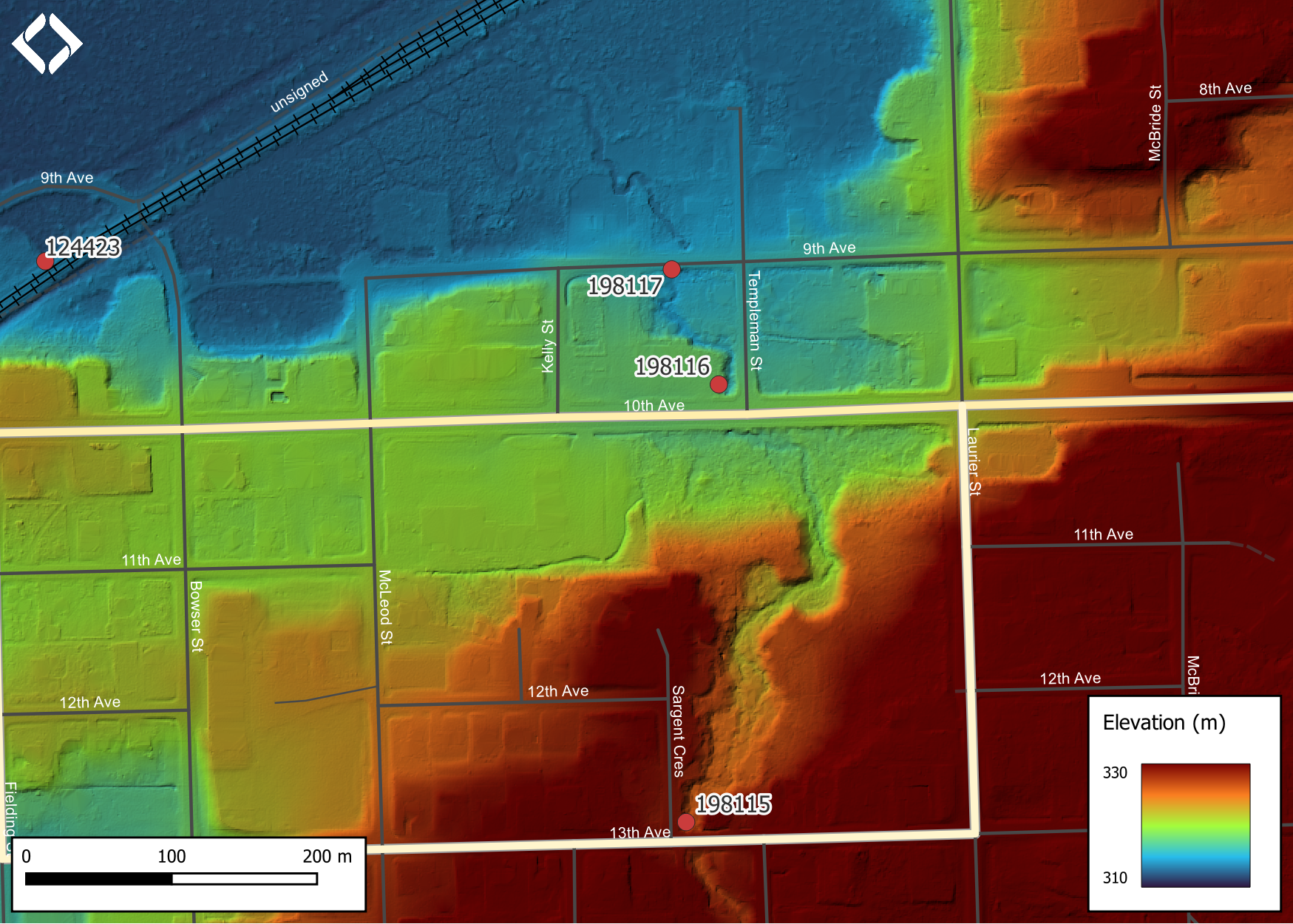
Figure 5.21: Lidar generated digital elevation model of tributary to Waterfall Creek (data collected in 2019, taken from BC Open LiDAR data portal).
Stream Characteristics at Crossing
At the time of the survey, PSCIS crossing 198116 was un-embedded, non-backwatered and ranked as a barrier to upstream fish passage according to the provincial protocol (MoE 2011b) (Table 5.25). Water temperature was 8\(^\circ\)C, pH was 8.1 and conductivity was 52uS/cm.
| Location and Stream Data |
|
Crossing Characteristics | – |
|---|---|---|---|
| Date | 2022-09-10 | Crossing Sub Type | Round Culvert |
| PSCIS ID | 198116 | Diameter (m) | 1.5 |
| External ID | – | Length (m) | 27 |
| Crew | AI | Embedded | No |
| UTM Zone | 9 | Depth Embedded (m) | – |
| Easting | 590233.2 | Resemble Channel | No |
| Northing | 6123183 | Backwatered | No |
| Stream | Waterfall Creek | Percent Backwatered | – |
| Road | Highway 16 | Fill Depth (m) | 1 |
| Road Tenure | MoTi | Outlet Drop (m) | 0 |
| Channel Width (m) | 3.9 | Outlet Pool Depth (m) | 0.2 |
| Stream Slope (%) | 2.5 | Inlet Drop | Yes |
| Beaver Activity | No | Slope (%) | 2.5 |
| Habitat Value | High | Valley Fill | Deep Fill |
| Final score | 24 | Barrier Result | Barrier |
| Fix type | Replace with New Open Bottom Structure | Fix Span / Diameter | 15 |
Photos: From top left clockwise: Road/Site Card, Barrel, Outlet, Downstream, Upstream, Inlet.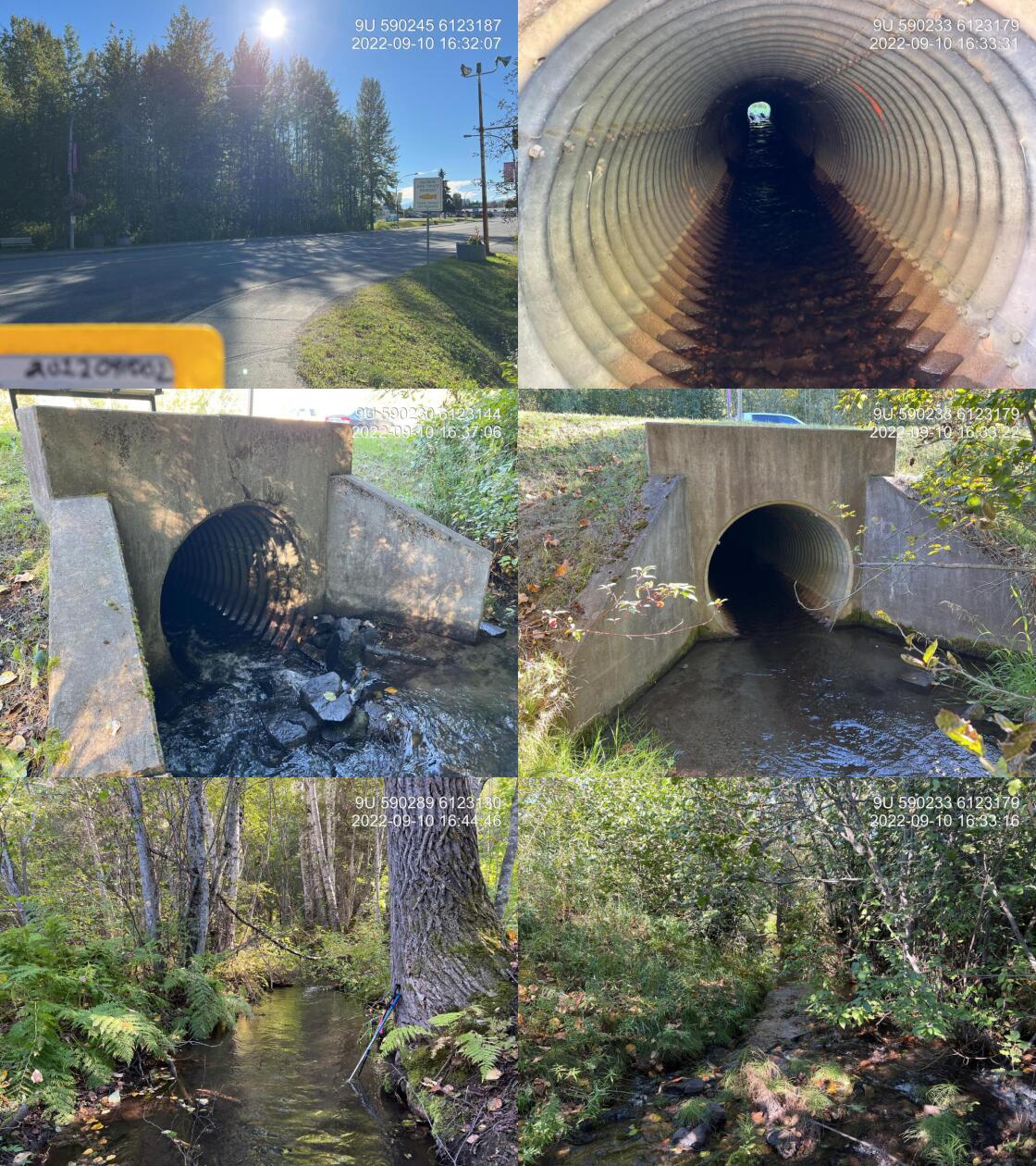
|
|||
| Comments: Stream is not mapped correctly in the freshwater atlas as it actually flows north through town. Great flow, patches of gravel suitable for coho spawning. Located right within the town of New Hazelton. Trap and truck coho operation occurring with spawners transplanted upstream of the railway and 14th avenue. 16:34 |
Stream Characteristics Downstream
The stream was surveyed downstream from crossing 198116 for 450m past PSCIS crossing 198177 (9th avenue) to approximately 220m upstream of PSCIS crossing 124423 on the CN railway (Figures 5.22 - 5.23). <<<<<<< Updated upstream Total cover amount was rated as abundant with overhanging vegetation dominant. Cover was also present as instream vegetation.The average channel width was 3m, the average wetted width was 2.8m, and the average gradient was 1%.The dominant substrate was fines with gravels sub-dominant. PSCIS crossing 198117 on 9th avenue was also ======= The average channel width was 3m, the average wetted width was 2.8m, and the average gradient was 1%.The dominant substrate was fines with gravels sub-dominant.Total cover amount was rated as abundant with overhanging vegetation dominant. Cover was also present as instream vegetation. PSCIS crossing 198117 on 9th avenue was also >>>>>>> Stashed changes assessed for fish passage and at the time of survey, the crossing was un-embedded, non-backwatered, and ranked as a barrier to upstream fish passage (Table 5.26).The stream flows through the town of New Hazelton. There was low flow at the time of survey and the stream contained a lot of waste and debris. There was a lot of cover from vegetation. The stream hits the railway and is drained into a tributary that flows west until it joins Station Creek. The habitat was rated as high value for salmonid rearing and spawning.
| Location and Stream Data |
|
Crossing Characteristics | – |
|---|---|---|---|
| Date | 2022-09-10 | Crossing Sub Type | Round Culvert |
| PSCIS ID | 198117 | Diameter (m) | 1.8 |
| External ID | 2022091003 | Length (m) | 19 |
| Crew | AI | Embedded | No |
| UTM Zone | 9 | Depth Embedded (m) | – |
| Easting | 590200.9 | Resemble Channel | No |
| Northing | 6123262 | Backwatered | No |
| Stream | Waterfall Creek | Percent Backwatered | – |
| Road | 9th Avenue | Fill Depth (m) | 1 |
| Road Tenure | New Hazelton | Outlet Drop (m) | 0.2 |
| Channel Width (m) | 2.6 | Outlet Pool Depth (m) | 0.1 |
| Stream Slope (%) | 1 | Inlet Drop | Yes |
| Beaver Activity | No | Slope (%) | 1 |
| Habitat Value | High | Valley Fill | Deep Fill |
| Final score | 29 | Barrier Result | Barrier |
| Fix type | Replace with New Open Bottom Structure | Fix Span / Diameter | 10 |
Photos: From top left clockwise: Road/Site Card, Barrel, Outlet, Downstream, Upstream, Inlet.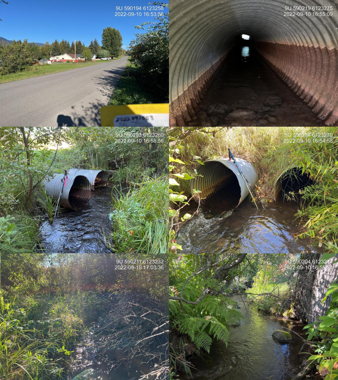
|
|||
| Comments: Two 0.9 pipe added together for width. Left pipe has significant blockage 1/3 of the way through the pipe. Right Bank of the stream has an empty lot with only grass and invasive weed riparian. 16:52 |
Stream Characteristics Upstream
The stream was surveyed upstream from crossing 198116 for 1200m to the location of a waterfall that blocks upstream migration for all life stages and species. (Figures 5.24 - 5.29). <<<<<<< Updated upstream The waterfall was estimated to be approximately 7m in height. The average channel width was 3.7m, the average wetted width was 3.5m, and the average gradient was 1.5%.The dominant substrate was fines with gravels sub-dominant.Total cover amount was rated as abundant with small woody debris dominant. Cover was also present as undercut banks.Total cover amount was rated as abundant with overhanging vegetation dominant. Cover was also present as undercut banks. There was a culvert ======= The waterfall was estimated to be approximately 7m in height. Total cover amount was rated as abundant with small woody debris dominant. Cover was also present as undercut banks.Total cover amount was rated as abundant with overhanging vegetation dominant. Cover was also present as undercut banks.The average channel width was 3.7m, the average wetted width was 3.5m, and the average gradient was 1.5%.The dominant substrate was fines with gravels sub-dominant. There was a culvert >>>>>>> Stashed changes approximately 400m upstream of PSCIS crossing 198116 that was also assessed. At the time of survey, this crossing was un-embedded, non-backwatered, and ranked as a barrier to upstream fish passage (Table 5.27). The habitat quality was excellent. The stream flow was moderate and there were fish spotted all the way up to the waterfall where the survey ended. An adult coho was seen upstream of crossing 198115. Cover from vegetation and undercut banks was noted as abundant. The habitat was rated as high value as an important migration corridor containing suitable spawning habitat and having high rearing potential for juvenile coho, rainbow trout, cuthtout trout and dolly varden.
| Location and Stream Data |
|
Crossing Characteristics | – |
|---|---|---|---|
| Date | 2022-09-10 | Crossing Sub Type | Round Culvert |
| PSCIS ID | 198115 | Diameter (m) | 1.25 |
| External ID | 2022091001 | Length (m) | 22 |
| Crew | AI | Embedded | No |
| UTM Zone | 9 | Depth Embedded (m) | – |
| Easting | 590210.7 | Resemble Channel | No |
| Northing | 6122882 | Backwatered | No |
| Stream | Waterfall Creek | Percent Backwatered | – |
| Road | 13 Avenue | Fill Depth (m) | 1.5 |
| Road Tenure | New Hazelton | Outlet Drop (m) | 0 |
| Channel Width (m) | 2.8 | Outlet Pool Depth (m) | 0.4 |
| Stream Slope (%) | 3 | Inlet Drop | Yes |
| Beaver Activity | No | Slope (%) | 1 |
| Habitat Value | High | Valley Fill | Deep Fill |
| Final score | 24 | Barrier Result | Barrier |
| Fix type | Replace with New Open Bottom Structure | Fix Span / Diameter | 10 |
Photos: From top left clockwise: Road/Site Card, Barrel, Outlet, Downstream, Upstream, Inlet.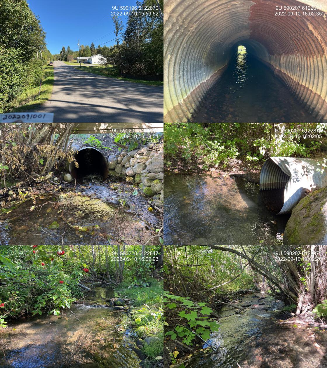
|
|||
| Comments: This is waterfall Creek. It does not show up in the freshwater atlas as here, however this is the main flow. Numerous fry and parr observed upstream of the crossing. No paper card for site. 16:03 |
Structure Remediation and Cost Estimate
Should restoration/maintenance activities proceed, replacement of PSCIS crossing 198116 on Highway 16 with a bridge (15m span) is recommended. The cost of the work is estimated at $7,500,000 for a cost benefit of 160 linear m/$1000 and 312 m2/$1000. Costs for replacement of the sites assessed on 9th avenue and 13th avenue with bridges are roughly estimated at /$2,000,000 dollars each.
Conclusion
The Waterfall Creek system is part of the greater Station/Mission Creek watershed and located directly in the community of New Hazelton. Although heavily impacted by urban and industrial development, this watershed provides valuable opportunities for public interaction with aquatic values and high potential for meaningful ecosystem function improvements. There is a long history of community led research, restoration and rehabilitation projects within the community which is likley to continue into the future through initiatives described in Donas (2022a). Although, at the time of assessment, it appeared that upstream migration of adult coho was unlikely to be hindered by the three crossings surveyed, conditions could degrade over time and passage through the structures by younger lifestages salmonids was likely already prevented at some flows. Ongoing research, monitoring and advocacy efforts by groups such as the Chicago Creek Society, Skeena Watershed Conservation Coalition and the Gitksan Watershed Authorities indicate that biological conditions in the stream have been worsening overtime. There was 1.2km of habitat upstream of crossing 198116 rated ashighvalue for salmonid rearing and spawning with all three crossings assessed (9th avenue, 10th avenue and 13th avenue) considered high priorities for proceeding to design for replacement. It could be considered that infrastructure upgrade dollars for the efforts also include funding for alternative restoration activities such as riparian enhancement, public education and research as this stream can be considered a valuable asset to the community providing extensive opportunities for restoration.
tab_hab_summary %>%
  filter(Site  == my_site) %>%
  # select(-Site) %>%
  fpr::fpr_kable(caption_text = paste0('Summary of habitat details for PSCIS crossing ', my_site, '.'),
scroll = F) | Site | Location | Length Surveyed (m) | Channel Width (m) | Wetted Width (m) | Pool Depth (m) | Gradient (%) | Total Cover | Habitat Value |
|---|---|---|---|---|---|---|---|---|
| 198116 | Downstream | 450 | 3.0 | 2.8 | 0.2 | 1.0 | abundant | high |
| 198116 | Upstream | 1200 | 3.7 | 3.5 | 0.3 | 1.5 | abundant | high |
my_photo1 = fpr::fpr_photo_pull_by_str(str_to_pull = '_d1_')

my_caption1 = paste0('Typical habitat downstream of PSCIS crossing ', my_site, '.')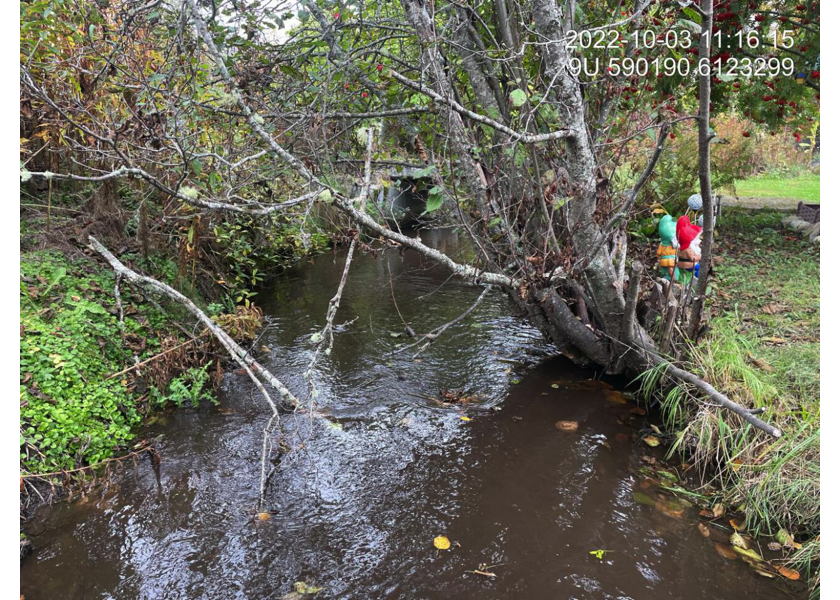
Figure 5.22: Typical habitat downstream of PSCIS crossing 198116.
my_photo2 = fpr::fpr_photo_pull_by_str(str_to_pull = '_d2_')

my_caption2 = paste0('Typical habitat downstream of PSCIS crossing ', my_site, '.')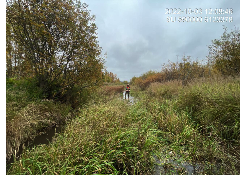
Figure 5.23: Typical habitat downstream of PSCIS crossing 198116.
my_caption <- paste0('Left: ', my_caption1, ' Right: ', my_caption2)

knitr::include_graphics(my_photo1)
knitr::include_graphics("fig/pixel.png")
knitr::include_graphics(my_photo2)
my_photo1 = fpr::fpr_photo_pull_by_str(str_to_pull = '_u1_')
my_caption1 = paste0('Gravel and cobble substrate immediately upstream of PSCIS crossing ', my_site, '.')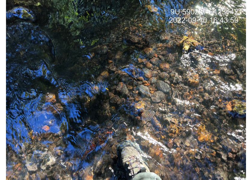
Figure 5.24: Gravel and cobble substrate immediately upstream of PSCIS crossing 198116.
my_photo2 = fpr::fpr_photo_pull_by_str(str_to_pull = '_u2_')

my_caption2 = paste0('Footbridge located upstream of PSCIS crossing ', my_site, '.')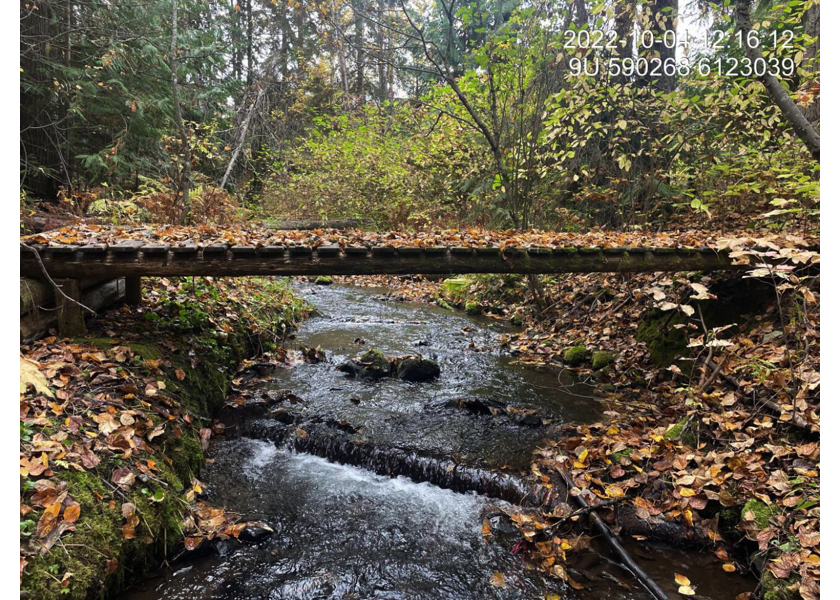
Figure 5.25: Footbridge located upstream of PSCIS crossing 198116.
my_caption <- paste0('Left: ', my_caption1, ' Right: ', my_caption2)

knitr::include_graphics(my_photo1)
knitr::include_graphics("fig/pixel.png")
knitr::include_graphics(my_photo2)
my_photo1 = fpr::fpr_photo_pull_by_str(str_to_pull = '_u3_')
my_caption1 = paste0('Typical habitat upstream of PSCIS crossing ', my_site, '.')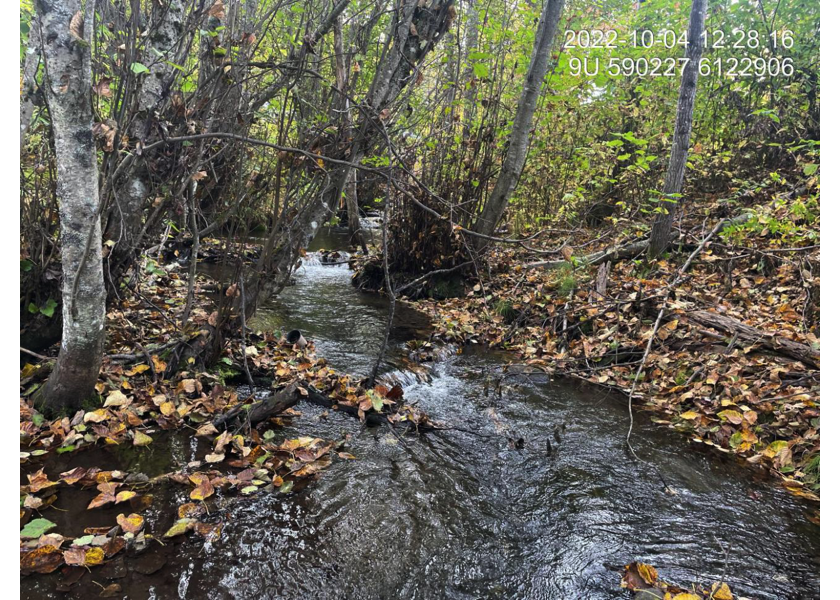
Figure 5.26: Typical habitat upstream of PSCIS crossing 198116.
my_photo2 = fpr::fpr_photo_pull_by_str(str_to_pull = '_u4_')

my_caption2 = paste0('Typical habitat upstream of PSCIS crossing ', my_site, '.')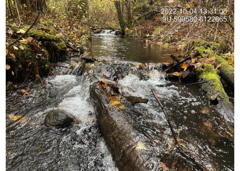
Figure 5.27: Typical habitat upstream of PSCIS crossing 198116.
my_caption <- paste0('Left: ', my_caption1, ' Right: ', my_caption2)

knitr::include_graphics(my_photo1)
knitr::include_graphics("fig/pixel.png")
knitr::include_graphics(my_photo2)
my_photo1 = fpr::fpr_photo_pull_by_str(str_to_pull = '_u5_')
my_caption1 = paste0('Typical habitat upstream of PSCIS crossing ', my_site, '.')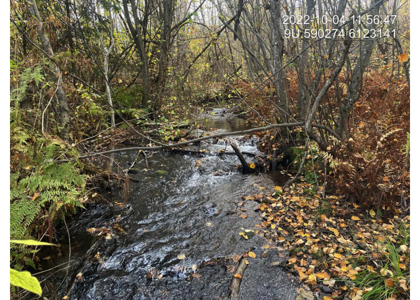
Figure 5.28: Typical habitat upstream of PSCIS crossing 198116.
# photo_flip <- function(site_id = my_site, rotate = 90, str_to_pull = '_u6_'){
#   photo <- fpr_photo_pull_by_str(site = site_id, str_to_pull = str_to_pull)
#   magick::image_read(photo) %>%
#     magick::image_rotate(rotate) %>%
#     magick::image_write(paste0('data/photos/', site_id, '/rotated_', basename(photo)))
# }
# photo_flip()

my_photo2 = fpr::fpr_photo_pull_by_str(str_to_pull = 'rotated')

my_caption2 = paste0('Waterfall at the end of survey, upstream of PSCIS crossing ', my_site3, '.')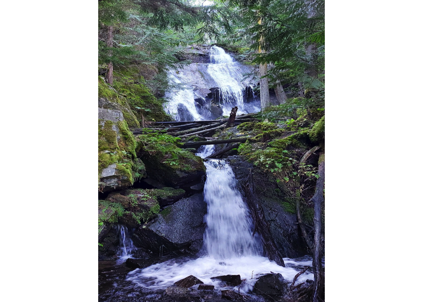
Figure 5.29: Waterfall at the end of survey, upstream of PSCIS crossing 198115.
my_caption <- paste0('Left: ', my_caption1, ' Right: ', my_caption2)

knitr::include_graphics(my_photo1)
knitr::include_graphics("fig/pixel.png")
knitr::include_graphics(my_photo2)