Appendix - Phase 1 Fish Passage Assessment Data and Photos
| Location and Stream Data |
|
Crossing Characteristics | – |
|---|---|---|---|
| Date | 2021-07-27 | Crossing Sub Type | Bridge |
| PSCIS ID | 197780 | Diameter (m) | 7.5 |
| External ID | 4601993 | Length (m) | 5 |
| Crew | AI TS | Embedded | – |
| UTM Zone | 11 | Depth Embedded (m) | – |
| Easting | 656655 | Resemble Channel | – |
| Northing | 5431721 | Backwatered | – |
| Stream | Rabbit Creek | Percent Backwatered | – |
| Road | – | Fill Depth (m) | – |
| Road Tenure | Unclassified | Outlet Drop (m) | – |
| Channel Width (m) | – | Outlet Pool Depth (m) | – |
| Stream Slope (%) | – | Inlet Drop | – |
| Beaver Activity | – | Slope (%) | – |
| Habitat Value | – | Valley Fill | – |
| Final score | 0 | Barrier Result | Passable |
| Fix type | – | Fix Span / Diameter | – |
Photos: PSCIS ID 197780. From top left clockwise: Road/Site Card, Barrel, Outlet, Downstream, Upstream, Inlet.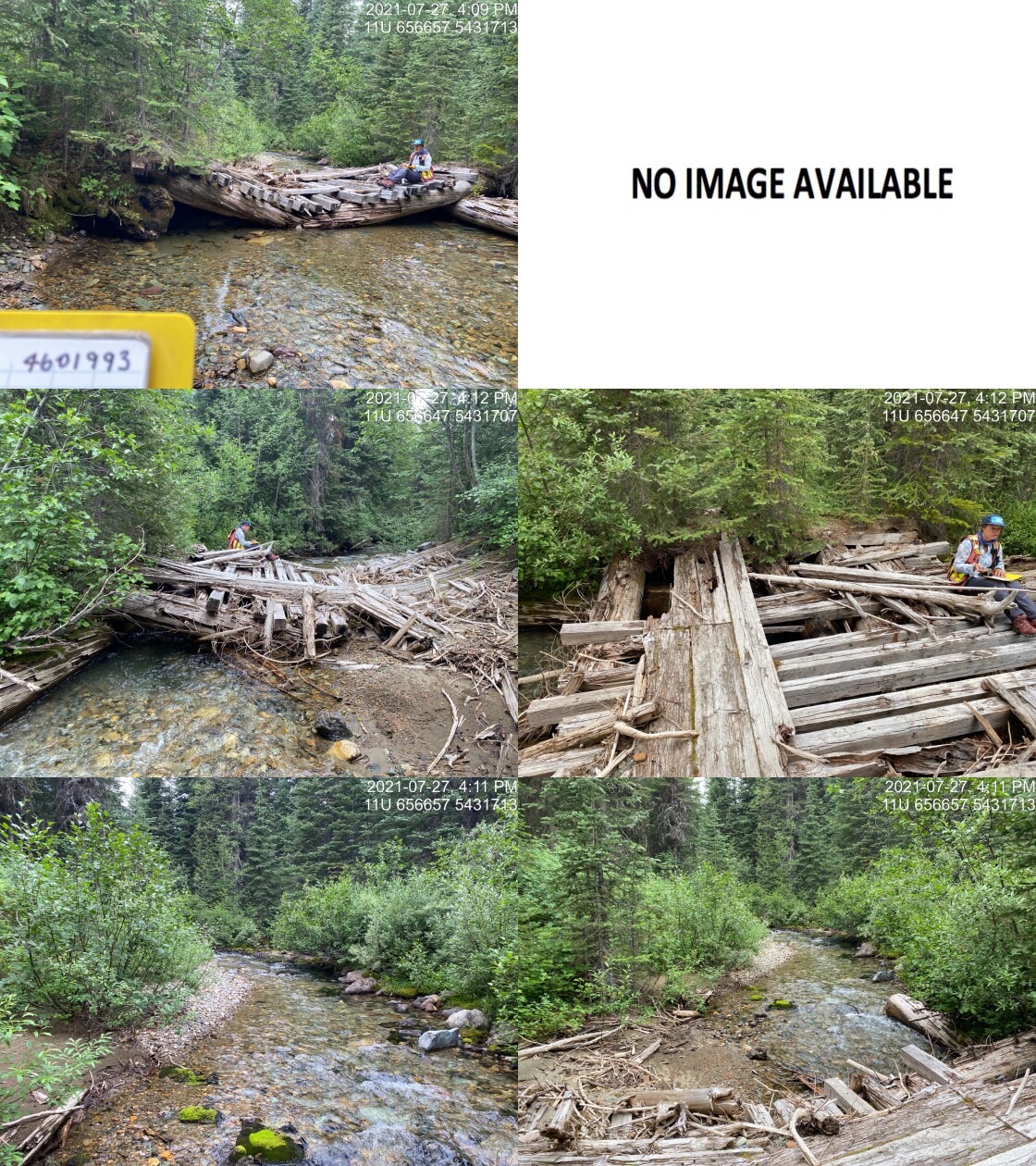
|
|||
| Comments: Bridge has collapsed but is not blocking channel. 16:08 |
| Location and Stream Data |
|
Crossing Characteristics | – |
|---|---|---|---|
| Date | 2021-07-27 | Crossing Sub Type | Bridge |
| PSCIS ID | 197781 | Diameter (m) | 14 |
| External ID | 4601995 | Length (m) | 5 |
| Crew | AI TS | Embedded | – |
| UTM Zone | 11 | Depth Embedded (m) | – |
| Easting | 655890.2 | Resemble Channel | – |
| Northing | 5431860 | Backwatered | – |
| Stream | Rabbit Creek | Percent Backwatered | – |
| Road | – | Fill Depth (m) | – |
| Road Tenure | Unclassified | Outlet Drop (m) | – |
| Channel Width (m) | – | Outlet Pool Depth (m) | – |
| Stream Slope (%) | – | Inlet Drop | – |
| Beaver Activity | – | Slope (%) | – |
| Habitat Value | – | Valley Fill | – |
| Final score | 0 | Barrier Result | Passable |
| Fix type | – | Fix Span / Diameter | – |
Photos: PSCIS ID 197781. From top left clockwise: Road/Site Card, Barrel, Outlet, Downstream, Upstream, Inlet.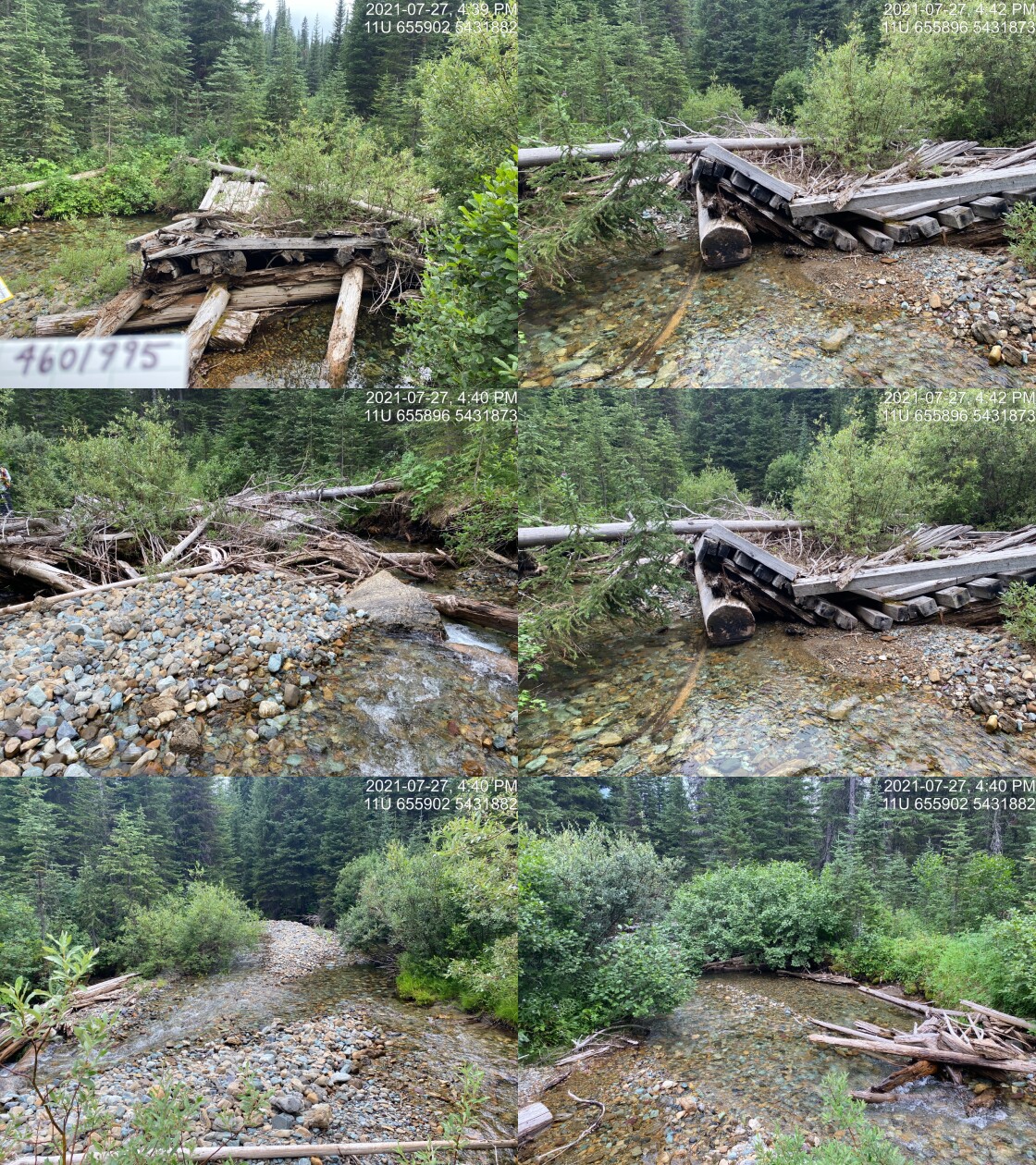
|
|||
| Comments: Bridge has collapsed but is not blocking channel. 16:36 |
| Location and Stream Data |
|
Crossing Characteristics | – |
|---|---|---|---|
| Date | 2021-07-27 | Crossing Sub Type | Bridge |
| PSCIS ID | 197782 | Diameter (m) | 12 |
| External ID | 4602359 | Length (m) | 5 |
| Crew | AI TS | Embedded | – |
| UTM Zone | 11 | Depth Embedded (m) | – |
| Easting | 655618 | Resemble Channel | – |
| Northing | 5431721 | Backwatered | – |
| Stream | Rabbit Creek | Percent Backwatered | – |
| Road | – | Fill Depth (m) | – |
| Road Tenure | Unclassified | Outlet Drop (m) | – |
| Channel Width (m) | – | Outlet Pool Depth (m) | – |
| Stream Slope (%) | – | Inlet Drop | – |
| Beaver Activity | – | Slope (%) | – |
| Habitat Value | – | Valley Fill | – |
| Final score | 0 | Barrier Result | Passable |
| Fix type | – | Fix Span / Diameter | – |
Photos: PSCIS ID 197782. From top left clockwise: Road/Site Card, Barrel, Outlet, Downstream, Upstream, Inlet.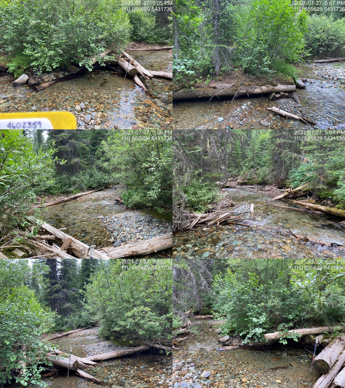
|
|||
| Comments: Bridge has collapsed but is not blocking channel. 16:59 |
| Location and Stream Data |
|
Crossing Characteristics | – |
|---|---|---|---|
| Date | 2021-07-28 | Crossing Sub Type | Round Culvert |
| PSCIS ID | 197783 | Diameter (m) | 0.4 |
| External ID | 4605937 | Length (m) | 12 |
| Crew | AI TS | Embedded | No |
| UTM Zone | 11 | Depth Embedded (m) | – |
| Easting | 662247 | Resemble Channel | No |
| Northing | 5431294 | Backwatered | No |
| Stream | Tributary to Wigwam River | Percent Backwatered | – |
| Road | Wigwam FSR | Fill Depth (m) | 2 |
| Road Tenure | Canfor R08380 | Outlet Drop (m) | 0 |
| Channel Width (m) | 0.6 | Outlet Pool Depth (m) | 0 |
| Stream Slope (%) | 3.5 | Inlet Drop | No |
| Beaver Activity | No | Slope (%) | 1 |
| Habitat Value | Low | Valley Fill | Deep Fill |
| Final score | 21 | Barrier Result | Barrier |
| Fix type | Replace Structure with Streambed Simulation CBS | Fix Span / Diameter | 3 |
Photos: PSCIS ID 197783. From top left clockwise: Road/Site Card, Barrel, Outlet, Downstream, Upstream, Inlet.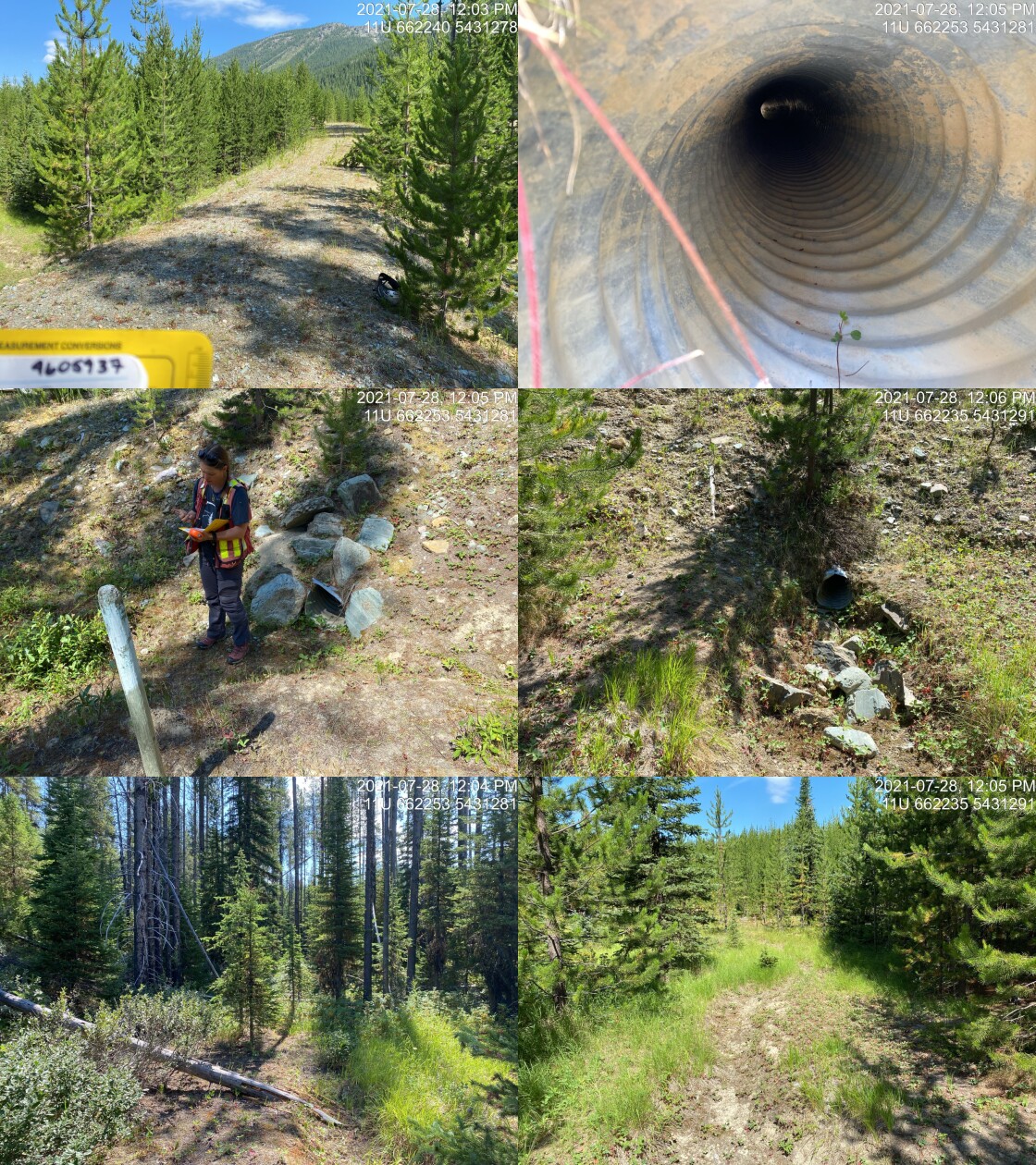
|
|||
| Comments: Dry with poorly defined downstream channel. 12:03 |
| Location and Stream Data |
|
Crossing Characteristics | – |
|---|---|---|---|
| Date | 2021-07-28 | Crossing Sub Type | Bridge |
| PSCIS ID | 197784 | Diameter (m) | 14 |
| External ID | 4605216 | Length (m) | 4 |
| Crew | AI TS | Embedded | – |
| UTM Zone | 11 | Depth Embedded (m) | – |
| Easting | 647551 | Resemble Channel | – |
| Northing | 5449746 | Backwatered | – |
| Stream | Tributary to Wigwam River | Percent Backwatered | – |
| Road | – | Fill Depth (m) | – |
| Road Tenure | Unknown | Outlet Drop (m) | – |
| Channel Width (m) | – | Outlet Pool Depth (m) | – |
| Stream Slope (%) | – | Inlet Drop | – |
| Beaver Activity | – | Slope (%) | – |
| Habitat Value | – | Valley Fill | – |
| Final score | 0 | Barrier Result | Passable |
| Fix type | – | Fix Span / Diameter | – |
Photos: PSCIS ID 197784. From top left clockwise: Road/Site Card, Barrel, Outlet, Downstream, Upstream, Inlet.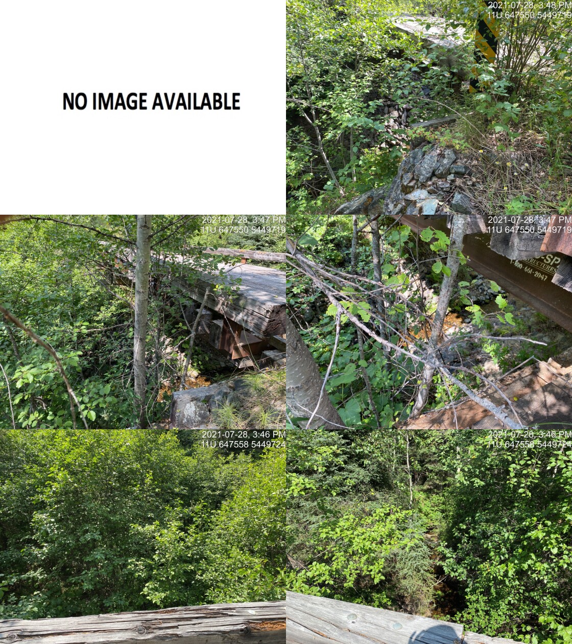
|
|||
| Comments: Suspect that this stream is mapped incorrectly. 15:41 |
| Location and Stream Data |
|
Crossing Characteristics | – |
|---|---|---|---|
| Date | 2021-07-28 | Crossing Sub Type | Round Culvert |
| PSCIS ID | 197785 | Diameter (m) | 1 |
| External ID | 4606129 | Length (m) | 28 |
| Crew | AI TS | Embedded | No |
| UTM Zone | 11 | Depth Embedded (m) | – |
| Easting | 649481.2 | Resemble Channel | No |
| Northing | 5446732 | Backwatered | No |
| Stream | Tributary to Wigwam River | Percent Backwatered | – |
| Road | – | Fill Depth (m) | 4 |
| Road Tenure | Canfor R08380 | Outlet Drop (m) | 0.4 |
| Channel Width (m) | 0 | Outlet Pool Depth (m) | 0 |
| Stream Slope (%) | 5 | Inlet Drop | No |
| Beaver Activity | No | Slope (%) | 1.5 |
| Habitat Value | Low | Valley Fill | Deep Fill |
| Final score | 28 | Barrier Result | Barrier |
| Fix type | Replace Structure with Streambed Simulation CBS | Fix Span / Diameter | 3 |
Photos: PSCIS ID 197785. From top left clockwise: Road/Site Card, Barrel, Outlet, Downstream, Upstream, Inlet.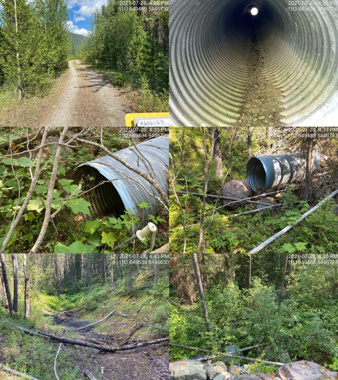
|
|||
| Comments: Drains Snowshoe Lake. No visible channel. No fish habitat present as the channel empties into large natural depression area ~60m upstream of the road. 16:25 |
| Location and Stream Data |
|
Crossing Characteristics | – |
|---|---|---|---|
| Date | 2021-07-29 | Crossing Sub Type | Round Culvert |
| PSCIS ID | 197786 | Diameter (m) | 1.2 |
| External ID | 4606398 | Length (m) | 10 |
| Crew | AI TS | Embedded | No |
| UTM Zone | 11 | Depth Embedded (m) | – |
| Easting | 665796.1 | Resemble Channel | No |
| Northing | 5462152 | Backwatered | No |
| Stream | Lodgepole Creek | Percent Backwatered | – |
| Road | Harvey FSR | Fill Depth (m) | 0.1 |
| Road Tenure | FLNR DRM 5466 | Outlet Drop (m) | 0 |
| Channel Width (m) | 2 | Outlet Pool Depth (m) | 0.1 |
| Stream Slope (%) | 3.8 | Inlet Drop | Yes |
| Beaver Activity | No | Slope (%) | 1.7 |
| Habitat Value | Medium | Valley Fill | Deep Fill |
| Final score | 21 | Barrier Result | Barrier |
| Fix type | Replace with New Open Bottom Structure | Fix Span / Diameter | 12 |
Photos: PSCIS ID 197786. From top left clockwise: Road/Site Card, Barrel, Outlet, Downstream, Upstream, Inlet.
|
|||
| Comments: Small stream with good flow. Abundant gravels just upstream with gradients increasing to 6-7% near 540m upstream of culvert where large (~30m high) waterfall is located. 10:18 |
| Location and Stream Data |
|
Crossing Characteristics | – |
|---|---|---|---|
| Date | 2021-07-29 | Crossing Sub Type | Round Culvert |
| PSCIS ID | 197787 | Diameter (m) | 2 |
| External ID | 4606370 | Length (m) | 2 |
| Crew | AI TS | Embedded | No |
| UTM Zone | 11 | Depth Embedded (m) | – |
| Easting | 664905.1 | Resemble Channel | No |
| Northing | 5462562 | Backwatered | No |
| Stream | Lodgepole Creek | Percent Backwatered | – |
| Road | Harvey FSR | Fill Depth (m) | 1.5 |
| Road Tenure | FLNR DRM 5466 | Outlet Drop (m) | 0 |
| Channel Width (m) | 3.26 | Outlet Pool Depth (m) | 0.1 |
| Stream Slope (%) | 2.8 | Inlet Drop | Yes |
| Beaver Activity | Yes | Slope (%) | 0.5 |
| Habitat Value | Medium | Valley Fill | Deep Fill |
| Final score | 16 | Barrier Result | Potential |
| Fix type | Replace with New Open Bottom Structure | Fix Span / Diameter | 12 |
Photos: PSCIS ID 197787. From top left clockwise: Road/Site Card, Barrel, Outlet, Downstream, Upstream, Inlet.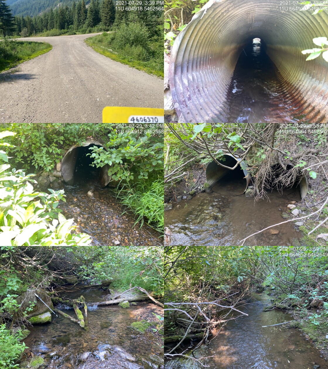
|
|||
| Comments: Two pipes (1m each) but one blocked with debris. Because height of outlets equivalent widths were added together for input to stream width ratio. Large beaver dams upstream between culvert and Lodgepole Lake. 15:37 |
| Location and Stream Data |
|
Crossing Characteristics | – |
|---|---|---|---|
| Date | 2021-07-30 | Crossing Sub Type | Ford |
| PSCIS ID | 197788 | Diameter (m) | – |
| External ID | 4603788 | Length (m) | – |
| Crew | AI TS | Embedded | – |
| UTM Zone | 11 | Depth Embedded (m) | – |
| Easting | 660450.9 | Resemble Channel | – |
| Northing | 5461352 | Backwatered | – |
| Stream | Lodgepole Creek | Percent Backwatered | – |
| Road | – | Fill Depth (m) | – |
| Road Tenure | Unclassified | Outlet Drop (m) | – |
| Channel Width (m) | – | Outlet Pool Depth (m) | – |
| Stream Slope (%) | – | Inlet Drop | – |
| Beaver Activity | – | Slope (%) | – |
| Habitat Value | – | Valley Fill | – |
| Final score | 0 | Barrier Result | Unknown |
| Fix type | – | Fix Span / Diameter | – |
Photos: PSCIS ID 197788. From top left clockwise: Road/Site Card, Barrel, Outlet, Downstream, Upstream, Inlet.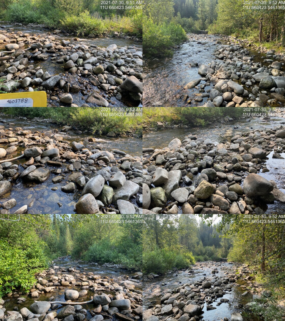
|
|||
| Comments: Bridge has been removed. No isuues. 9:50 |
| Location and Stream Data |
|
Crossing Characteristics | – |
|---|---|---|---|
| Date | 2021-07-30 | Crossing Sub Type | Ford |
| PSCIS ID | 197789 | Diameter (m) | – |
| External ID | 4603791 | Length (m) | – |
| Crew | AI TS | Embedded | – |
| UTM Zone | 11 | Depth Embedded (m) | – |
| Easting | 660586 | Resemble Channel | – |
| Northing | 5461227 | Backwatered | – |
| Stream | Tributary to Lodgepole Creek | Percent Backwatered | – |
| Road | – | Fill Depth (m) | – |
| Road Tenure | Unclassified | Outlet Drop (m) | – |
| Channel Width (m) | – | Outlet Pool Depth (m) | – |
| Stream Slope (%) | – | Inlet Drop | – |
| Beaver Activity | – | Slope (%) | – |
| Habitat Value | – | Valley Fill | – |
| Final score | 0 | Barrier Result | Unknown |
| Fix type | – | Fix Span / Diameter | – |
Photos: PSCIS ID 197789. From top left clockwise: Road/Site Card, Barrel, Outlet, Downstream, Upstream, Inlet.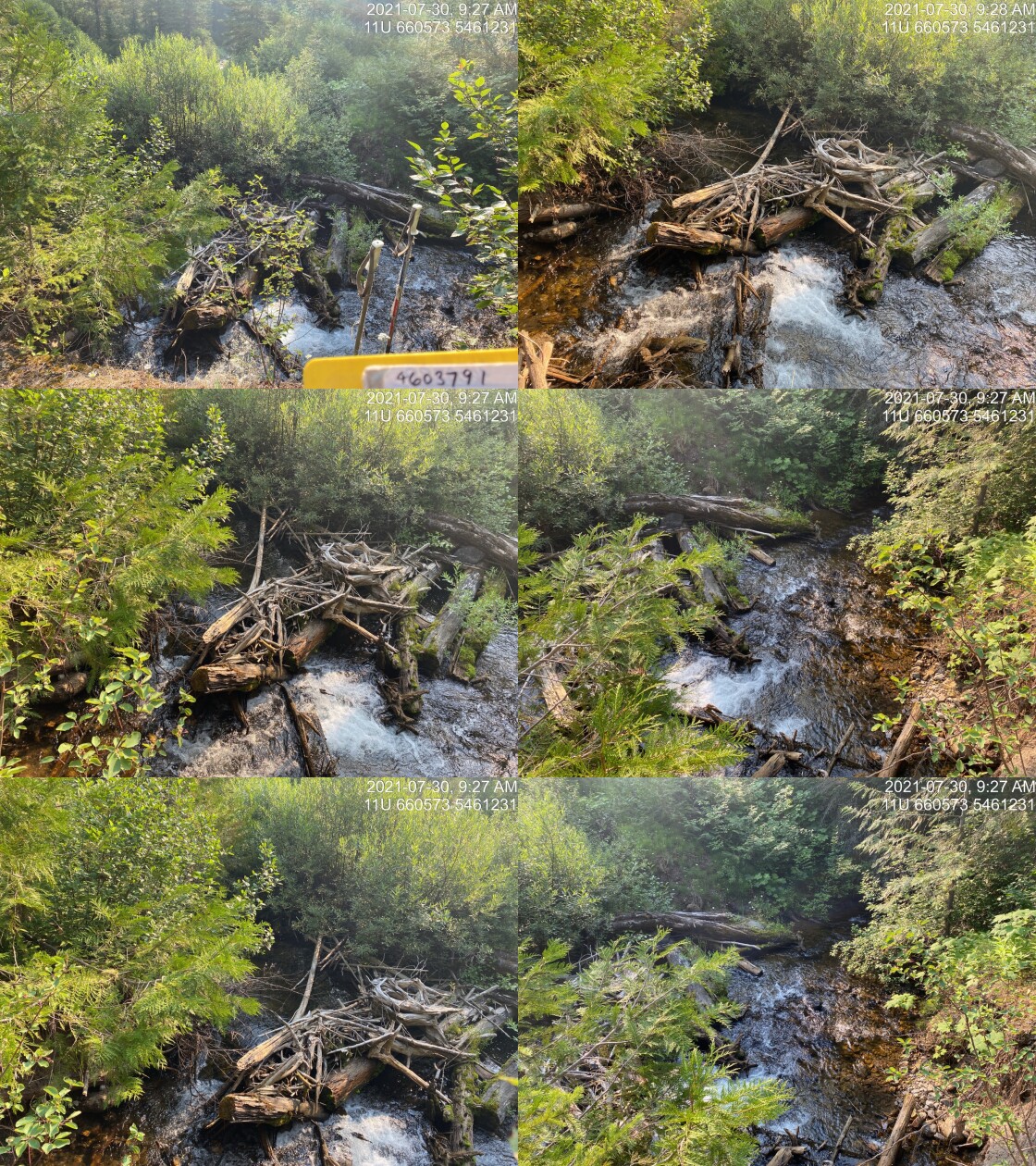
|
|||
| Comments: Bridge has been removed. No isuues. 9:25 |
| Location and Stream Data |
|
Crossing Characteristics | – |
|---|---|---|---|
| Date | 2021-07-30 | Crossing Sub Type | Ford |
| PSCIS ID | 197790 | Diameter (m) | – |
| External ID | 4606411 | Length (m) | – |
| Crew | AI TS | Embedded | – |
| UTM Zone | 11 | Depth Embedded (m) | – |
| Easting | 658765 | Resemble Channel | – |
| Northing | 5459547 | Backwatered | – |
| Stream | Tributary to Lodgepole Creek | Percent Backwatered | – |
| Road | – | Fill Depth (m) | – |
| Road Tenure | Canfor R08388 | Outlet Drop (m) | – |
| Channel Width (m) | – | Outlet Pool Depth (m) | – |
| Stream Slope (%) | – | Inlet Drop | – |
| Beaver Activity | – | Slope (%) | – |
| Habitat Value | – | Valley Fill | – |
| Final score | 0 | Barrier Result | Unknown |
| Fix type | – | Fix Span / Diameter | – |
Photos: PSCIS ID 197790. From top left clockwise: Road/Site Card, Barrel, Outlet, Downstream, Upstream, Inlet.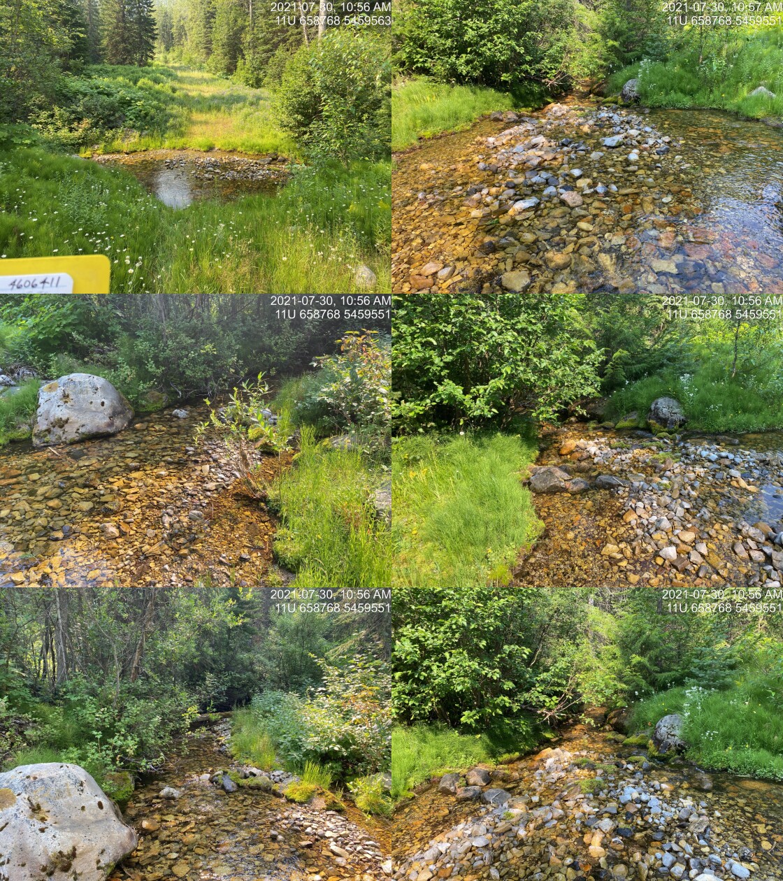
|
|||
| Comments: Ford. No fish passage issues. 10:55 |
| Location and Stream Data |
|
Crossing Characteristics | – |
|---|---|---|---|
| Date | 2021-07-30 | Crossing Sub Type | Ford |
| PSCIS ID | 197791 | Diameter (m) | – |
| External ID | 24706666 | Length (m) | – |
| Crew | AI TS | Embedded | – |
| UTM Zone | 11 | Depth Embedded (m) | – |
| Easting | 658955.9 | Resemble Channel | – |
| Northing | 5461097 | Backwatered | – |
| Stream | Lodgepole Creek | Percent Backwatered | – |
| Road | – | Fill Depth (m) | – |
| Road Tenure | Canfor R08388 | Outlet Drop (m) | – |
| Channel Width (m) | – | Outlet Pool Depth (m) | – |
| Stream Slope (%) | – | Inlet Drop | – |
| Beaver Activity | – | Slope (%) | – |
| Habitat Value | – | Valley Fill | – |
| Final score | 0 | Barrier Result | Unknown |
| Fix type | – | Fix Span / Diameter | – |
Photos: PSCIS ID 197791. From top left clockwise: Road/Site Card, Barrel, Outlet, Downstream, Upstream, Inlet.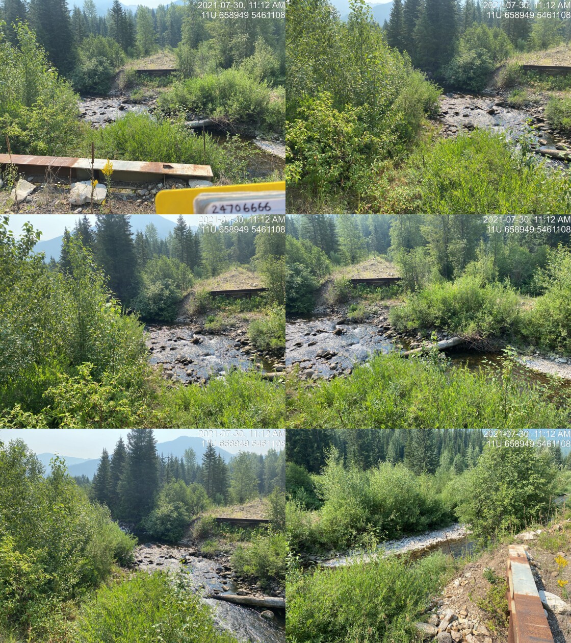
|
|||
| Comments: ATV ford. No fish passage issues. 11:10 |
| Location and Stream Data |
|
Crossing Characteristics | – |
|---|---|---|---|
| Date | 2021-07-30 | Crossing Sub Type | Bridge |
| PSCIS ID | 197792 | Diameter (m) | 8 |
| External ID | 4605499 | Length (m) | 7 |
| Crew | AI TS | Embedded | – |
| UTM Zone | 11 | Depth Embedded (m) | – |
| Easting | 650057.1 | Resemble Channel | – |
| Northing | 5463543 | Backwatered | – |
| Stream | Bean Creek | Percent Backwatered | – |
| Road | Ram FSR | Fill Depth (m) | – |
| Road Tenure | FLNR DRM 5466 | Outlet Drop (m) | – |
| Channel Width (m) | – | Outlet Pool Depth (m) | – |
| Stream Slope (%) | – | Inlet Drop | – |
| Beaver Activity | – | Slope (%) | – |
| Habitat Value | – | Valley Fill | – |
| Final score | 0 | Barrier Result | Passable |
| Fix type | – | Fix Span / Diameter | – |
Photos: PSCIS ID 197792. From top left clockwise: Road/Site Card, Barrel, Outlet, Downstream, Upstream, Inlet.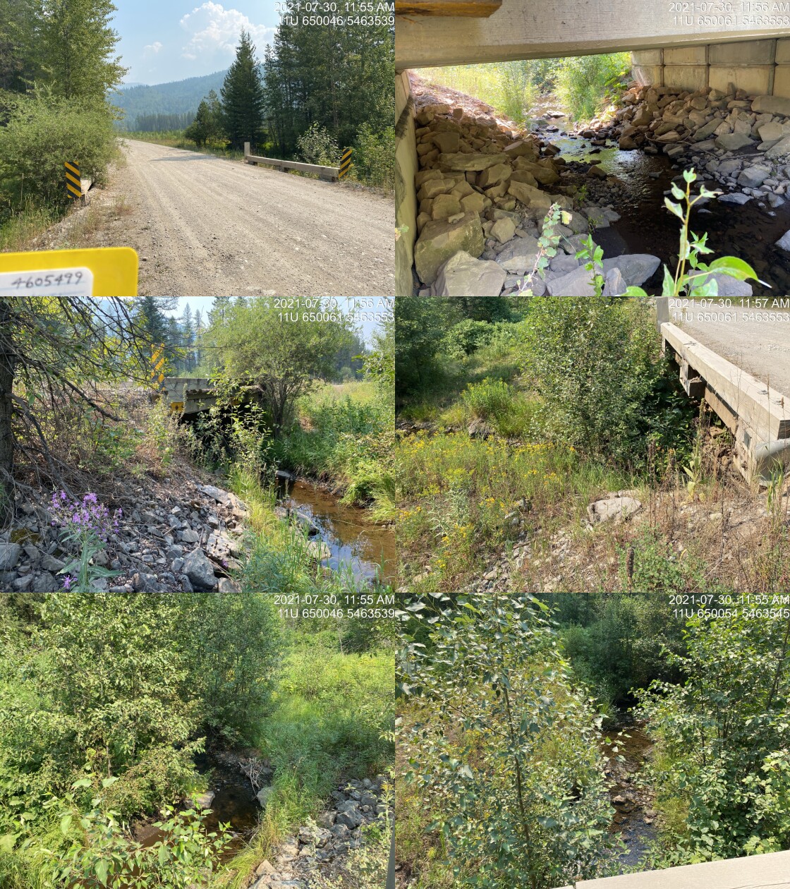
|
|||
| Comments: Bridge. 11:53 |
| Location and Stream Data |
|
Crossing Characteristics | – |
|---|---|---|---|
| Date | 2021-07-30 | Crossing Sub Type | Round Culvert |
| PSCIS ID | 197793 | Diameter (m) | 1.5 |
| External ID | 4606347 | Length (m) | 14 |
| Crew | AI TS | Embedded | No |
| UTM Zone | 11 | Depth Embedded (m) | – |
| Easting | 650414.6 | Resemble Channel | No |
| Northing | 5463819 | Backwatered | No |
| Stream | Tributary to Bean Creek | Percent Backwatered | – |
| Road | Lodgepole FSR | Fill Depth (m) | 1 |
| Road Tenure | FLNR DRM 5466 | Outlet Drop (m) | 0 |
| Channel Width (m) | 5.3 | Outlet Pool Depth (m) | 0.2 |
| Stream Slope (%) | 2.7 | Inlet Drop | No |
| Beaver Activity | No | Slope (%) | 2.5 |
| Habitat Value | Low | Valley Fill | Deep Fill |
| Final score | 21 | Barrier Result | Barrier |
| Fix type | Replace with New Open Bottom Structure | Fix Span / Diameter | 12 |
Photos: PSCIS ID 197793. From top left clockwise: Road/Site Card, Barrel, Outlet, Downstream, Upstream, Inlet.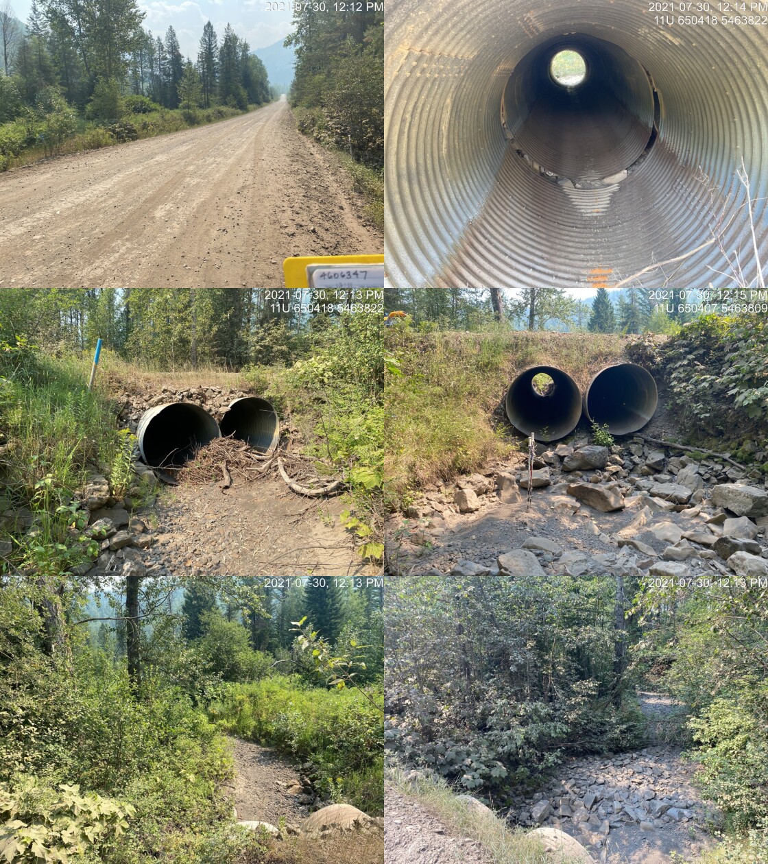
|
|||
| Comments: Large channel but stream is completely dry. 12:11 |
| Location and Stream Data |
|
Crossing Characteristics | – |
|---|---|---|---|
| Date | 2021-07-30 | Crossing Sub Type | Bridge |
| PSCIS ID | 197794 | Diameter (m) | 14 |
| External ID | 4603480 | Length (m) | 5 |
| Crew | AI TS | Embedded | – |
| UTM Zone | 11 | Depth Embedded (m) | – |
| Easting | 650539 | Resemble Channel | – |
| Northing | 5464640 | Backwatered | – |
| Stream | Tributary to Bean Creek | Percent Backwatered | – |
| Road | Gasline | Fill Depth (m) | – |
| Road Tenure | Unclassified | Outlet Drop (m) | – |
| Channel Width (m) | – | Outlet Pool Depth (m) | – |
| Stream Slope (%) | – | Inlet Drop | – |
| Beaver Activity | – | Slope (%) | – |
| Habitat Value | – | Valley Fill | – |
| Final score | 0 | Barrier Result | Passable |
| Fix type | – | Fix Span / Diameter | – |
Photos: PSCIS ID 197794. From top left clockwise: Road/Site Card, Barrel, Outlet, Downstream, Upstream, Inlet.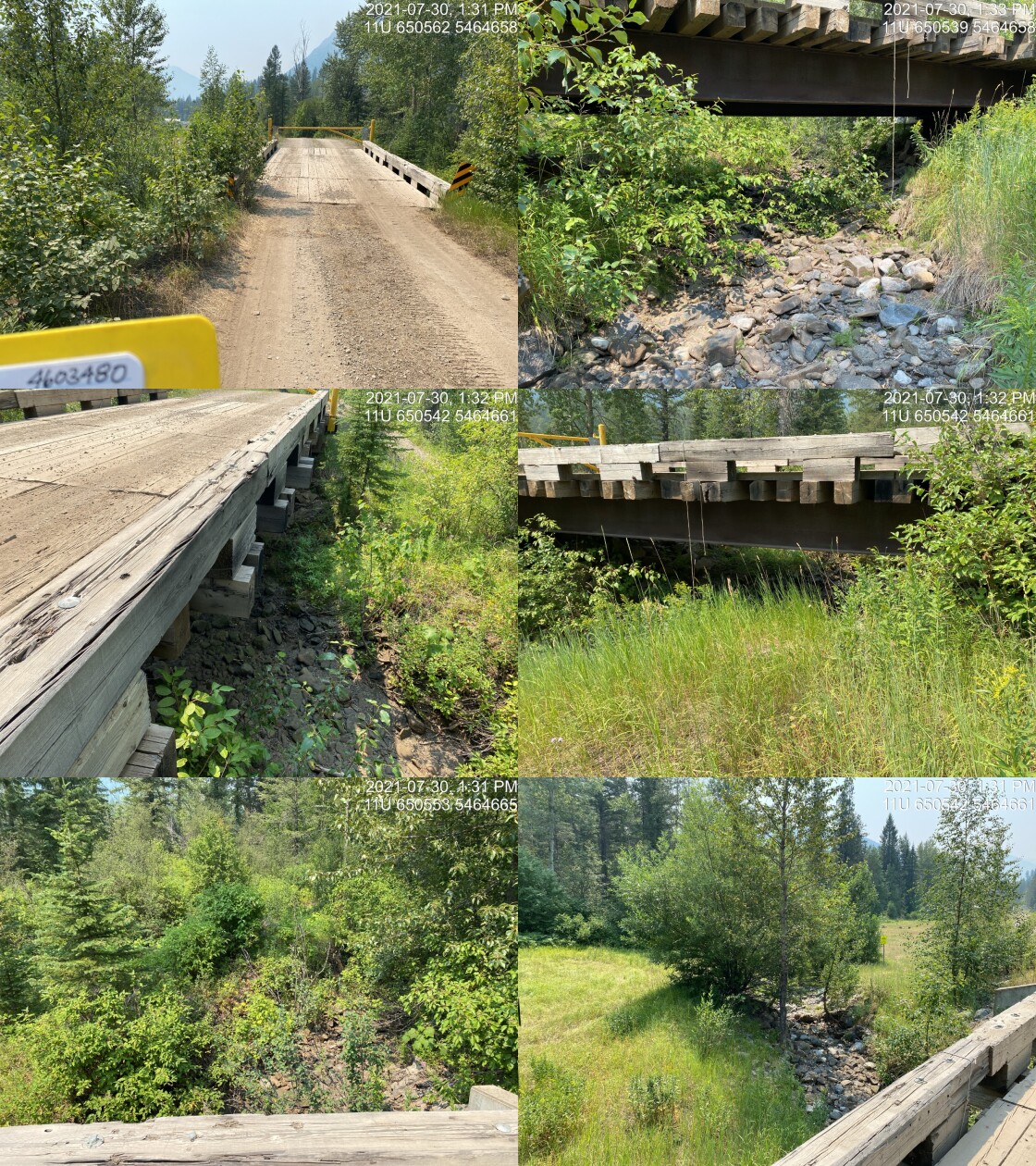
|
|||
| Comments: Bridge on the pipeline right of way. 13:30 |
| Location and Stream Data |
|
Crossing Characteristics | – |
|---|---|---|---|
| Date | 2021-09-27 | Crossing Sub Type | Bridge |
| PSCIS ID | 197795 | Diameter (m) | 18 |
| External ID | 24733953 | Length (m) | 5 |
| Crew | AI | Embedded | – |
| UTM Zone | 11 | Depth Embedded (m) | – |
| Easting | 652220.8 | Resemble Channel | – |
| Northing | 5461435 | Backwatered | – |
| Stream | Tributary to Lodgepole Creek | Percent Backwatered | – |
| Road | Spur | Fill Depth (m) | – |
| Road Tenure | Unknown | Outlet Drop (m) | – |
| Channel Width (m) | – | Outlet Pool Depth (m) | – |
| Stream Slope (%) | – | Inlet Drop | – |
| Beaver Activity | – | Slope (%) | – |
| Habitat Value | – | Valley Fill | – |
| Final score | 0 | Barrier Result | Passable |
| Fix type | – | Fix Span / Diameter | – |
Photos: PSCIS ID 197795. From top left clockwise: Road/Site Card, Barrel, Outlet, Downstream, Upstream, Inlet.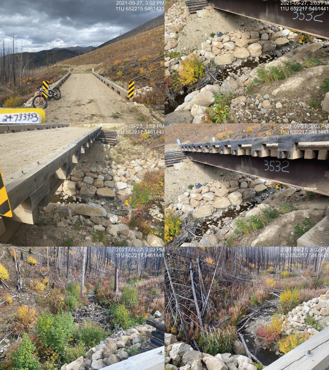
|
|||
| Comments: Gated access management area. 15:00 |
| Location and Stream Data |
|
Crossing Characteristics | – |
|---|---|---|---|
| Date | 2021-09-27 | Crossing Sub Type | Round Culvert |
| PSCIS ID | 197796 | Diameter (m) | 1.6 |
| External ID | 4601984 | Length (m) | 14 |
| Crew | AI | Embedded | No |
| UTM Zone | 11 | Depth Embedded (m) | – |
| Easting | 654301.7 | Resemble Channel | No |
| Northing | 5458678 | Backwatered | No |
| Stream | Tributary to Lodgepole Creek | Percent Backwatered | – |
| Road | Spur | Fill Depth (m) | 2 |
| Road Tenure | Unclassified | Outlet Drop (m) | 0.6 |
| Channel Width (m) | 3.8 | Outlet Pool Depth (m) | 0.8 |
| Stream Slope (%) | 8.5 | Inlet Drop | Yes |
| Beaver Activity | No | Slope (%) | 5 |
| Habitat Value | Low | Valley Fill | Deep Fill |
| Final score | 36 | Barrier Result | Barrier |
| Fix type | Replace with New Open Bottom Structure | Fix Span / Diameter | 12 |
Photos: PSCIS ID 197796. From top left clockwise: Road/Site Card, Barrel, Outlet, Downstream, Upstream, Inlet.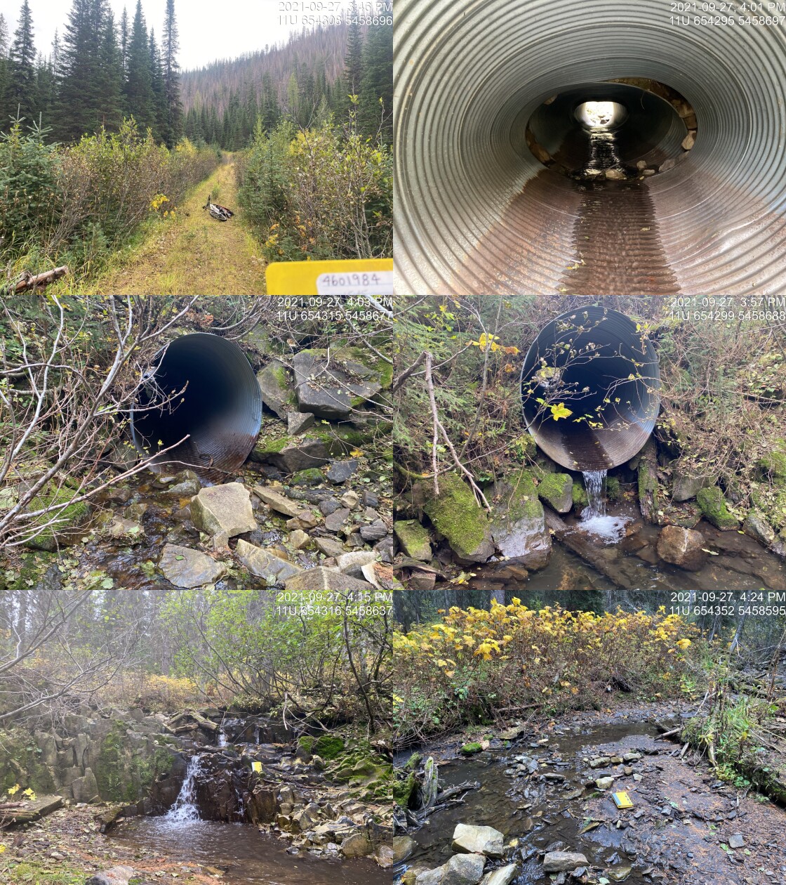
|
|||
| Comments: Gated access management area. Falls located ~60m upstream of the crossing. 15:45 |
| Location and Stream Data |
|
Crossing Characteristics | – |
|---|---|---|---|
| Date | 2021-09-28 | Crossing Sub Type | Ford |
| PSCIS ID | 197797 | Diameter (m) | – |
| External ID | 4606926 | Length (m) | – |
| Crew | AI | Embedded | – |
| UTM Zone | 11 | Depth Embedded (m) | – |
| Easting | 663230 | Resemble Channel | – |
| Northing | 5447429 | Backwatered | – |
| Stream | Tributary to Bighorn Creek | Percent Backwatered | – |
| Road | Spur | Fill Depth (m) | – |
| Road Tenure | Unclassified | Outlet Drop (m) | – |
| Channel Width (m) | – | Outlet Pool Depth (m) | – |
| Stream Slope (%) | – | Inlet Drop | – |
| Beaver Activity | – | Slope (%) | – |
| Habitat Value | – | Valley Fill | – |
| Final score | 0 | Barrier Result | Unknown |
| Fix type | – | Fix Span / Diameter | – |
Photos: PSCIS ID 197797. From top left clockwise: Road/Site Card, Barrel, Outlet, Downstream, Upstream, Inlet.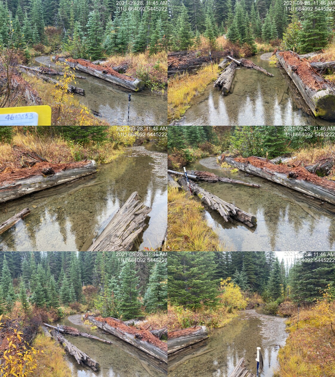
|
|||
| Comments: Ford. No road present on far side of stream. 11:28 |
| Location and Stream Data |
|
Crossing Characteristics | – |
|---|---|---|---|
| Date | 2021-09-28 | Crossing Sub Type | Round Culvert |
| PSCIS ID | 197798 | Diameter (m) | 0.6 |
| External ID | 4605518 | Length (m) | 11 |
| Crew | AI | Embedded | No |
| UTM Zone | 11 | Depth Embedded (m) | – |
| Easting | 664404.6 | Resemble Channel | No |
| Northing | 5445263 | Backwatered | No |
| Stream | Tributary to Bighorn Creek | Percent Backwatered | – |
| Road | Cabin FSR | Fill Depth (m) | 1 |
| Road Tenure | FLNR DRM 5466 | Outlet Drop (m) | 0.6 |
| Channel Width (m) | 1 | Outlet Pool Depth (m) | 0 |
| Stream Slope (%) | 4 | Inlet Drop | No |
| Beaver Activity | No | Slope (%) | 4 |
| Habitat Value | Low | Valley Fill | Deep Fill |
| Final score | 36 | Barrier Result | Barrier |
| Fix type | Replace Structure with Streambed Simulation CBS | Fix Span / Diameter | 3 |
Photos: PSCIS ID 197798. From top left clockwise: Road/Site Card, Barrel, Outlet, Downstream, Upstream, Inlet.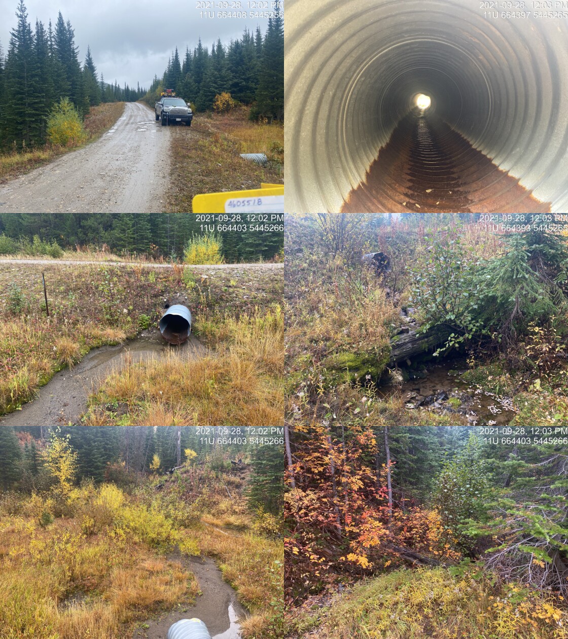
|
|||
| Comments: Culvert installed in road prism which creates 1m step, steep gradients and outlet drop. Small system. 12:00 |
| Location and Stream Data |
|
Crossing Characteristics | – |
|---|---|---|---|
| Date | 2021-09-28 | Crossing Sub Type | Round Culvert |
| PSCIS ID | 197799 | Diameter (m) | 0.6 |
| External ID | 4605522 | Length (m) | 16 |
| Crew | AI | Embedded | No |
| UTM Zone | 11 | Depth Embedded (m) | – |
| Easting | 664642.1 | Resemble Channel | No |
| Northing | 5444852 | Backwatered | No |
| Stream | Tributary to Bighorn Creek | Percent Backwatered | – |
| Road | Cabin FSR | Fill Depth (m) | 3 |
| Road Tenure | FLNR DRM 5466 | Outlet Drop (m) | 1.2 |
| Channel Width (m) | 1.3 | Outlet Pool Depth (m) | 0.2 |
| Stream Slope (%) | 9 | Inlet Drop | No |
| Beaver Activity | No | Slope (%) | 5 |
| Habitat Value | Low | Valley Fill | Deep Fill |
| Final score | 39 | Barrier Result | Barrier |
| Fix type | Replace Structure with Streambed Simulation CBS | Fix Span / Diameter | 3 |
Photos: PSCIS ID 197799. From top left clockwise: Road/Site Card, Barrel, Outlet, Downstream, Upstream, Inlet.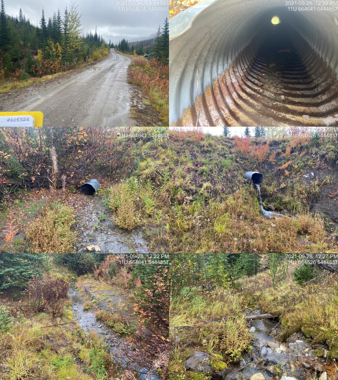
|
|||
| Comments: Nice gravels with good flow but small stream with steeper grade for size of channel. LWD drop of ~90cm located at ~55m upstream. Borderline moderate habitat value. 12:20 |
| Location and Stream Data |
|
Crossing Characteristics | – |
|---|---|---|---|
| Date | 2021-09-28 | Crossing Sub Type | Round Culvert |
| PSCIS ID | 197800 | Diameter (m) | 1.75 |
| External ID | 4605525 | Length (m) | 17 |
| Crew | AI | Embedded | No |
| UTM Zone | 11 | Depth Embedded (m) | – |
| Easting | 660106.9 | Resemble Channel | No |
| Northing | 5450958 | Backwatered | No |
| Stream | Tributary to Bighorn Creek | Percent Backwatered | – |
| Road | Cabin FSR | Fill Depth (m) | 2.5 |
| Road Tenure | FLNR DRM 5466 | Outlet Drop (m) | 1.5 |
| Channel Width (m) | 1.9 | Outlet Pool Depth (m) | 0 |
| Stream Slope (%) | 15 | Inlet Drop | Yes |
| Beaver Activity | No | Slope (%) | 7 |
| Habitat Value | Medium | Valley Fill | Deep Fill |
| Final score | 36 | Barrier Result | Barrier |
| Fix type | Replace Structure with Streambed Simulation CBS | Fix Span / Diameter | 3 |
Photos: PSCIS ID 197800. From top left clockwise: Road/Site Card, Barrel, Outlet, Downstream, Upstream, Inlet.
|
|||
| Comments: Dredged upstream. Nice stream with boulder habitat but very steep.13:15 |
| Location and Stream Data |
|
Crossing Characteristics | – |
|---|---|---|---|
| Date | 2021-09-28 | Crossing Sub Type | Ford |
| PSCIS ID | 197801 | Diameter (m) | – |
| External ID | 4603688 | Length (m) | – |
| Crew | AI | Embedded | – |
| UTM Zone | 11 | Depth Embedded (m) | – |
| Easting | 658120 | Resemble Channel | – |
| Northing | 5452872 | Backwatered | – |
| Stream | Tributary to Bighorn Creek | Percent Backwatered | – |
| Road | Cabin FSR | Fill Depth (m) | – |
| Road Tenure | Unclassified | Outlet Drop (m) | – |
| Channel Width (m) | – | Outlet Pool Depth (m) | – |
| Stream Slope (%) | – | Inlet Drop | – |
| Beaver Activity | – | Slope (%) | – |
| Habitat Value | – | Valley Fill | – |
| Final score | 0 | Barrier Result | Unknown |
| Fix type | – | Fix Span / Diameter | – |
Photos: PSCIS ID 197801. From top left clockwise: Road/Site Card, Barrel, Outlet, Downstream, Upstream, Inlet.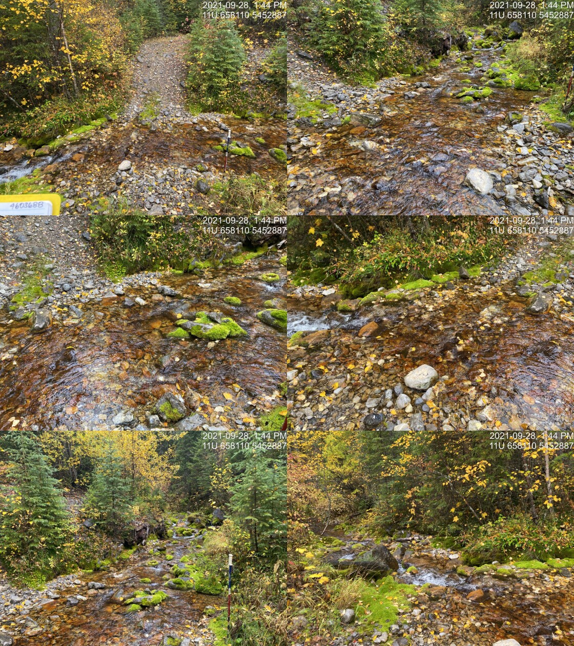
|
|||
| Comments: Ford. 13:43 |
| Location and Stream Data |
|
Crossing Characteristics | – |
|---|---|---|---|
| Date | 2021-09-28 | Crossing Sub Type | Round Culvert |
| PSCIS ID | 197802 | Diameter (m) | 0.9 |
| External ID | 4605540 | Length (m) | 12 |
| Crew | AI | Embedded | No |
| UTM Zone | 11 | Depth Embedded (m) | – |
| Easting | 654192.9 | Resemble Channel | No |
| Northing | 5452980 | Backwatered | No |
| Stream | Tributary to Bighorn Creek | Percent Backwatered | – |
| Road | Cabin FSR | Fill Depth (m) | 1 |
| Road Tenure | FLNR DRM 5466 | Outlet Drop (m) | 0.13 |
| Channel Width (m) | 1.6 | Outlet Pool Depth (m) | 0 |
| Stream Slope (%) | 11 | Inlet Drop | No |
| Beaver Activity | No | Slope (%) | 2.5 |
| Habitat Value | Low | Valley Fill | Deep Fill |
| Final score | 21 | Barrier Result | Barrier |
| Fix type | Replace Structure with Streambed Simulation CBS | Fix Span / Diameter | 3 |
Photos: PSCIS ID 197802. From top left clockwise: Road/Site Card, Barrel, Outlet, Downstream, Upstream, Inlet.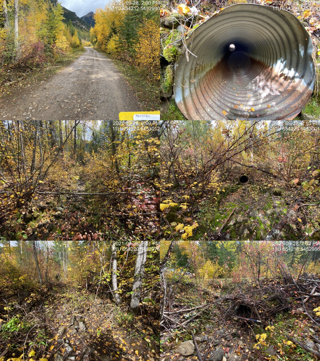
|
|||
| Comments: Dry with partially vegetated channel. 14:00 |
| Location and Stream Data |
|
Crossing Characteristics | – |
|---|---|---|---|
| Date | 2021-09-29 | Crossing Sub Type | Ford |
| PSCIS ID | 197803 | Diameter (m) | – |
| External ID | 4602514 | Length (m) | – |
| Crew | AI | Embedded | – |
| UTM Zone | 11 | Depth Embedded (m) | – |
| Easting | 659393 | Resemble Channel | – |
| Northing | 5517830 | Backwatered | – |
| Stream | Harmer Creek | Percent Backwatered | – |
| Road | – | Fill Depth (m) | – |
| Road Tenure | Sparwood Unclassified | Outlet Drop (m) | – |
| Channel Width (m) | – | Outlet Pool Depth (m) | – |
| Stream Slope (%) | – | Inlet Drop | – |
| Beaver Activity | – | Slope (%) | – |
| Habitat Value | – | Valley Fill | – |
| Final score | 0 | Barrier Result | Unknown |
| Fix type | – | Fix Span / Diameter | – |
Photos: PSCIS ID 197803. From top left clockwise: Road/Site Card, Barrel, Outlet, Downstream, Upstream, Inlet.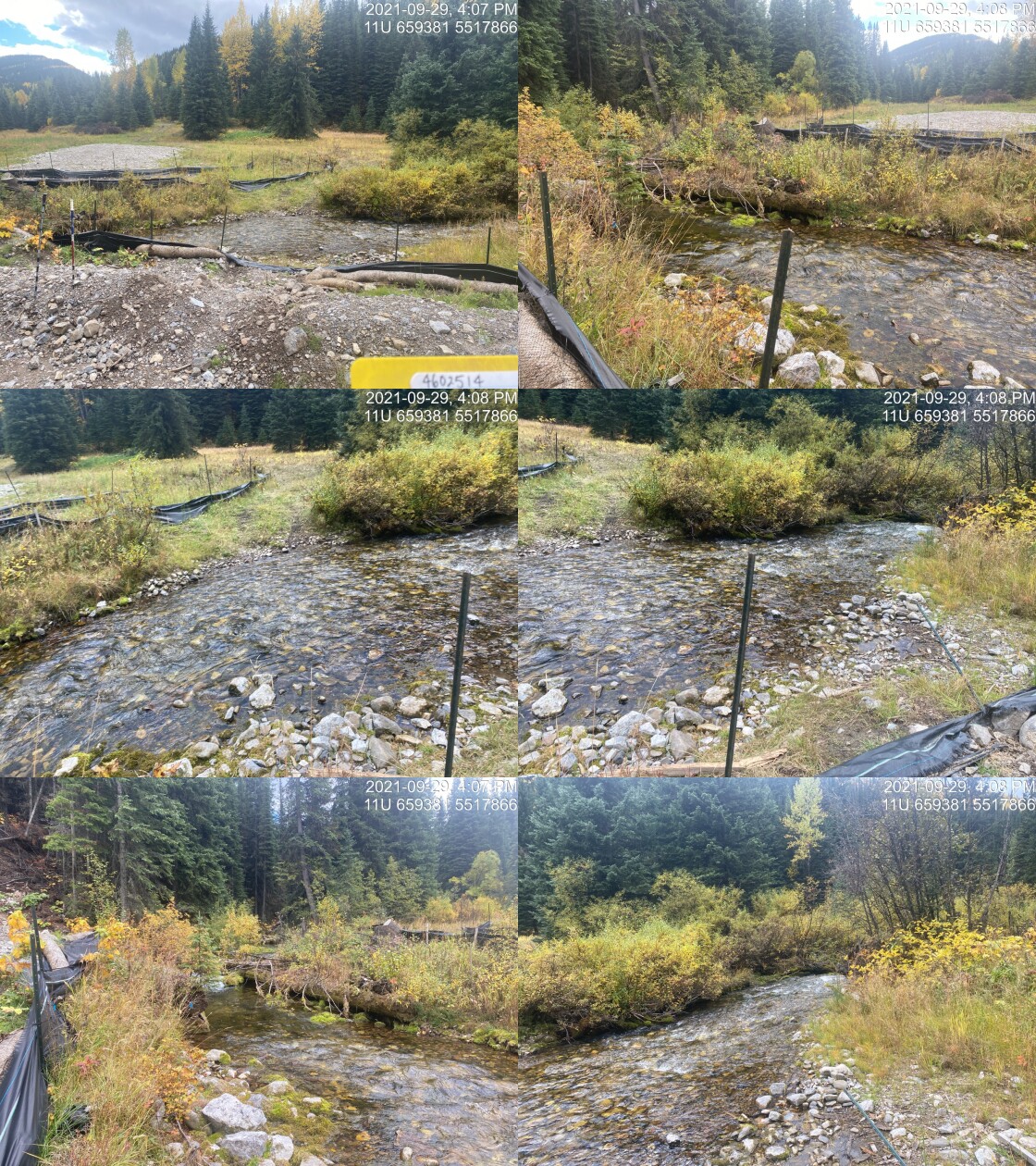
|
|||
| Comments: Appears that bridge may have been removed recently. 16:06 |
| Location and Stream Data |
|
Crossing Characteristics | – |
|---|---|---|---|
| Date | 2021-09-30 | Crossing Sub Type | Ford |
| PSCIS ID | 197804 | Diameter (m) | – |
| External ID | 4606350 | Length (m) | – |
| Crew | AI | Embedded | – |
| UTM Zone | 11 | Depth Embedded (m) | – |
| Easting | 668801.1 | Resemble Channel | – |
| Northing | 5458712 | Backwatered | – |
| Stream | Kisoo Creek | Percent Backwatered | – |
| Road | Spur | Fill Depth (m) | – |
| Road Tenure | FLNR DRM 5466 | Outlet Drop (m) | – |
| Channel Width (m) | – | Outlet Pool Depth (m) | – |
| Stream Slope (%) | – | Inlet Drop | – |
| Beaver Activity | – | Slope (%) | – |
| Habitat Value | – | Valley Fill | – |
| Final score | 0 | Barrier Result | Unknown |
| Fix type | – | Fix Span / Diameter | – |
Photos: PSCIS ID 197804. From top left clockwise: Road/Site Card, Barrel, Outlet, Downstream, Upstream, Inlet.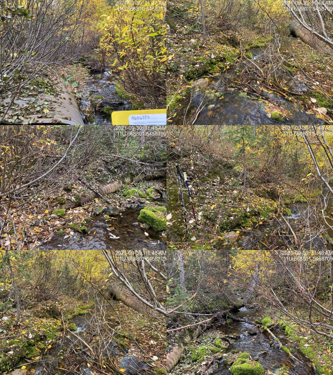
|
|||
| Comments: Crossing removed. 11:45 |
| Location and Stream Data |
|
Crossing Characteristics | – |
|---|---|---|---|
| Date | 2021-09-29 | Crossing Sub Type | Ford |
| PSCIS ID | 197805 | Diameter (m) | – |
| External ID | 4601280 | Length (m) | – |
| Crew | AI | Embedded | – |
| UTM Zone | 11 | Depth Embedded (m) | – |
| Easting | 659427 | Resemble Channel | – |
| Northing | 5517583 | Backwatered | – |
| Stream | Harmer Creek | Percent Backwatered | – |
| Road | Unnamed | Fill Depth (m) | – |
| Road Tenure | Sparwood Unclassified | Outlet Drop (m) | – |
| Channel Width (m) | – | Outlet Pool Depth (m) | – |
| Stream Slope (%) | – | Inlet Drop | – |
| Beaver Activity | – | Slope (%) | – |
| Habitat Value | – | Valley Fill | – |
| Final score | 0 | Barrier Result | Unknown |
| Fix type | – | Fix Span / Diameter | – |
Photos: PSCIS ID 197805. From top left clockwise: Road/Site Card, Barrel, Outlet, Downstream, Upstream, Inlet.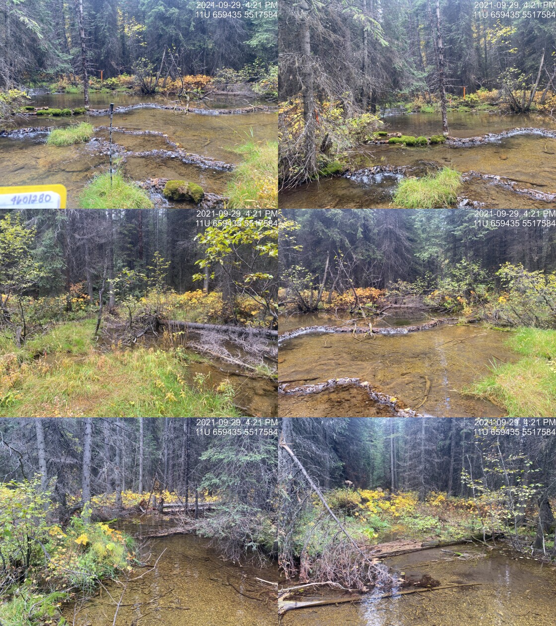
|
|||
| Comments: No crossing present. 16:20 |
| Location and Stream Data |
|
Crossing Characteristics | – |
|---|---|---|---|
| Date | 2021-09-30 | Crossing Sub Type | Ford |
| PSCIS ID | 197806 | Diameter (m) | – |
| External ID | 4601687 | Length (m) | – |
| Crew | AI | Embedded | – |
| UTM Zone | 11 | Depth Embedded (m) | – |
| Easting | 670843 | Resemble Channel | – |
| Northing | 5469802 | Backwatered | – |
| Stream | Tributary to Flathead River | Percent Backwatered | – |
| Road | Spur | Fill Depth (m) | – |
| Road Tenure | Unclassified | Outlet Drop (m) | – |
| Channel Width (m) | – | Outlet Pool Depth (m) | – |
| Stream Slope (%) | – | Inlet Drop | – |
| Beaver Activity | – | Slope (%) | – |
| Habitat Value | – | Valley Fill | – |
| Final score | 0 | Barrier Result | Unknown |
| Fix type | – | Fix Span / Diameter | – |
Photos: PSCIS ID 197806. From top left clockwise: Road/Site Card, Barrel, Outlet, Downstream, Upstream, Inlet.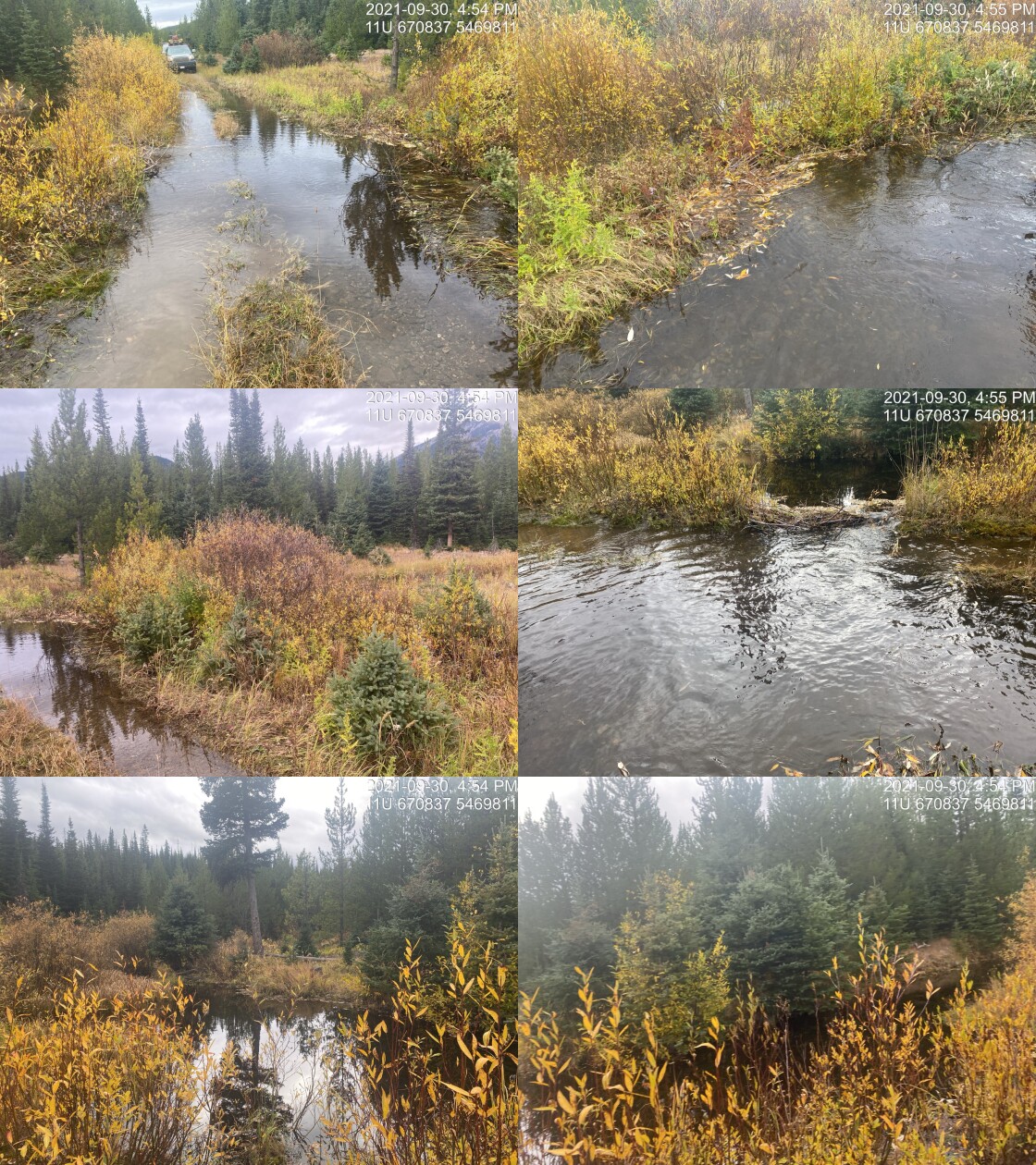
|
|||
| Comments: Ford. 16:52 |
| Location and Stream Data |
|
Crossing Characteristics | – |
|---|---|---|---|
| Date | 2021-10-01 | Crossing Sub Type | Pipe Arch |
| PSCIS ID | 197807 | Diameter (m) | 1.8 |
| External ID | 4605451 | Length (m) | 15 |
| Crew | AI | Embedded | – |
| UTM Zone | 11 | Depth Embedded (m) | – |
| Easting | 686581.3 | Resemble Channel | – |
| Northing | 5436976 | Backwatered | – |
| Stream | Nettie Creek | Percent Backwatered | – |
| Road | Flathead FSR | Fill Depth (m) | – |
| Road Tenure | FLNR DRM 0030 | Outlet Drop (m) | – |
| Channel Width (m) | – | Outlet Pool Depth (m) | – |
| Stream Slope (%) | – | Inlet Drop | – |
| Beaver Activity | – | Slope (%) | – |
| Habitat Value | – | Valley Fill | – |
| Final score | 3 | Barrier Result | Passable |
| Fix type | – | Fix Span / Diameter | – |
Photos: PSCIS ID 197807. From top left clockwise: Road/Site Card, Barrel, Outlet, Downstream, Upstream, Inlet.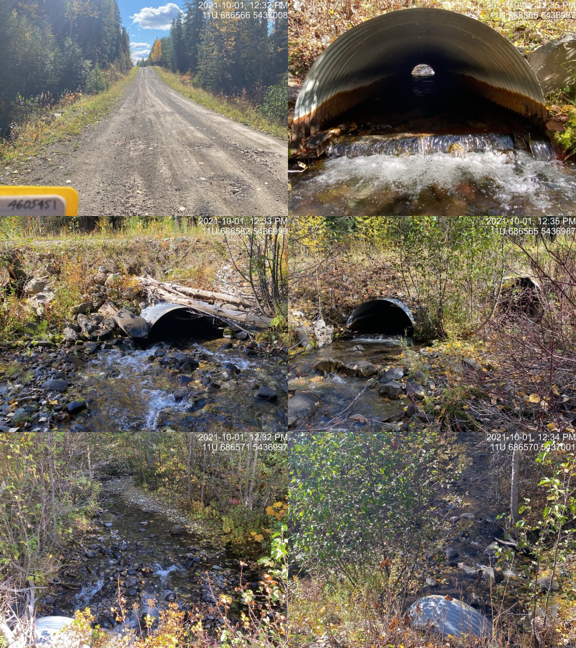
|
|||
| Comments: Overflow pipe on river left is ~1.4m diameter. Aggrading happening upstream of structure because undersized. Aggrading is 8-9% gradient for rise of 0.55m over a distance of 2.3m. Channel width is 4.0m. 12:32 |
| Location and Stream Data |
|
Crossing Characteristics | – |
|---|---|---|---|
| Date | 2021-10-01 | Crossing Sub Type | Ford |
| PSCIS ID | 197808 | Diameter (m) | – |
| External ID | 4602728 | Length (m) | – |
| Crew | AI | Embedded | – |
| UTM Zone | 11 | Depth Embedded (m) | – |
| Easting | 682706 | Resemble Channel | – |
| Northing | 5442018 | Backwatered | – |
| Stream | Tributary to Flathead River | Percent Backwatered | – |
| Road | Spur | Fill Depth (m) | – |
| Road Tenure | Unclassified | Outlet Drop (m) | – |
| Channel Width (m) | – | Outlet Pool Depth (m) | – |
| Stream Slope (%) | – | Inlet Drop | – |
| Beaver Activity | – | Slope (%) | – |
| Habitat Value | – | Valley Fill | – |
| Final score | 0 | Barrier Result | Unknown |
| Fix type | – | Fix Span / Diameter | – |
Photos: PSCIS ID 197808. From top left clockwise: Road/Site Card, Barrel, Outlet, Downstream, Upstream, Inlet.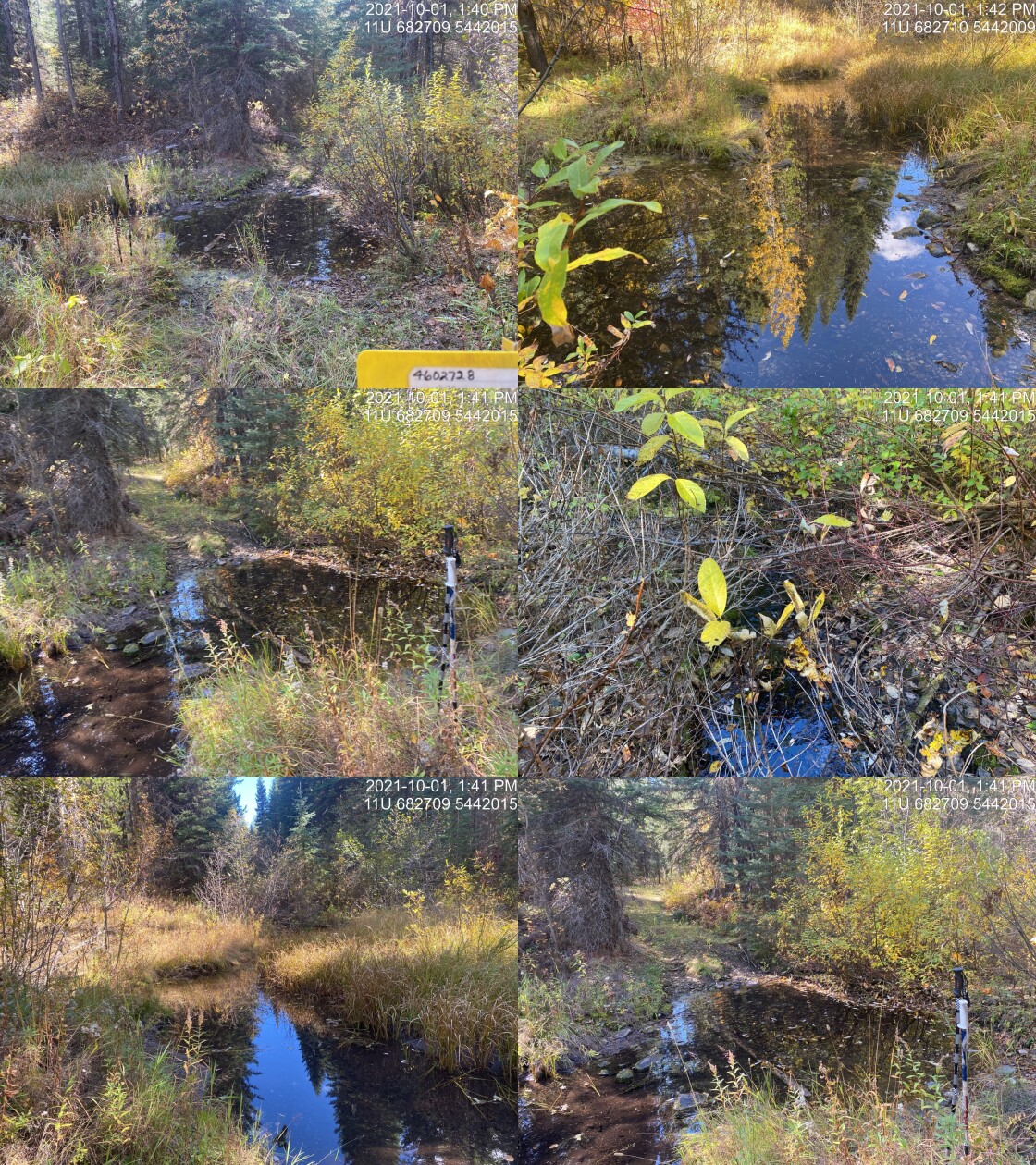
|
|||
| Comments: ATV access road. Small beaver dam along road. Good flow but very small channel. 13:39 |
| Location and Stream Data |
|
Crossing Characteristics | – |
|---|---|---|---|
| Date | 2021-10-01 | Crossing Sub Type | Round Culvert |
| PSCIS ID | 197809 | Diameter (m) | 0.3 |
| External ID | 4606597 | Length (m) | 12 |
| Crew | AI | Embedded | No |
| UTM Zone | 11 | Depth Embedded (m) | – |
| Easting | 683097 | Resemble Channel | No |
| Northing | 5444416 | Backwatered | No |
| Stream | Tributary to Flathead River | Percent Backwatered | – |
| Road | Commerce FSR | Fill Depth (m) | 1 |
| Road Tenure | FLNR DRM 0030 | Outlet Drop (m) | 0 |
| Channel Width (m) | 0.9 | Outlet Pool Depth (m) | 0 |
| Stream Slope (%) | 1 | Inlet Drop | No |
| Beaver Activity | No | Slope (%) | 3 |
| Habitat Value | Low | Valley Fill | Deep Fill |
| Final score | 26 | Barrier Result | Barrier |
| Fix type | Replace Structure with Streambed Simulation CBS | Fix Span / Diameter | 3 |
Photos: PSCIS ID 197809. From top left clockwise: Road/Site Card, Barrel, Outlet, Downstream, Upstream, Inlet.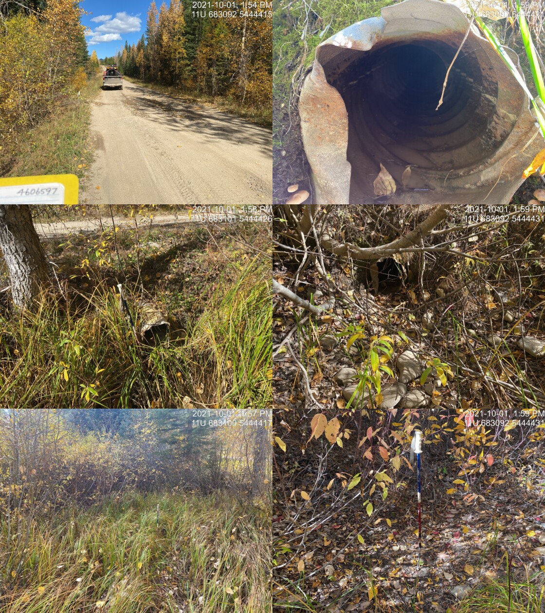
|
|||
| Comments: Dry channel. Very poorly defined channel upstream. Inlet perched. Unlikely fish habitat. 13:53 |
| Location and Stream Data |
|
Crossing Characteristics | – |
|---|---|---|---|
| Date | 2021-10-03 | Crossing Sub Type | Bridge |
| PSCIS ID | 197810 | Diameter (m) | 10 |
| External ID | 2021100301 | Length (m) | 4 |
| Crew | AI | Embedded | – |
| UTM Zone | 11 | Depth Embedded (m) | – |
| Easting | 679699 | Resemble Channel | – |
| Northing | 5433877 | Backwatered | – |
| Stream | Tributary to Calder Creek | Percent Backwatered | – |
| Road | Spur 1000 | Fill Depth (m) | – |
| Road Tenure | Unknown | Outlet Drop (m) | – |
| Channel Width (m) | – | Outlet Pool Depth (m) | – |
| Stream Slope (%) | – | Inlet Drop | – |
| Beaver Activity | – | Slope (%) | – |
| Habitat Value | – | Valley Fill | – |
| Final score | 0 | Barrier Result | Passable |
| Fix type | – | Fix Span / Diameter | – |
Photos: PSCIS ID 197810. From top left clockwise: Road/Site Card, Barrel, Outlet, Downstream, Upstream, Inlet.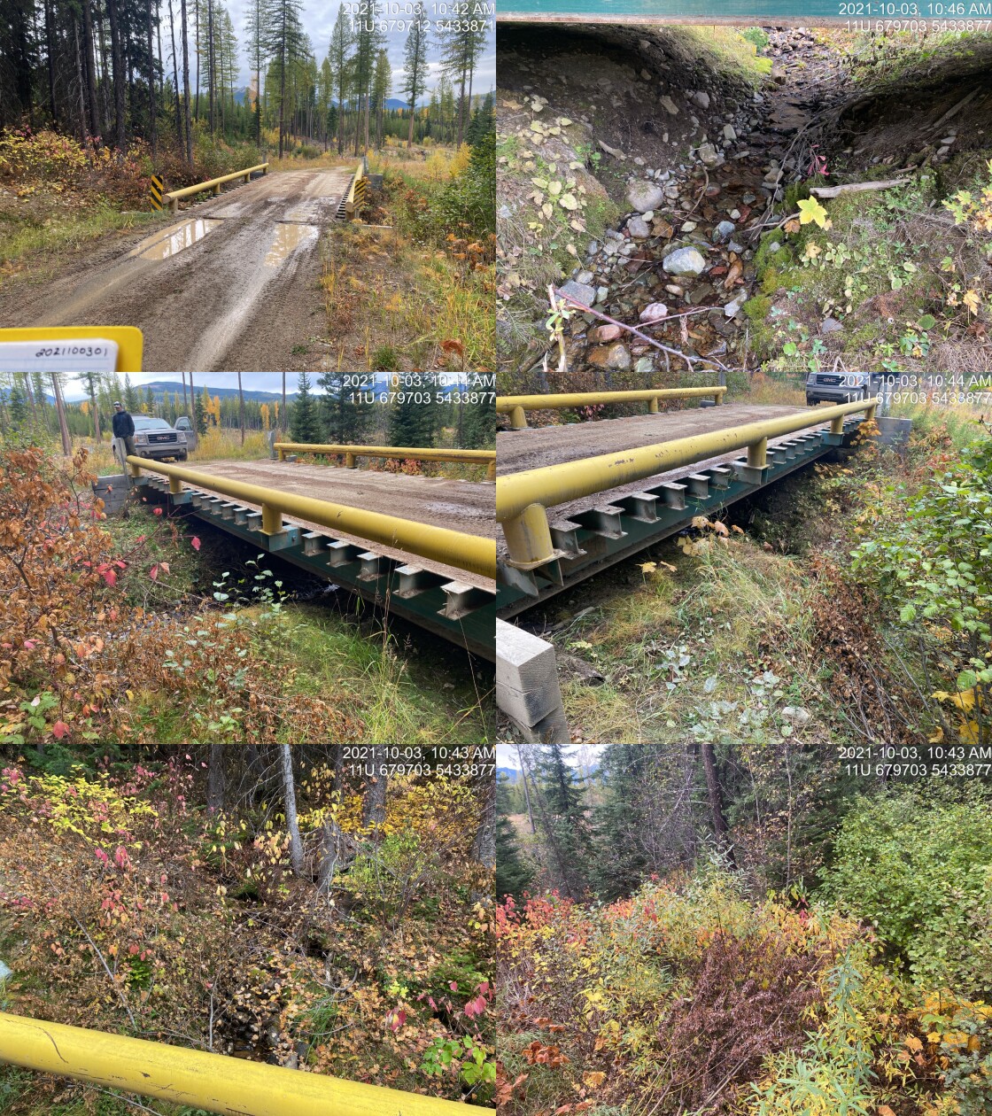
|
|||
| Comments: WCT captured just upsteram of this site in 2014 https://a100.gov.bc.ca/pub/acat/public/viewReport.do?reportId=50581 . 10:40 |
| Location and Stream Data |
|
Crossing Characteristics | – |
|---|---|---|---|
| Date | 2021-10-03 | Crossing Sub Type | Ford |
| PSCIS ID | 197811 | Diameter (m) | – |
| External ID | 4605202 | Length (m) | – |
| Crew | AI | Embedded | – |
| UTM Zone | 11 | Depth Embedded (m) | – |
| Easting | 680079.5 | Resemble Channel | – |
| Northing | 5433197 | Backwatered | – |
| Stream | Calder Creek | Percent Backwatered | – |
| Road | Spur 1000 | Fill Depth (m) | – |
| Road Tenure | FLNR DRM 0030 | Outlet Drop (m) | – |
| Channel Width (m) | – | Outlet Pool Depth (m) | – |
| Stream Slope (%) | – | Inlet Drop | – |
| Beaver Activity | – | Slope (%) | – |
| Habitat Value | – | Valley Fill | – |
| Final score | 0 | Barrier Result | Unknown |
| Fix type | – | Fix Span / Diameter | – |
Photos: PSCIS ID 197811. From top left clockwise: Road/Site Card, Barrel, Outlet, Downstream, Upstream, Inlet.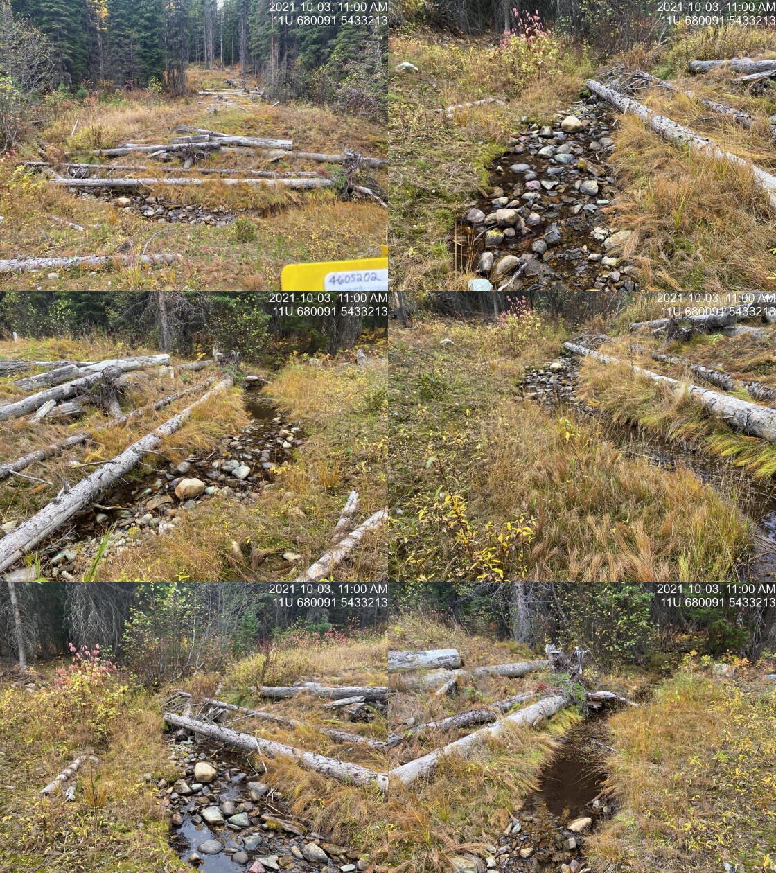
|
|||
| Comments: Road deactivated. Full rehab. No ATV access. 10:58 |
| Location and Stream Data |
|
Crossing Characteristics | – |
|---|---|---|---|
| Date | 2021-10-03 | Crossing Sub Type | Ford |
| PSCIS ID | 197812 | Diameter (m) | – |
| External ID | 2021100302 | Length (m) | – |
| Crew | AI | Embedded | – |
| UTM Zone | 11 | Depth Embedded (m) | – |
| Easting | 678863 | Resemble Channel | – |
| Northing | 5434967 | Backwatered | – |
| Stream | Couldrey Creek | Percent Backwatered | – |
| Road | Spur | Fill Depth (m) | – |
| Road Tenure | Unknown | Outlet Drop (m) | – |
| Channel Width (m) | – | Outlet Pool Depth (m) | – |
| Stream Slope (%) | – | Inlet Drop | – |
| Beaver Activity | – | Slope (%) | – |
| Habitat Value | – | Valley Fill | – |
| Final score | 0 | Barrier Result | Unknown |
| Fix type | – | Fix Span / Diameter | – |
Photos: PSCIS ID 197812. From top left clockwise: Road/Site Card, Barrel, Outlet, Downstream, Upstream, Inlet.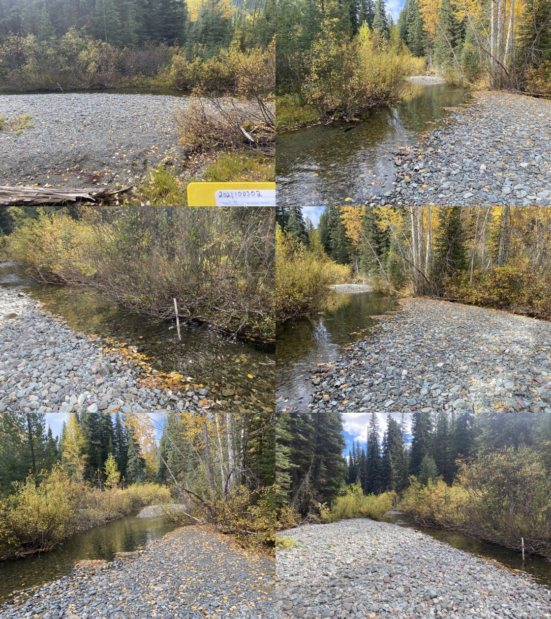
|
|||
| Comments: No modelled crossing on maps. 14:28 |
| Location and Stream Data |
|
Crossing Characteristics | – |
|---|---|---|---|
| Date | 2021-10-04 | Crossing Sub Type | Ford |
| PSCIS ID | 197813 | Diameter (m) | – |
| External ID | 4603820 | Length (m) | – |
| Crew | AI | Embedded | – |
| UTM Zone | 11 | Depth Embedded (m) | – |
| Easting | 676011 | Resemble Channel | – |
| Northing | 5459528 | Backwatered | – |
| Stream | Morris Creek | Percent Backwatered | – |
| Road | Spur | Fill Depth (m) | – |
| Road Tenure | Unclassified | Outlet Drop (m) | – |
| Channel Width (m) | – | Outlet Pool Depth (m) | – |
| Stream Slope (%) | – | Inlet Drop | – |
| Beaver Activity | – | Slope (%) | – |
| Habitat Value | – | Valley Fill | – |
| Final score | 0 | Barrier Result | Unknown |
| Fix type | – | Fix Span / Diameter | – |
Photos: PSCIS ID 197813. From top left clockwise: Road/Site Card, Barrel, Outlet, Downstream, Upstream, Inlet.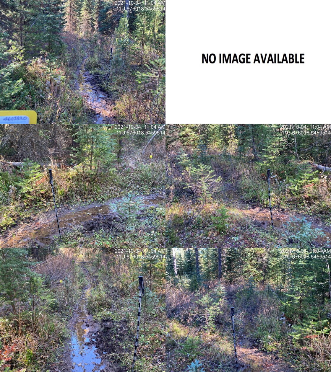
|
|||
| Comments: Wildlife trail. No structure. Road does not appear to be usd by ATVs. Man flow of Morris Creek is actually north of here and flows in from the north. Small amount of flow on trail. No indiction of channel. 11:02 |
| Location and Stream Data |
|
Crossing Characteristics | – |
|---|---|---|---|
| Date | 2021-10-04 | Crossing Sub Type | Ford |
| PSCIS ID | 197814 | Diameter (m) | – |
| External ID | 4603821 | Length (m) | – |
| Crew | AI | Embedded | – |
| UTM Zone | 11 | Depth Embedded (m) | – |
| Easting | 676015 | Resemble Channel | – |
| Northing | 5459481 | Backwatered | – |
| Stream | Morris Creek | Percent Backwatered | – |
| Road | Spur | Fill Depth (m) | – |
| Road Tenure | Unclassified | Outlet Drop (m) | – |
| Channel Width (m) | – | Outlet Pool Depth (m) | – |
| Stream Slope (%) | – | Inlet Drop | – |
| Beaver Activity | – | Slope (%) | – |
| Habitat Value | – | Valley Fill | – |
| Final score | 0 | Barrier Result | Unknown |
| Fix type | – | Fix Span / Diameter | – |
Photos: PSCIS ID 197814. From top left clockwise: Road/Site Card, Barrel, Outlet, Downstream, Upstream, Inlet.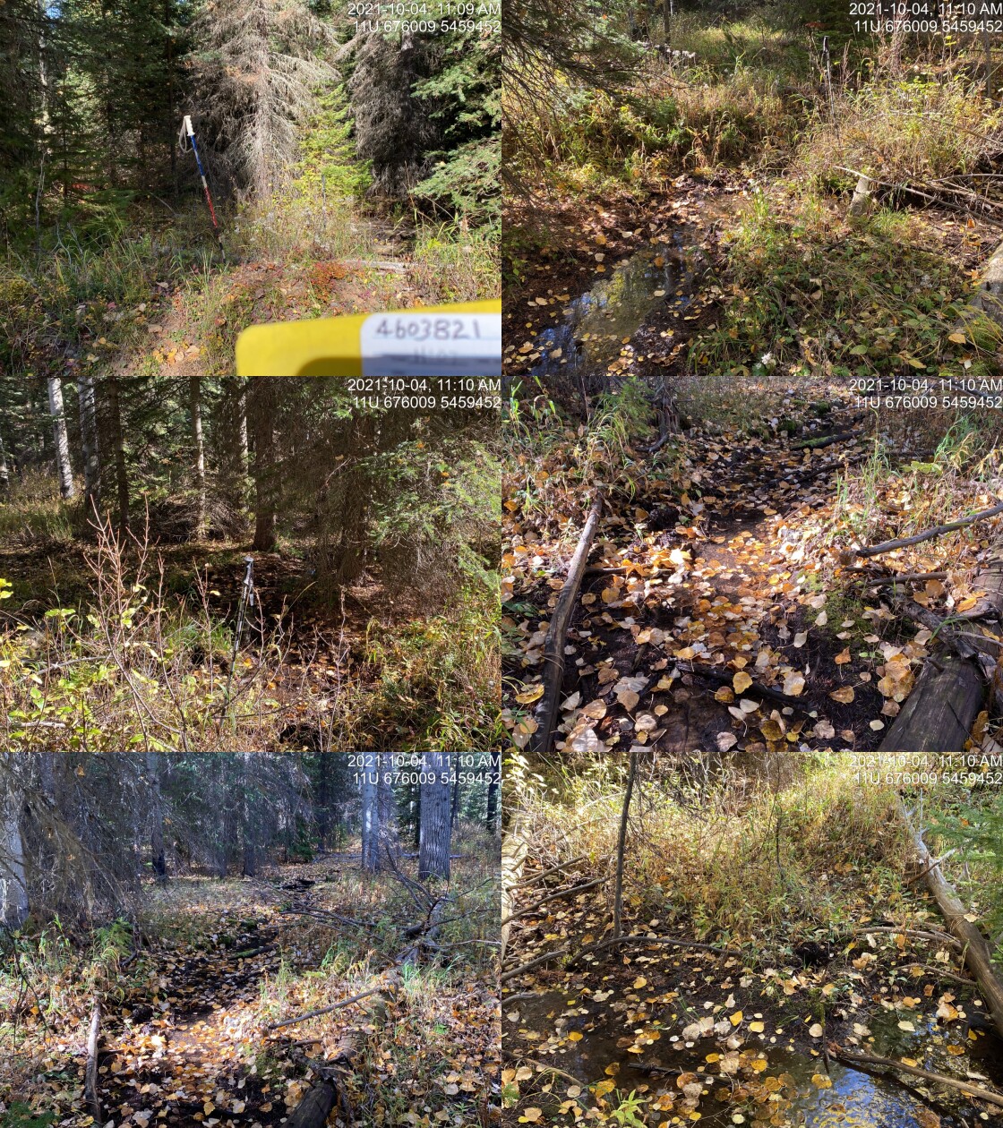
|
|||
| Comments: Wildlife trail. No structure. Road does not appear to be usd by ATVs. Man flow of Morris Creek is actually north of here and flows in from the north. Small amount of flow on trail. No indiction of channel. 11:07 |
| Location and Stream Data |
|
Crossing Characteristics | – |
|---|---|---|---|
| Date | 2021-10-04 | Crossing Sub Type | Round Culvert |
| PSCIS ID | 197815 | Diameter (m) | 4.5 |
| External ID | 4607464 | Length (m) | 60 |
| Crew | AI | Embedded | Yes |
| UTM Zone | 11 | Depth Embedded (m) | 1.5 |
| Easting | 682774 | Resemble Channel | Yes |
| Northing | 5448438 | Backwatered | No |
| Stream | Tributary to Flathead River | Percent Backwatered | – |
| Road | Flathead FSR | Fill Depth (m) | 9.99 |
| Road Tenure | FLNR DRM 0030 | Outlet Drop (m) | 0 |
| Channel Width (m) | 3 | Outlet Pool Depth (m) | 0 |
| Stream Slope (%) | 4 | Inlet Drop | Yes |
| Beaver Activity | No | Slope (%) | 2 |
| Habitat Value | High | Valley Fill | Deep Fill |
| Final score | 11 | Barrier Result | Passable |
| Fix type | – | Fix Span / Diameter | – |
Photos: PSCIS ID 197815. From top left clockwise: Road/Site Card, Barrel, Outlet, Downstream, Upstream, Inlet.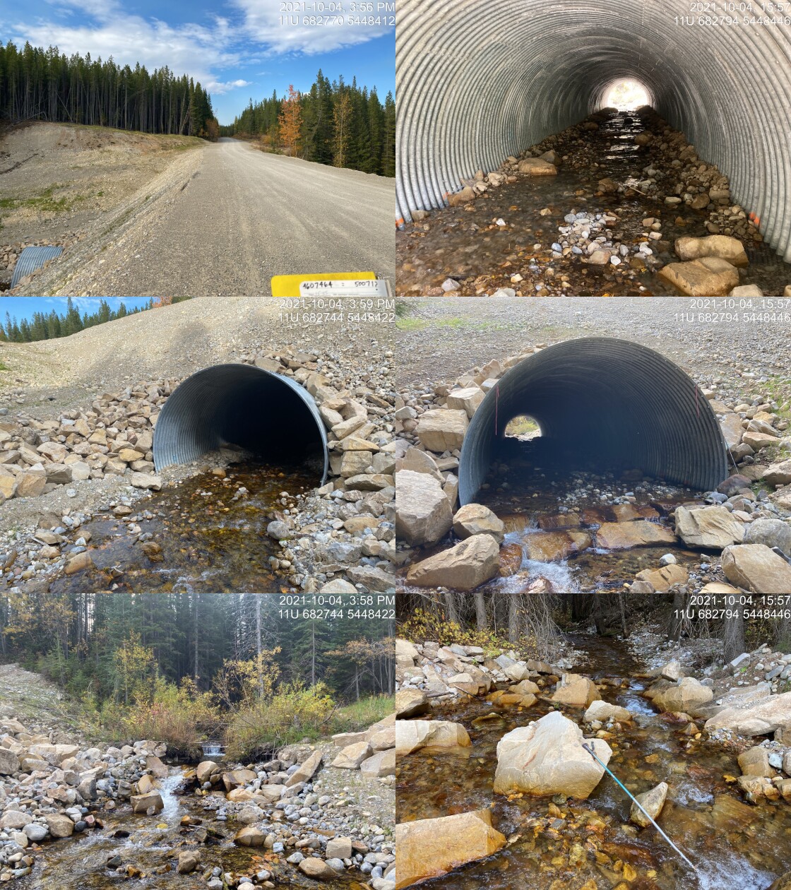
|
|||
| Comments: Newly replaced culvert with natural embedded substrate. Likely PSCIS point 50071 however the coordinates for that site appear to be input incorrectly. 15:55 |
| Location and Stream Data |
|
Crossing Characteristics | – |
|---|---|---|---|
| Date | 2021-10-05 | Crossing Sub Type | Ford |
| PSCIS ID | 197816 | Diameter (m) | – |
| External ID | 4602949 | Length (m) | – |
| Crew | AI | Embedded | – |
| UTM Zone | 11 | Depth Embedded (m) | – |
| Easting | 647247 | Resemble Channel | – |
| Northing | 5534524 | Backwatered | – |
| Stream | Weigert Creek | Percent Backwatered | – |
| Road | Weigert FSR | Fill Depth (m) | – |
| Road Tenure | Unclassified | Outlet Drop (m) | – |
| Channel Width (m) | – | Outlet Pool Depth (m) | – |
| Stream Slope (%) | – | Inlet Drop | – |
| Beaver Activity | – | Slope (%) | – |
| Habitat Value | – | Valley Fill | – |
| Final score | 0 | Barrier Result | Unknown |
| Fix type | – | Fix Span / Diameter | – |
Photos: PSCIS ID 197816. From top left clockwise: Road/Site Card, Barrel, Outlet, Downstream, Upstream, Inlet.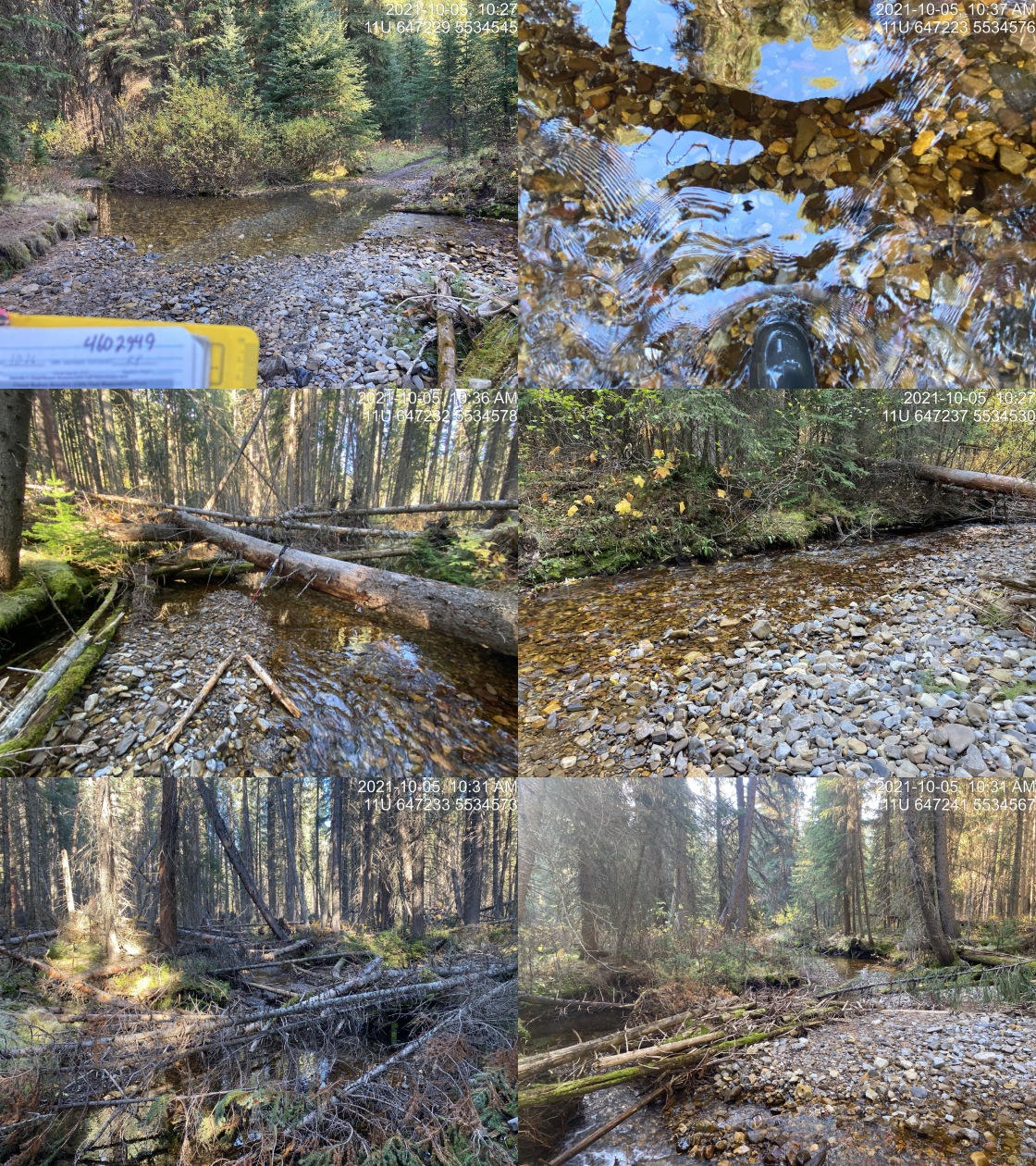
|
|||
| Comments: Ford within access mnagement area. 10:26 |
| Location and Stream Data |
|
Crossing Characteristics | – |
|---|---|---|---|
| Date | 2021-10-05 | Crossing Sub Type | Round Culvert |
| PSCIS ID | 197817 | Diameter (m) | 1 |
| External ID | 4605995 | Length (m) | 15 |
| Crew | AI | Embedded | No |
| UTM Zone | 11 | Depth Embedded (m) | – |
| Easting | 647526 | Resemble Channel | No |
| Northing | 5533149 | Backwatered | No |
| Stream | Tributary to Weigert Creek | Percent Backwatered | – |
| Road | Weigert FSR | Fill Depth (m) | 1 |
| Road Tenure | FLNR DRM 8633 | Outlet Drop (m) | 1.7 |
| Channel Width (m) | 2.4 | Outlet Pool Depth (m) | 0.3 |
| Stream Slope (%) | 17 | Inlet Drop | Yes |
| Beaver Activity | No | Slope (%) | 5 |
| Habitat Value | Low | Valley Fill | Deep Fill |
| Final score | 39 | Barrier Result | Barrier |
| Fix type | Replace with New Open Bottom Structure | Fix Span / Diameter | 12 |
Photos: PSCIS ID 197817. From top left clockwise: Road/Site Card, Barrel, Outlet, Downstream, Upstream, Inlet.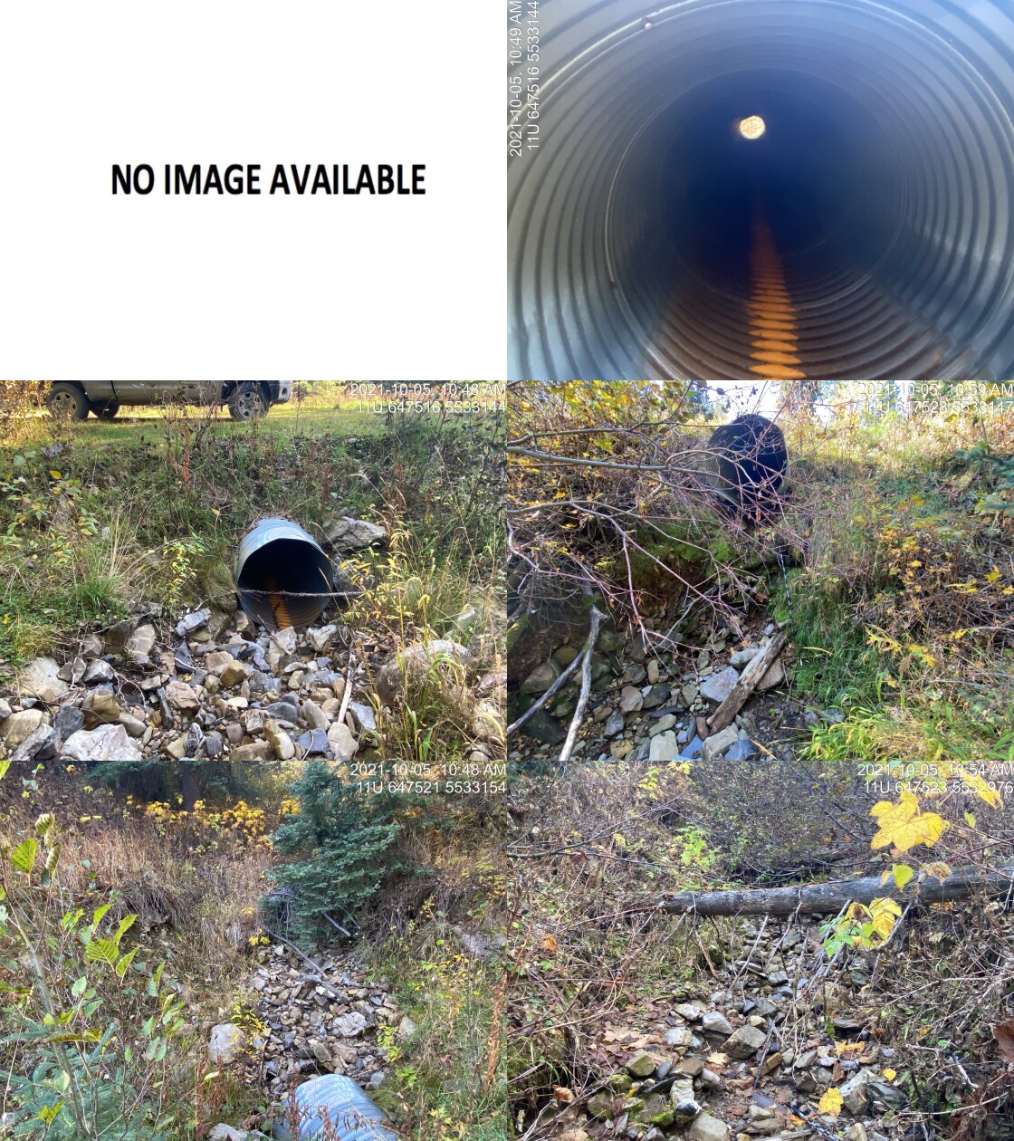
|
|||
| Comments: Dry and very steep stream channel. Likely to steep for WCT. 10:47 |
| Location and Stream Data |
|
Crossing Characteristics | – |
|---|---|---|---|
| Date | 2021-10-05 | Crossing Sub Type | Ford |
| PSCIS ID | 197818 | Diameter (m) | – |
| External ID | 4606007 | Length (m) | – |
| Crew | KP | Embedded | – |
| UTM Zone | 11 | Depth Embedded (m) | – |
| Easting | 647156.3 | Resemble Channel | – |
| Northing | 5534676 | Backwatered | – |
| Stream | Weigert Creek | Percent Backwatered | – |
| Road | Spur | Fill Depth (m) | – |
| Road Tenure | FLNR DRM 8633 | Outlet Drop (m) | – |
| Channel Width (m) | – | Outlet Pool Depth (m) | – |
| Stream Slope (%) | – | Inlet Drop | – |
| Beaver Activity | – | Slope (%) | – |
| Habitat Value | – | Valley Fill | – |
| Final score | 0 | Barrier Result | Unknown |
| Fix type | – | Fix Span / Diameter | – |
Photos: PSCIS ID 197818. From top left clockwise: Road/Site Card, Barrel, Outlet, Downstream, Upstream, Inlet.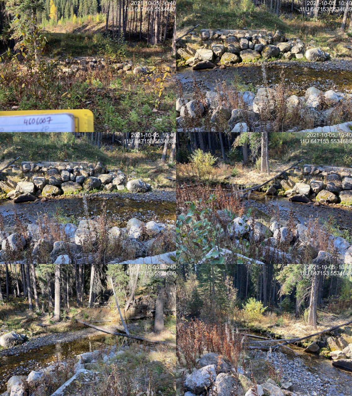
|
|||
| Comments: Road deactivated at entrance and crossings pulled. 10:37 |
| Location and Stream Data |
|
Crossing Characteristics | – |
|---|---|---|---|
| Date | 2021-10-05 | Crossing Sub Type | Ford |
| PSCIS ID | 197819 | Diameter (m) | – |
| External ID | 24735034 | Length (m) | – |
| Crew | KP | Embedded | – |
| UTM Zone | 11 | Depth Embedded (m) | – |
| Easting | 647195 | Resemble Channel | – |
| Northing | 5534741 | Backwatered | – |
| Stream | Tributary to Weigert Creek | Percent Backwatered | – |
| Road | Spur | Fill Depth (m) | – |
| Road Tenure | FLNR DRM 8633 | Outlet Drop (m) | – |
| Channel Width (m) | – | Outlet Pool Depth (m) | – |
| Stream Slope (%) | – | Inlet Drop | – |
| Beaver Activity | – | Slope (%) | – |
| Habitat Value | – | Valley Fill | – |
| Final score | 0 | Barrier Result | Unknown |
| Fix type | – | Fix Span / Diameter | – |
Photos: PSCIS ID 197819. From top left clockwise: Road/Site Card, Barrel, Outlet, Downstream, Upstream, Inlet.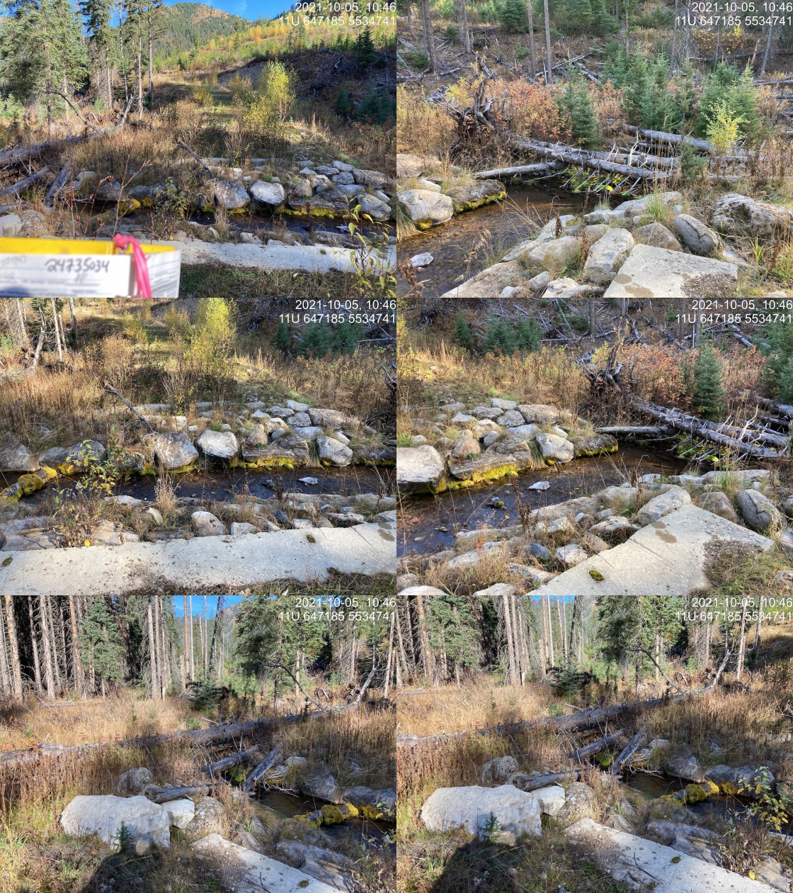
|
|||
| Comments: Road deactivated. Multiple crossings pulled out. Appears to be a tributary on map but on ground appears that it is possibly a side channel to Weigert. 10:42 |
| Location and Stream Data |
|
Crossing Characteristics | – |
|---|---|---|---|
| Date | 2021-10-05 | Crossing Sub Type | Ford |
| PSCIS ID | 197820 | Diameter (m) | – |
| External ID | 24735049 | Length (m) | – |
| Crew | KP | Embedded | – |
| UTM Zone | 11 | Depth Embedded (m) | – |
| Easting | 650009.9 | Resemble Channel | – |
| Northing | 5531958 | Backwatered | – |
| Stream | Weigert Creek | Percent Backwatered | – |
| Road | Spur | Fill Depth (m) | – |
| Road Tenure | Unknown | Outlet Drop (m) | – |
| Channel Width (m) | – | Outlet Pool Depth (m) | – |
| Stream Slope (%) | – | Inlet Drop | – |
| Beaver Activity | – | Slope (%) | – |
| Habitat Value | – | Valley Fill | – |
| Final score | 0 | Barrier Result | Unknown |
| Fix type | – | Fix Span / Diameter | – |
Photos: PSCIS ID 197820. From top left clockwise: Road/Site Card, Barrel, Outlet, Downstream, Upstream, Inlet.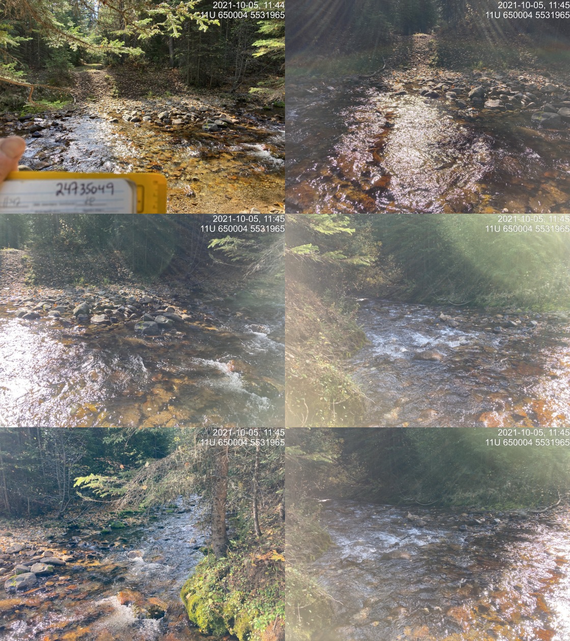
|
|||
| Comments: ATV Trail. 11:42 |
| Location and Stream Data |
|
Crossing Characteristics | – |
|---|---|---|---|
| Date | 2021-10-05 | Crossing Sub Type | Ford |
| PSCIS ID | 197821 | Diameter (m) | – |
| External ID | 4606545 | Length (m) | – |
| Crew | AI KP | Embedded | – |
| UTM Zone | 11 | Depth Embedded (m) | – |
| Easting | 644862 | Resemble Channel | – |
| Northing | 5520738 | Backwatered | – |
| Stream | Cummings Creek | Percent Backwatered | – |
| Road | Cummings FSR | Fill Depth (m) | – |
| Road Tenure | FLNR DRM 0142 | Outlet Drop (m) | – |
| Channel Width (m) | – | Outlet Pool Depth (m) | – |
| Stream Slope (%) | – | Inlet Drop | – |
| Beaver Activity | – | Slope (%) | – |
| Habitat Value | – | Valley Fill | – |
| Final score | 0 | Barrier Result | Unknown |
| Fix type | – | Fix Span / Diameter | – |
Photos: PSCIS ID 197821. From top left clockwise: Road/Site Card, Barrel, Outlet, Downstream, Upstream, Inlet.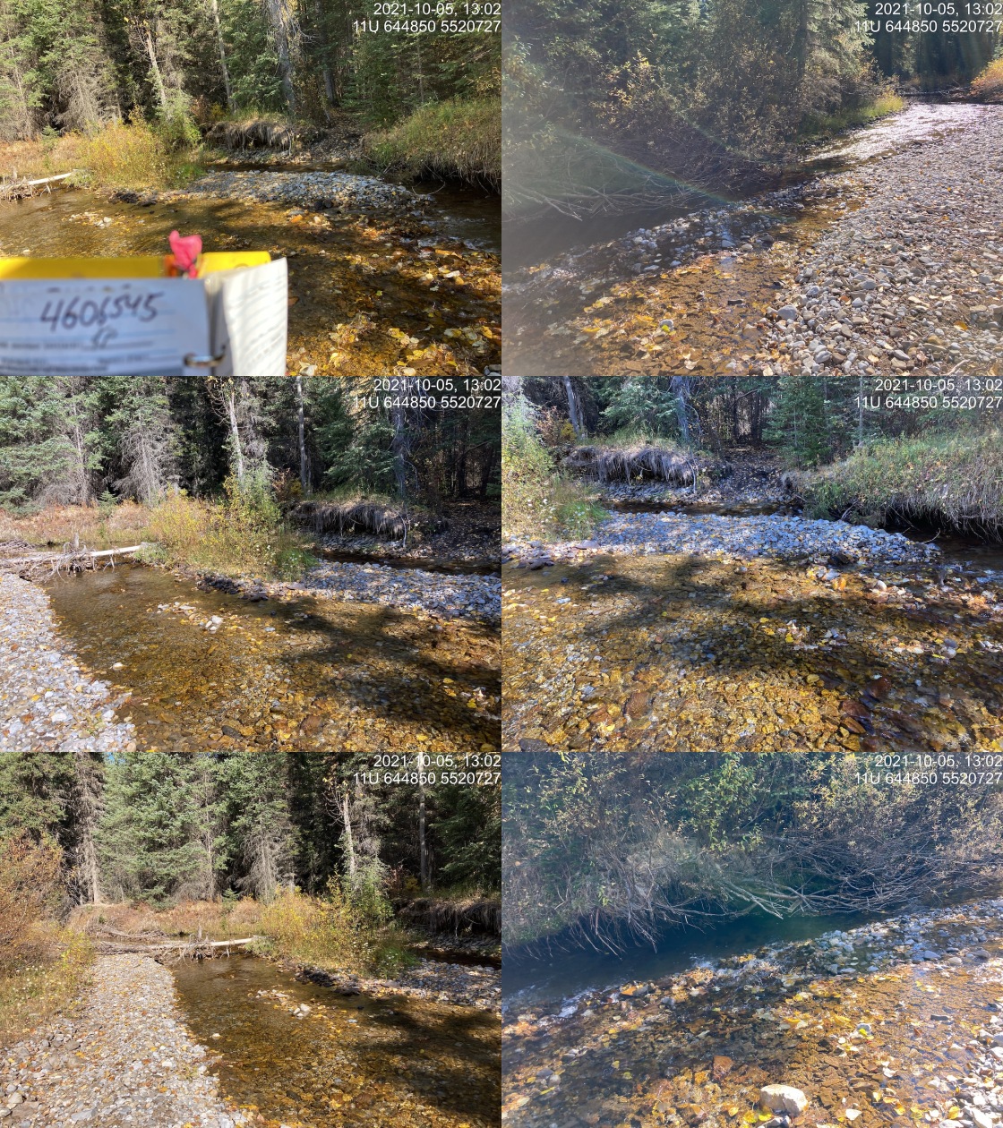
|
|||
| Comments: ATV Trail. 13:00 |
| Location and Stream Data |
|
Crossing Characteristics | – |
|---|---|---|---|
| Date | 2021-10-05 | Crossing Sub Type | Ford |
| PSCIS ID | 197822 | Diameter (m) | – |
| External ID | 4602093 | Length (m) | – |
| Crew | AI KP | Embedded | – |
| UTM Zone | 11 | Depth Embedded (m) | – |
| Easting | 639326 | Resemble Channel | – |
| Northing | 5520829 | Backwatered | – |
| Stream | Cummings Creek | Percent Backwatered | – |
| Road | Cummings FSR | Fill Depth (m) | – |
| Road Tenure | Unclassified | Outlet Drop (m) | – |
| Channel Width (m) | – | Outlet Pool Depth (m) | – |
| Stream Slope (%) | – | Inlet Drop | – |
| Beaver Activity | – | Slope (%) | – |
| Habitat Value | – | Valley Fill | – |
| Final score | 0 | Barrier Result | Unknown |
| Fix type | – | Fix Span / Diameter | – |
Photos: PSCIS ID 197822. From top left clockwise: Road/Site Card, Barrel, Outlet, Downstream, Upstream, Inlet.
|
|||
| Comments: Sporty ATV access only ;). 13:40 |
| Location and Stream Data |
|
Crossing Characteristics | – |
|---|---|---|---|
| Date | 2021-11-02 | Crossing Sub Type | Ford |
| PSCIS ID | 197823 | Diameter (m) | – |
| External ID | 24706614 | Length (m) | – |
| Crew | AI SS RA | Embedded | – |
| UTM Zone | 11 | Depth Embedded (m) | – |
| Easting | 653180.2 | Resemble Channel | – |
| Northing | 5566732 | Backwatered | – |
| Stream | Henretta Creek | Percent Backwatered | – |
| Road | – | Fill Depth (m) | – |
| Road Tenure | Teck | Outlet Drop (m) | – |
| Channel Width (m) | – | Outlet Pool Depth (m) | – |
| Stream Slope (%) | – | Inlet Drop | – |
| Beaver Activity | – | Slope (%) | – |
| Habitat Value | – | Valley Fill | – |
| Final score | 0 | Barrier Result | Unknown |
| Fix type | – | Fix Span / Diameter | – |
Photos: PSCIS ID 197823. From top left clockwise: Road/Site Card, Barrel, Outlet, Downstream, Upstream, Inlet.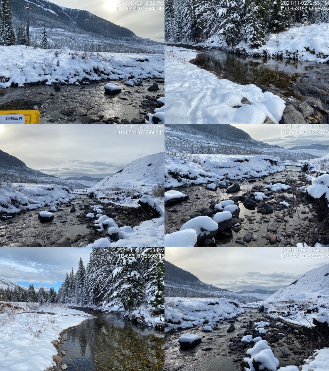
|
|||
| Comments: Transmission line crossing. May have been a bridge historically. 14:49 |
| Location and Stream Data |
|
Crossing Characteristics | – |
|---|---|---|---|
| Date | 2021-11-02 | Crossing Sub Type | Ford |
| PSCIS ID | 197824 | Diameter (m) | – |
| External ID | 4604696 | Length (m) | – |
| Crew | AI SS RA | Embedded | – |
| UTM Zone | 11 | Depth Embedded (m) | – |
| Easting | 652346.1 | Resemble Channel | – |
| Northing | 5566461 | Backwatered | – |
| Stream | Henretta Creek | Percent Backwatered | – |
| Road | – | Fill Depth (m) | – |
| Road Tenure | Teck | Outlet Drop (m) | – |
| Channel Width (m) | – | Outlet Pool Depth (m) | – |
| Stream Slope (%) | – | Inlet Drop | – |
| Beaver Activity | – | Slope (%) | – |
| Habitat Value | – | Valley Fill | – |
| Final score | 0 | Barrier Result | Unknown |
| Fix type | – | Fix Span / Diameter | – |
Photos: PSCIS ID 197824. From top left clockwise: Road/Site Card, Barrel, Outlet, Downstream, Upstream, Inlet.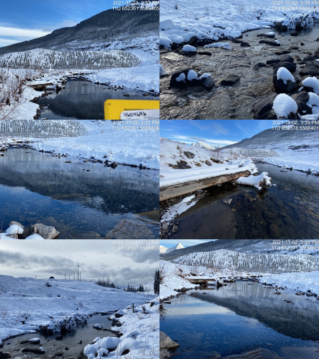
|
|||
| Comments: Approximately 60m downstream of modelled location. 15:25 |
| Location and Stream Data |
|
Crossing Characteristics | – |
|---|---|---|---|
| Date | 2021-11-02 | Crossing Sub Type | Round Culvert |
| PSCIS ID | 197825 | Diameter (m) | 2.7 |
| External ID | 4604677 | Length (m) | 99 |
| Crew | AI SS RA | Embedded | No |
| UTM Zone | 11 | Depth Embedded (m) | – |
| Easting | 652123.3 | Resemble Channel | No |
| Northing | 5566424 | Backwatered | Yes |
| Stream | Henretta Creek | Percent Backwatered | 100 |
| Road | – | Fill Depth (m) | 2.4 |
| Road Tenure | Teck | Outlet Drop (m) | 0 |
| Channel Width (m) | 12 | Outlet Pool Depth (m) | 0.4 |
| Stream Slope (%) | 3.5 | Inlet Drop | No |
| Beaver Activity | No | Slope (%) | 0.5 |
| Habitat Value | High | Valley Fill | Deep Fill |
| Final score | 22 | Barrier Result | Barrier |
| Fix type | Replace with New Open Bottom Structure | Fix Span / Diameter | 18 |
Photos: PSCIS ID 197825. From top left clockwise: Road/Site Card, Barrel, Outlet, Downstream, Upstream, Inlet.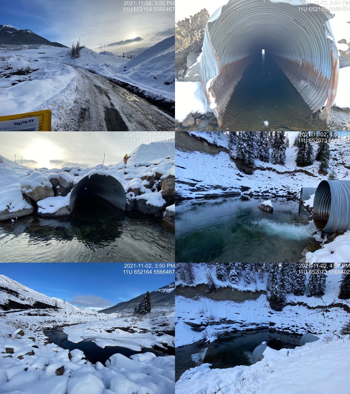
|
|||
| Comments: Two pipes (2.7 x 2.2). Length of pipes is 130m! Biomark station installed to document fish movement through culvert. Four concrete weirs (~0.3m drops) located downstream of outlet. 15:50 |
| Location and Stream Data |
|
Crossing Characteristics | – |
|---|---|---|---|
| Date | 2021-11-03 | Crossing Sub Type | Ford |
| PSCIS ID | 197826 | Diameter (m) | – |
| External ID | 4603334 | Length (m) | – |
| Crew | AI SS RA | Embedded | – |
| UTM Zone | 11 | Depth Embedded (m) | – |
| Easting | 651460.9 | Resemble Channel | – |
| Northing | 5566706 | Backwatered | – |
| Stream | Fording River | Percent Backwatered | – |
| Road | – | Fill Depth (m) | – |
| Road Tenure | Teck | Outlet Drop (m) | – |
| Channel Width (m) | – | Outlet Pool Depth (m) | – |
| Stream Slope (%) | – | Inlet Drop | – |
| Beaver Activity | – | Slope (%) | – |
| Habitat Value | – | Valley Fill | – |
| Final score | 0 | Barrier Result | Unknown |
| Fix type | – | Fix Span / Diameter | – |
Photos: PSCIS ID 197826. From top left clockwise: Road/Site Card, Barrel, Outlet, Downstream, Upstream, Inlet.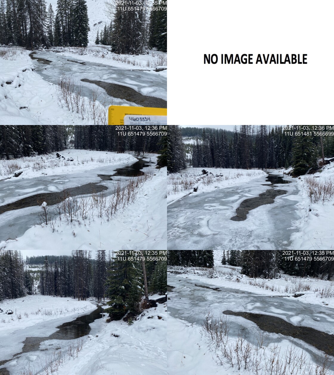
|
|||
| Comments: Staff gauge and transducer upstream. 12:30 |
| Location and Stream Data |
|
Crossing Characteristics | – |
|---|---|---|---|
| Date | 2021-11-03 | Crossing Sub Type | Round Culvert |
| PSCIS ID | 197827 | Diameter (m) | 5 |
| External ID | 4600762 | Length (m) | 40 |
| Crew | AI SS RA | Embedded | No |
| UTM Zone | 11 | Depth Embedded (m) | – |
| Easting | 651282 | Resemble Channel | No |
| Northing | 5562574 | Backwatered | No |
| Stream | Fording River | Percent Backwatered | – |
| Road | FRO Coal Haul | Fill Depth (m) | 9.99 |
| Road Tenure | Teck | Outlet Drop (m) | 0 |
| Channel Width (m) | 16 | Outlet Pool Depth (m) | 4 |
| Stream Slope (%) | 2 | Inlet Drop | Yes |
| Beaver Activity | No | Slope (%) | 2 |
| Habitat Value | High | Valley Fill | Deep Fill |
| Final score | 27 | Barrier Result | Barrier |
| Fix type | Replace with New Open Bottom Structure | Fix Span / Diameter | 33 |
Photos: PSCIS ID 197827. From top left clockwise: Road/Site Card, Barrel, Outlet, Downstream, Upstream, Inlet.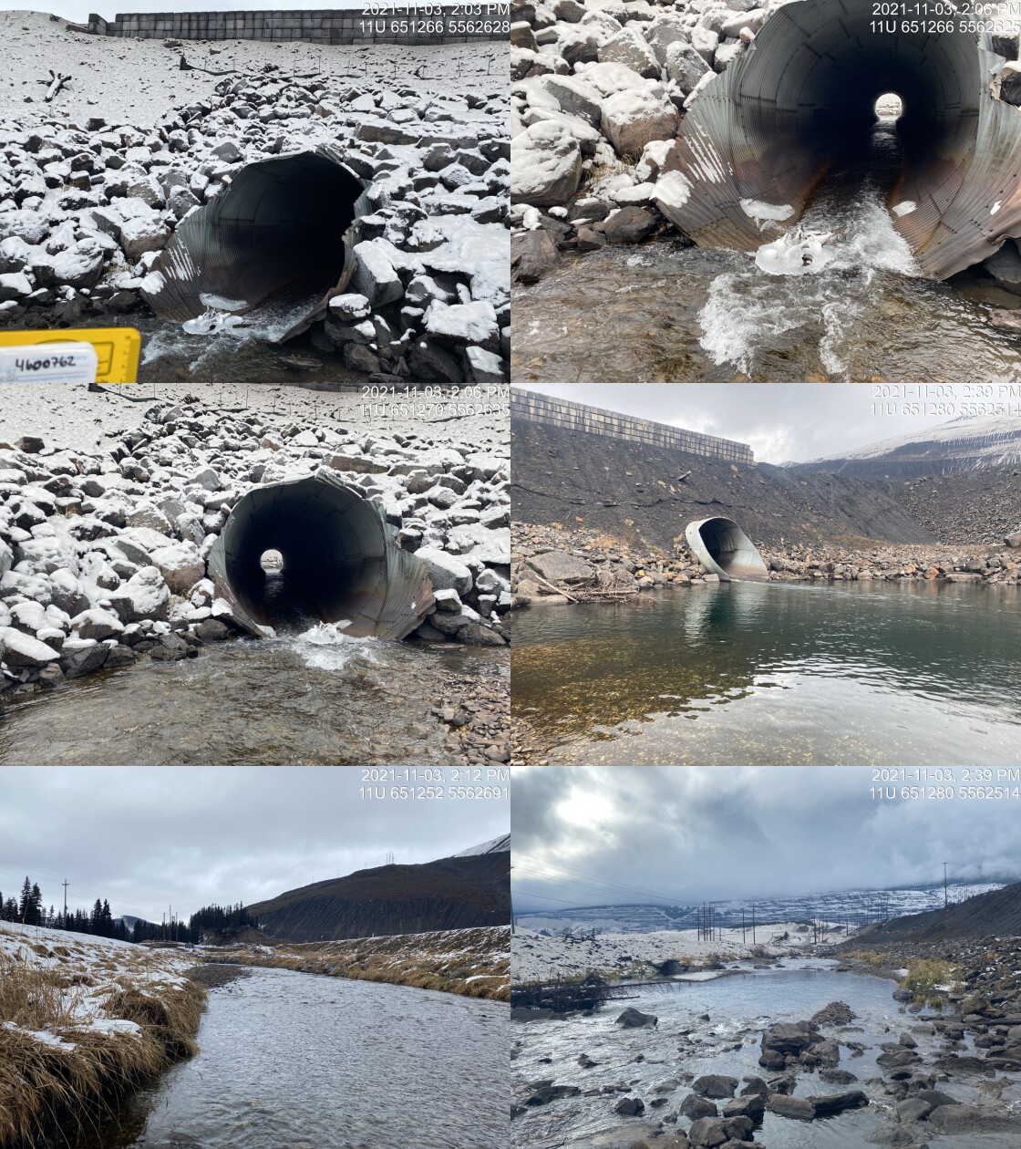
|
|||
| Comments: Very large culvert on main coal haul road. Outlet appears to have been backwatered by downstream wiers. 14:04 |
| Location and Stream Data |
|
Crossing Characteristics | – |
|---|---|---|---|
| Date | 2021-10-14 | Crossing Sub Type | Round Culvert |
| PSCIS ID | 197828 | Diameter (m) | 1.1 |
| External ID | 4605671 | Length (m) | 12 |
| Crew | AI BK SS RA | Embedded | No |
| UTM Zone | 11 | Depth Embedded (m) | – |
| Easting | 647549 | Resemble Channel | No |
| Northing | 5574967 | Backwatered | No |
| Stream | Tributary to Elk River | Percent Backwatered | – |
| Road | Elk FSR | Fill Depth (m) | 0.7 |
| Road Tenure | FLNR DRM 0103 | Outlet Drop (m) | 0.05 |
| Channel Width (m) | 1.3 | Outlet Pool Depth (m) | 0.23 |
| Stream Slope (%) | 5 | Inlet Drop | Yes |
| Beaver Activity | No | Slope (%) | 3.5 |
| Habitat Value | Low | Valley Fill | Deep Fill |
| Final score | 23 | Barrier Result | Barrier |
| Fix type | Replace Structure with Streambed Simulation CBS | Fix Span / Diameter | 3 |
Photos: PSCIS ID 197828. From top left clockwise: Road/Site Card, Barrel, Outlet, Downstream, Upstream, Inlet.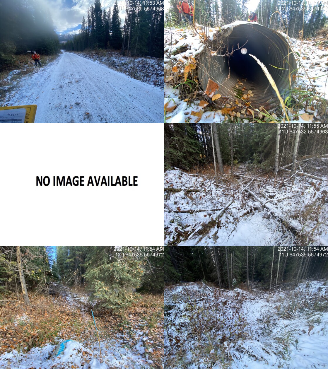
|
|||
| Comments: Dry at the time of the assessment. Inlet drop of 10cm. 11:51 |
| Location and Stream Data |
|
Crossing Characteristics | – |
|---|---|---|---|
| Date | 2021-10-14 | Crossing Sub Type | Round Culvert |
| PSCIS ID | 197829 | Diameter (m) | 0.5 |
| External ID | 4605698 | Length (m) | 11 |
| Crew | AI BK SS RA | Embedded | No |
| UTM Zone | 11 | Depth Embedded (m) | – |
| Easting | 646781 | Resemble Channel | No |
| Northing | 5572308 | Backwatered | No |
| Stream | Tributary to Elk River | Percent Backwatered | – |
| Road | Elk FSR | Fill Depth (m) | 0.7 |
| Road Tenure | FLNR DRM 0103 | Outlet Drop (m) | 0.15 |
| Channel Width (m) | 0.95 | Outlet Pool Depth (m) | 0.1 |
| Stream Slope (%) | 14 | Inlet Drop | Yes |
| Beaver Activity | No | Slope (%) | 2 |
| Habitat Value | Low | Valley Fill | Deep Fill |
| Final score | 26 | Barrier Result | Barrier |
| Fix type | Replace Structure with Streambed Simulation CBS | Fix Span / Diameter | 3 |
Photos: PSCIS ID 197829. From top left clockwise: Road/Site Card, Barrel, Outlet, Downstream, Upstream, Inlet.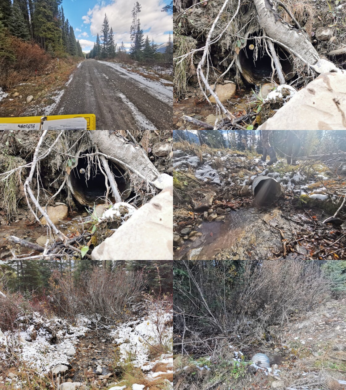
|
|||
| Comments: Inlet drop ~5cm. 13:15 |
| Location and Stream Data |
|
Crossing Characteristics | – |
|---|---|---|---|
| Date | 2021-10-14 | Crossing Sub Type | Round Culvert |
| PSCIS ID | 197830 | Diameter (m) | 0.6 |
| External ID | 4605731 | Length (m) | 14 |
| Crew | AI BK SS RA | Embedded | No |
| UTM Zone | 11 | Depth Embedded (m) | – |
| Easting | 646748 | Resemble Channel | No |
| Northing | 5571001 | Backwatered | No |
| Stream | Tributary to Elk River | Percent Backwatered | – |
| Road | Elk FSR | Fill Depth (m) | 1.32 |
| Road Tenure | FLNR DRM 0103 | Outlet Drop (m) | 0.4 |
| Channel Width (m) | 2 | Outlet Pool Depth (m) | 0 |
| Stream Slope (%) | 9 | Inlet Drop | No |
| Beaver Activity | No | Slope (%) | 4.5 |
| Habitat Value | Medium | Valley Fill | Deep Fill |
| Final score | 36 | Barrier Result | Barrier |
| Fix type | Replace with New Open Bottom Structure | Fix Span / Diameter | 12 |
Photos: PSCIS ID 197830. From top left clockwise: Road/Site Card, Barrel, Outlet, Downstream, Upstream, Inlet.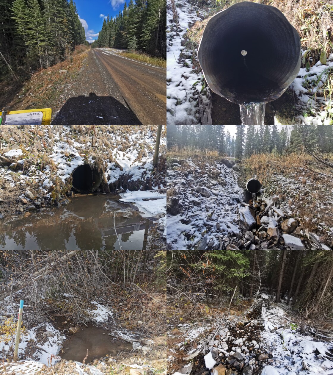
|
|||
| Comments: Good flow with some decent lower gradient habitat upstream of the FSR. 13:24 |
| Location and Stream Data |
|
Crossing Characteristics | – |
|---|---|---|---|
| Date | 2021-10-15 | Crossing Sub Type | Ford |
| PSCIS ID | 197831 | Diameter (m) | – |
| External ID | 2021101501 | Length (m) | – |
| Crew | AI BK SS RA | Embedded | – |
| UTM Zone | 11 | Depth Embedded (m) | – |
| Easting | 646931 | Resemble Channel | – |
| Northing | 5494699 | Backwatered | – |
| Stream | Hosmer Creek | Percent Backwatered | – |
| Road | Unnamed | Fill Depth (m) | – |
| Road Tenure | Unclassified | Outlet Drop (m) | – |
| Channel Width (m) | – | Outlet Pool Depth (m) | – |
| Stream Slope (%) | – | Inlet Drop | – |
| Beaver Activity | – | Slope (%) | – |
| Habitat Value | – | Valley Fill | – |
| Final score | 0 | Barrier Result | Unknown |
| Fix type | – | Fix Span / Diameter | – |
Photos: PSCIS ID 197831. From top left clockwise: Road/Site Card, Barrel, Outlet, Downstream, Upstream, Inlet.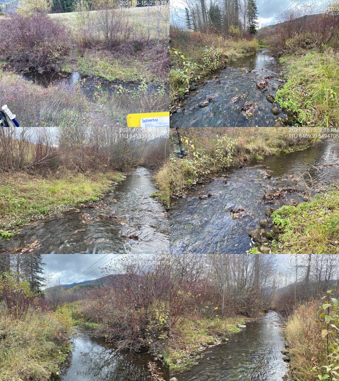
|
|||
| Comments: Ford. 14:15 |
| Location and Stream Data |
|
Crossing Characteristics | – |
|---|---|---|---|
| Date | 2021-10-15 | Crossing Sub Type | Round Culvert |
| PSCIS ID | 197832 | Diameter (m) | 5 |
| External ID | 4600087 | Length (m) | 12 |
| Crew | AI BK SS RA | Embedded | Yes |
| UTM Zone | 11 | Depth Embedded (m) | 0.5 |
| Easting | 647133.2 | Resemble Channel | Yes |
| Northing | 5495082 | Backwatered | Yes |
| Stream | Tributary to Hosmer Creek | Percent Backwatered | 100 |
| Road | 3rd Avenue | Fill Depth (m) | 1 |
| Road Tenure | MoTi Local | Outlet Drop (m) | 0 |
| Channel Width (m) | 5 | Outlet Pool Depth (m) | 0.5 |
| Stream Slope (%) | 0 | Inlet Drop | Yes |
| Beaver Activity | Yes | Slope (%) | 0 |
| Habitat Value | Medium | Valley Fill | Deep Fill |
| Final score | 8 | Barrier Result | Passable |
| Fix type | – | Fix Span / Diameter | – |
Photos: PSCIS ID 197832. From top left clockwise: Road/Site Card, Barrel, Outlet, Downstream, Upstream, Inlet.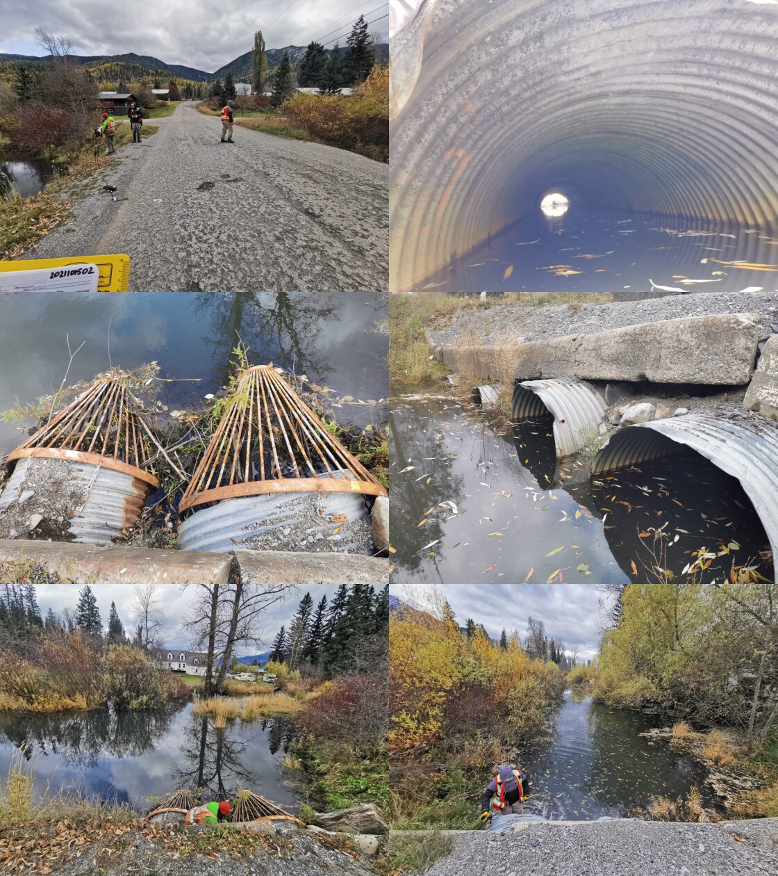
|
|||
| Comments: Four round culverts (1.4, 1.4, 1.0, 1.0m). Width used is equal to estimated channel width because the crossing is fully backwatered with wetland type habitat. Very unlikely that there are other crossings on this tributary upstream or downstream (it is Hosmer Creek downstream) as there does not appear to be any roads. Confirmed that modelled crossing 4603285 (30m upstream) does not exist. 14:35 |
| Location and Stream Data |
|
Crossing Characteristics | – |
|---|---|---|---|
| Date | 2021-10-15 | Crossing Sub Type | Round Culvert |
| PSCIS ID | 197833 | Diameter (m) | 1.5 |
| External ID | 4600129 | Length (m) | 22 |
| Crew | AI BK SS RA | Embedded | No |
| UTM Zone | 11 | Depth Embedded (m) | – |
| Easting | 647141.4 | Resemble Channel | No |
| Northing | 5494823 | Backwatered | No |
| Stream | Hosmer Creek | Percent Backwatered | – |
| Road | Highway 3 | Fill Depth (m) | 3 |
| Road Tenure | MoTi Arterial | Outlet Drop (m) | 0 |
| Channel Width (m) | 3 | Outlet Pool Depth (m) | 0.4 |
| Stream Slope (%) | 2.5 | Inlet Drop | Yes |
| Beaver Activity | No | Slope (%) | 4.5 |
| Habitat Value | Medium | Valley Fill | Deep Fill |
| Final score | 29 | Barrier Result | Barrier |
| Fix type | Replace with New Open Bottom Structure | Fix Span / Diameter | 12 |
Photos: PSCIS ID 197833. From top left clockwise: Road/Site Card, Barrel, Outlet, Downstream, Upstream, Inlet.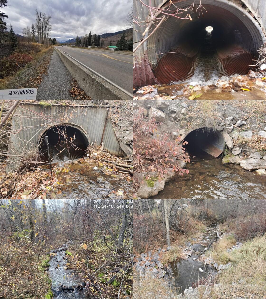
|
|||
| Comments: Inlet drop ~0.75m. Backwatering done in past to reduce outlet drop. Water intake downstream form the culvert. 15:12 |
| Location and Stream Data |
|
Crossing Characteristics | – |
|---|---|---|---|
| Date | 2021-10-15 | Crossing Sub Type | Round Culvert |
| PSCIS ID | 197834 | Diameter (m) | 1.75 |
| External ID | 4606711 | Length (m) | 30 |
| Crew | AI BK SS RA | Embedded | Yes |
| UTM Zone | 11 | Depth Embedded (m) | 0.3 |
| Easting | 647221.7 | Resemble Channel | Yes |
| Northing | 5494759 | Backwatered | No |
| Stream | Hosmer Creek | Percent Backwatered | – |
| Road | CP Railway | Fill Depth (m) | 1.5 |
| Road Tenure | Canadian Pacific | Outlet Drop (m) | 0 |
| Channel Width (m) | 3.9 | Outlet Pool Depth (m) | 0.4 |
| Stream Slope (%) | 5 | Inlet Drop | No |
| Beaver Activity | No | Slope (%) | 2 |
| Habitat Value | High | Valley Fill | Deep Fill |
| Final score | 22 | Barrier Result | Barrier |
| Fix type | Replace with New Open Bottom Structure | Fix Span / Diameter | 12 |
Photos: PSCIS ID 197834. From top left clockwise: Road/Site Card, Barrel, Outlet, Downstream, Upstream, Inlet.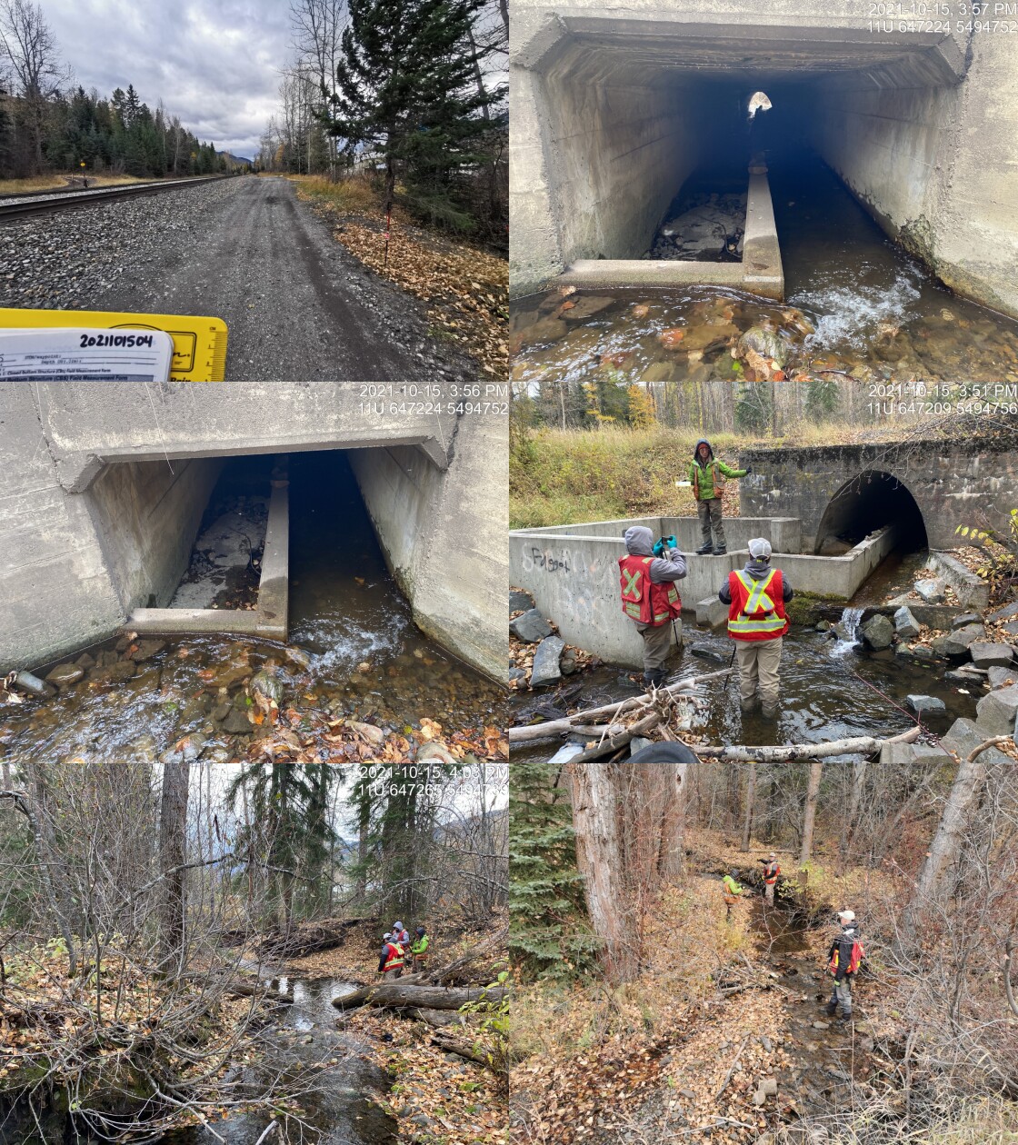
|
|||
| Comments: Concrete structure has been built to facilitate fish passage. There are baffles and installed within one side of the culvert which embedded this area of the culvert with substrate. 15:45 |
| Location and Stream Data |
|
Crossing Characteristics | – |
|---|---|---|---|
| Date | 2021-10-15 | Crossing Sub Type | Round Culvert |
| PSCIS ID | 197835 | Diameter (m) | 2.5 |
| External ID | 4600088 | Length (m) | 17 |
| Crew | AI BK SS RA | Embedded | No |
| UTM Zone | 11 | Depth Embedded (m) | – |
| Easting | 647446.7 | Resemble Channel | No |
| Northing | 5494639 | Backwatered | No |
| Stream | Hosmer Creek | Percent Backwatered | – |
| Road | Stephenson Road | Fill Depth (m) | 0.35 |
| Road Tenure | MoTi Local | Outlet Drop (m) | 0.24 |
| Channel Width (m) | 4.1 | Outlet Pool Depth (m) | 0.15 |
| Stream Slope (%) | 7 | Inlet Drop | No |
| Beaver Activity | No | Slope (%) | 3 |
| Habitat Value | Medium | Valley Fill | Deep Fill |
| Final score | 34 | Barrier Result | Barrier |
| Fix type | Replace with New Open Bottom Structure | Fix Span / Diameter | 12 |
Photos: PSCIS ID 197835. From top left clockwise: Road/Site Card, Barrel, Outlet, Downstream, Upstream, Inlet.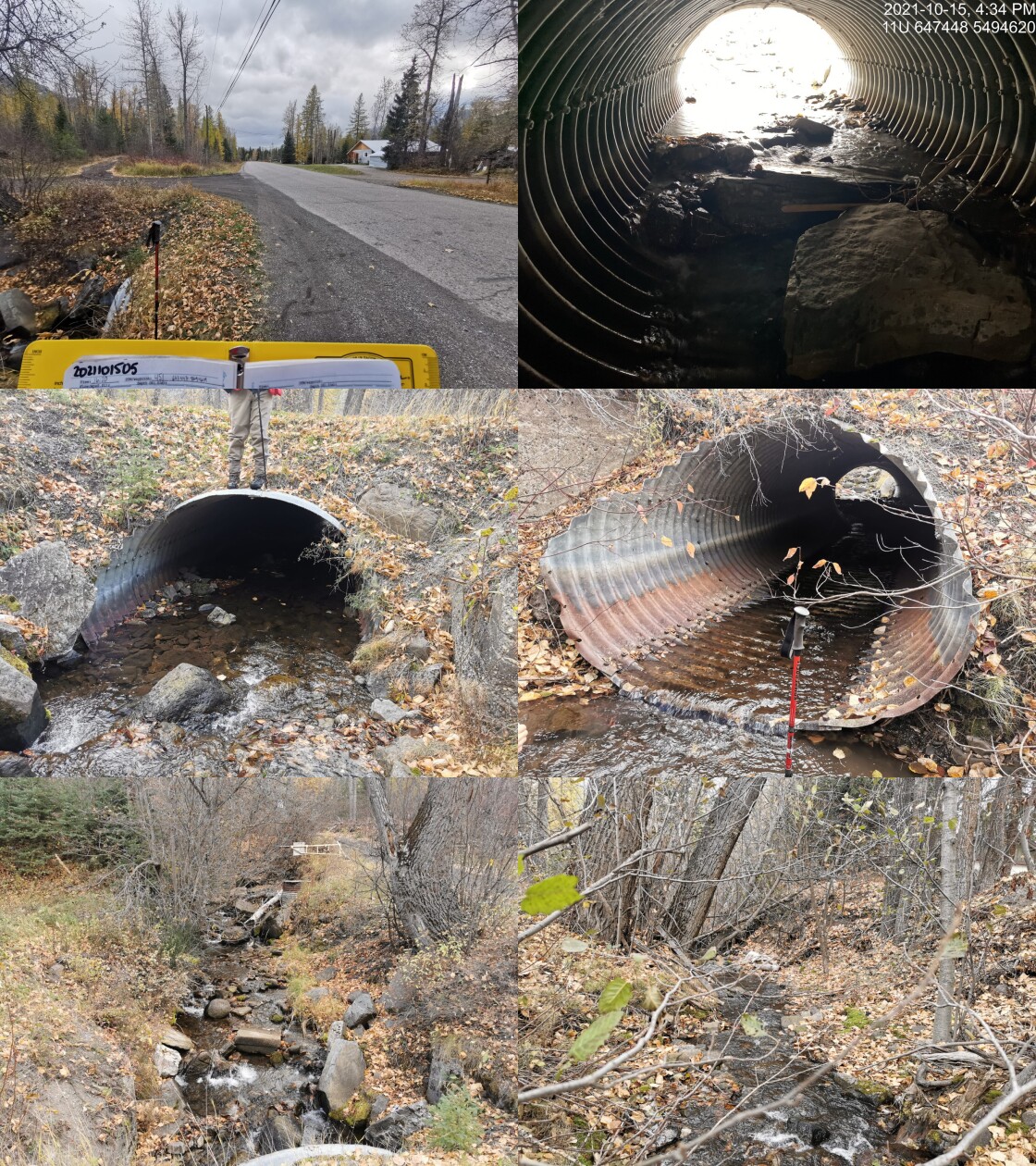
|
|||
| Comments: Adjacent landowner reports that this crossing was a bridge ~50 years ago and that the culvert is known to overflow during floods. Several 1m bolulders are lodge approximately 4m inside of the the pipe. 16:20 |
| Location and Stream Data |
|
Crossing Characteristics | – |
|---|---|---|---|
| Date | 2021-10-15 | Crossing Sub Type | Bridge |
| PSCIS ID | 197836 | Diameter (m) | 10 |
| External ID | 24734199 | Length (m) | 4 |
| Crew | AI BK SS RA | Embedded | – |
| UTM Zone | 11 | Depth Embedded (m) | – |
| Easting | 647622.9 | Resemble Channel | – |
| Northing | 5494599 | Backwatered | – |
| Stream | Hosmer Creek | Percent Backwatered | – |
| Road | Transmisson Line | Fill Depth (m) | – |
| Road Tenure | Unknown | Outlet Drop (m) | – |
| Channel Width (m) | – | Outlet Pool Depth (m) | – |
| Stream Slope (%) | – | Inlet Drop | – |
| Beaver Activity | – | Slope (%) | – |
| Habitat Value | – | Valley Fill | – |
| Final score | 0 | Barrier Result | Passable |
| Fix type | – | Fix Span / Diameter | – |
Photos: PSCIS ID 197836. From top left clockwise: Road/Site Card, Barrel, Outlet, Downstream, Upstream, Inlet.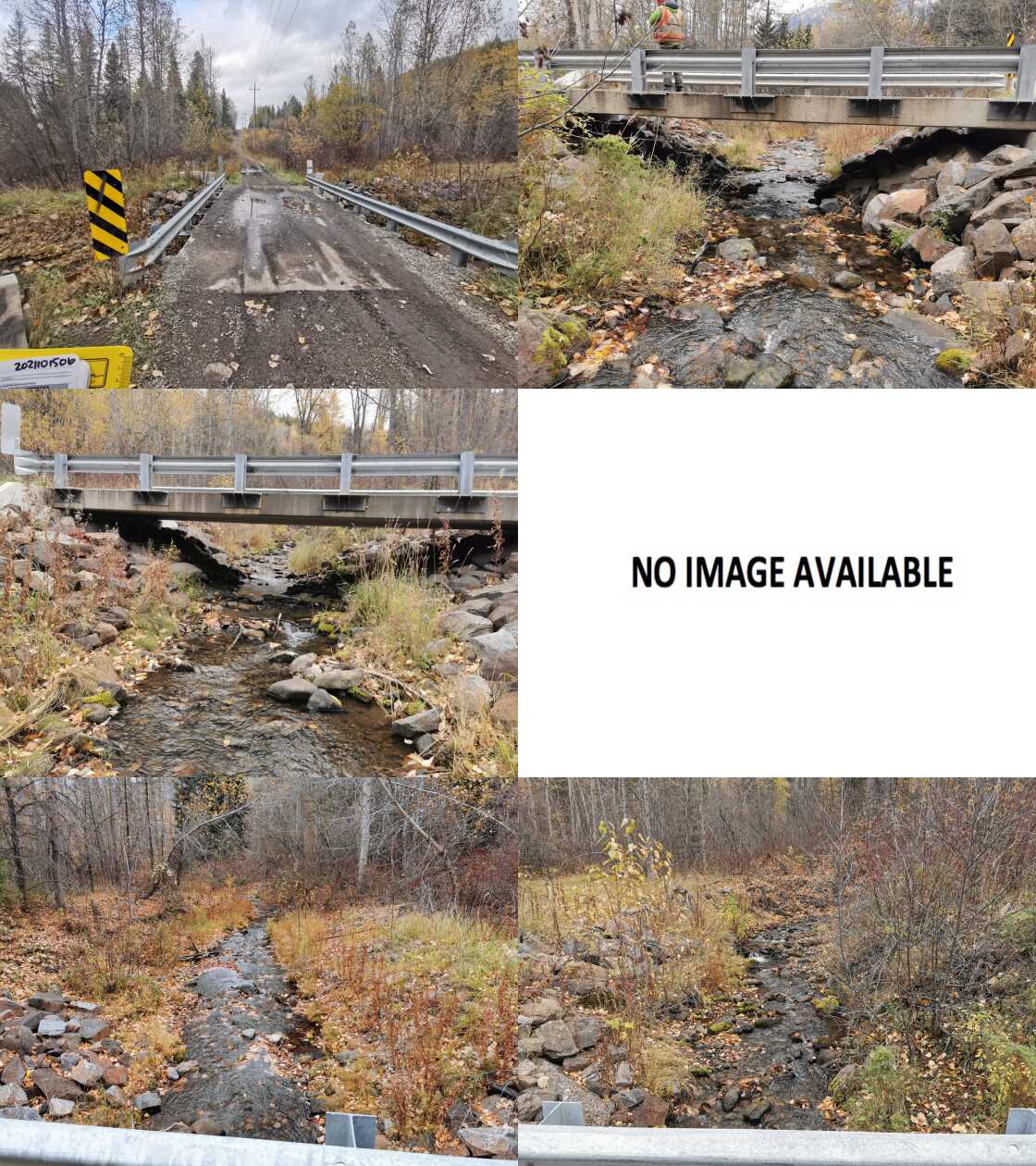
|
|||
| Comments: Bridge. 16:55 |
| Location and Stream Data |
|
Crossing Characteristics | – |
|---|---|---|---|
| Date | 2021-09-27 | Crossing Sub Type | Ford |
| PSCIS ID | 197837 | Diameter (m) | – |
| External ID | 4602163 | Length (m) | – |
| Crew | KP | Embedded | – |
| UTM Zone | 11 | Depth Embedded (m) | – |
| Easting | 651609.1 | Resemble Channel | – |
| Northing | 5475661 | Backwatered | – |
| Stream | Morrisey Creek | Percent Backwatered | – |
| Road | Spur | Fill Depth (m) | – |
| Road Tenure | Unclassified | Outlet Drop (m) | – |
| Channel Width (m) | – | Outlet Pool Depth (m) | – |
| Stream Slope (%) | – | Inlet Drop | – |
| Beaver Activity | – | Slope (%) | – |
| Habitat Value | – | Valley Fill | – |
| Final score | 0 | Barrier Result | Unknown |
| Fix type | – | Fix Span / Diameter | – |
Photos: PSCIS ID 197837. From top left clockwise: Road/Site Card, Barrel, Outlet, Downstream, Upstream, Inlet.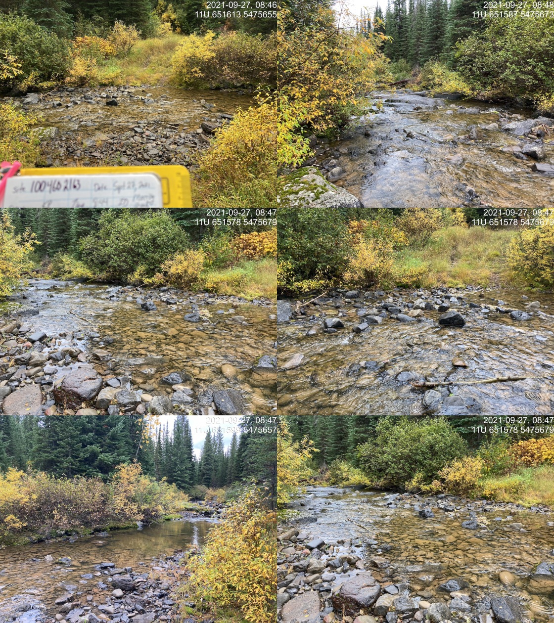
|
|||
| Comments: Ford on old road. Road is grassy. 8:44 |
| Location and Stream Data |
|
Crossing Characteristics | – |
|---|---|---|---|
| Date | 2021-09-27 | Crossing Sub Type | Ford |
| PSCIS ID | 197838 | Diameter (m) | – |
| External ID | 4601704 | Length (m) | – |
| Crew | KP | Embedded | – |
| UTM Zone | 11 | Depth Embedded (m) | – |
| Easting | 650166 | Resemble Channel | – |
| Northing | 5473852 | Backwatered | – |
| Stream | Morrisey Creek | Percent Backwatered | – |
| Road | Unnamed | Fill Depth (m) | – |
| Road Tenure | Unclassified | Outlet Drop (m) | – |
| Channel Width (m) | – | Outlet Pool Depth (m) | – |
| Stream Slope (%) | – | Inlet Drop | – |
| Beaver Activity | – | Slope (%) | – |
| Habitat Value | – | Valley Fill | – |
| Final score | 0 | Barrier Result | Unknown |
| Fix type | – | Fix Span / Diameter | – |
Photos: PSCIS ID 197838. From top left clockwise: Road/Site Card, Barrel, Outlet, Downstream, Upstream, Inlet.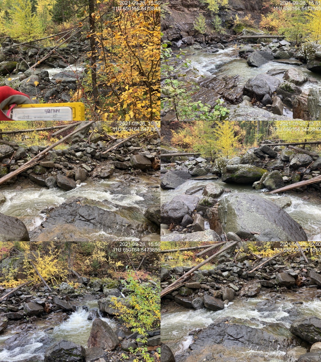
|
|||
| Comments: This road is not detectable in the field. There is no crossing structure. 15:48 |
| Location and Stream Data |
|
Crossing Characteristics | – |
|---|---|---|---|
| Date | 2021-09-27 | Crossing Sub Type | Ford |
| PSCIS ID | 197839 | Diameter (m) | – |
| External ID | 4607022 | Length (m) | – |
| Crew | KP | Embedded | – |
| UTM Zone | 11 | Depth Embedded (m) | – |
| Easting | 648168.1 | Resemble Channel | – |
| Northing | 5499879 | Backwatered | – |
| Stream | McCool Creek | Percent Backwatered | – |
| Road | Spur | Fill Depth (m) | – |
| Road Tenure | Resource | Outlet Drop (m) | – |
| Channel Width (m) | – | Outlet Pool Depth (m) | – |
| Stream Slope (%) | – | Inlet Drop | – |
| Beaver Activity | – | Slope (%) | – |
| Habitat Value | – | Valley Fill | – |
| Final score | 0 | Barrier Result | Unknown |
| Fix type | – | Fix Span / Diameter | – |
Photos: PSCIS ID 197839. From top left clockwise: Road/Site Card, Barrel, Outlet, Downstream, Upstream, Inlet.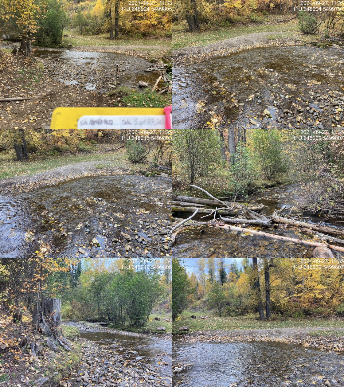
|
|||
| Comments: Well used ford. Actually crossing location does not align exceptionally well with modelled location but we have left the modelled location to facilitate the best modelling. Actual UTM (11U 648220 5499799). 11:29 |
| Location and Stream Data |
|
Crossing Characteristics | – |
|---|---|---|---|
| Date | 2021-09-28 | Crossing Sub Type | Bridge |
| PSCIS ID | 197840 | Diameter (m) | 15 |
| External ID | 24706675 | Length (m) | 4 |
| Crew | KP | Embedded | – |
| UTM Zone | 11 | Depth Embedded (m) | – |
| Easting | 663336.5 | Resemble Channel | – |
| Northing | 5447766 | Backwatered | – |
| Stream | Tributary to Bighorn Creek | Percent Backwatered | – |
| Road | Cabin FSR | Fill Depth (m) | – |
| Road Tenure | Unknown | Outlet Drop (m) | – |
| Channel Width (m) | – | Outlet Pool Depth (m) | – |
| Stream Slope (%) | – | Inlet Drop | – |
| Beaver Activity | – | Slope (%) | – |
| Habitat Value | – | Valley Fill | – |
| Final score | 0 | Barrier Result | Passable |
| Fix type | – | Fix Span / Diameter | – |
Photos: PSCIS ID 197840. From top left clockwise: Road/Site Card, Barrel, Outlet, Downstream, Upstream, Inlet.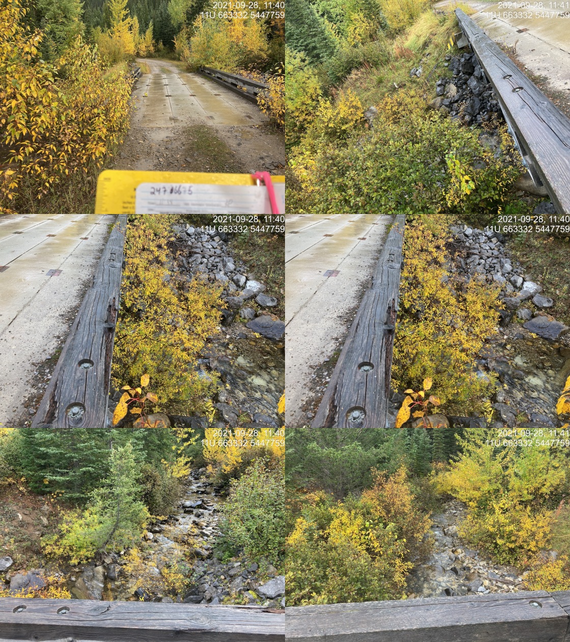
|
|||
| Comments: Bridge. 11:38 |
| Location and Stream Data |
|
Crossing Characteristics | – |
|---|---|---|---|
| Date | 2021-09-28 | Crossing Sub Type | Ford |
| PSCIS ID | 197841 | Diameter (m) | – |
| External ID | 4603555 | Length (m) | – |
| Crew | KP | Embedded | – |
| UTM Zone | 11 | Depth Embedded (m) | – |
| Easting | 662659 | Resemble Channel | – |
| Northing | 5447839 | Backwatered | – |
| Stream | Bighorn Creek | Percent Backwatered | – |
| Road | Spur | Fill Depth (m) | – |
| Road Tenure | Unclassified | Outlet Drop (m) | – |
| Channel Width (m) | – | Outlet Pool Depth (m) | – |
| Stream Slope (%) | – | Inlet Drop | – |
| Beaver Activity | – | Slope (%) | – |
| Habitat Value | – | Valley Fill | – |
| Final score | 0 | Barrier Result | Unknown |
| Fix type | – | Fix Span / Diameter | – |
Photos: PSCIS ID 197841. From top left clockwise: Road/Site Card, Barrel, Outlet, Downstream, Upstream, Inlet.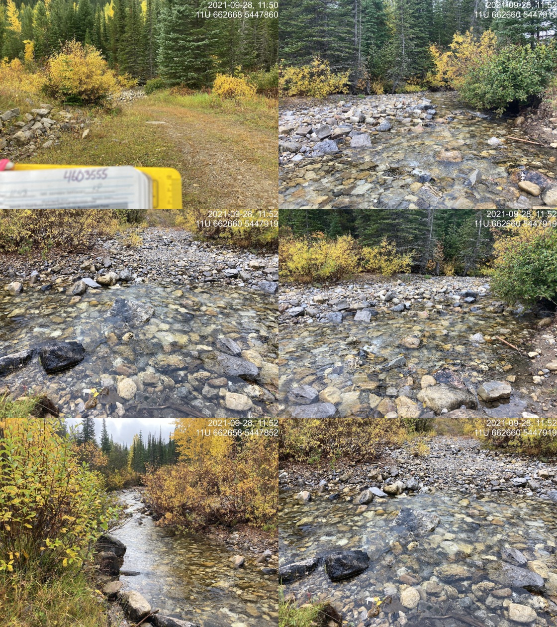
|
|||
| Comments: Some use of ATVs evident. Open gate on far side. 11:48 |
| Location and Stream Data |
|
Crossing Characteristics | – |
|---|---|---|---|
| Date | 2021-09-28 | Crossing Sub Type | Round Culvert |
| PSCIS ID | 197842 | Diameter (m) | 1.15 |
| External ID | 4605504 | Length (m) | 12 |
| Crew | KP | Embedded | No |
| UTM Zone | 11 | Depth Embedded (m) | – |
| Easting | 663661.2 | Resemble Channel | No |
| Northing | 5447169 | Backwatered | No |
| Stream | Tributary to Bighorn Creek | Percent Backwatered | – |
| Road | Cabin FSR | Fill Depth (m) | 1 |
| Road Tenure | FLNR DRM 5466 | Outlet Drop (m) | 0.21 |
| Channel Width (m) | 2.1 | Outlet Pool Depth (m) | 0.6 |
| Stream Slope (%) | 7.5 | Inlet Drop | No |
| Beaver Activity | No | Slope (%) | 7 |
| Habitat Value | Medium | Valley Fill | Deep Fill |
| Final score | 31 | Barrier Result | Barrier |
| Fix type | Replace with New Open Bottom Structure | Fix Span / Diameter | 12 |
Photos: PSCIS ID 197842. From top left clockwise: Road/Site Card, Barrel, Outlet, Downstream, Upstream, Inlet.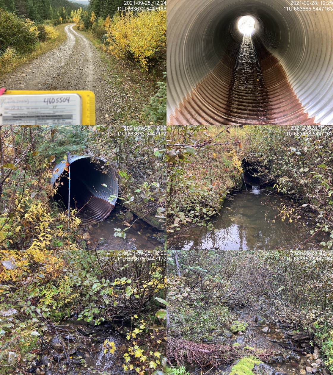
|
|||
| Comments: Nice stream with big pool. 12:22 |
| Location and Stream Data |
|
Crossing Characteristics | – |
|---|---|---|---|
| Date | 2021-09-28 | Crossing Sub Type | Round Culvert |
| PSCIS ID | 197843 | Diameter (m) | 0.6 |
| External ID | 4605502 | Length (m) | 9 |
| Crew | KP | Embedded | No |
| UTM Zone | 11 | Depth Embedded (m) | – |
| Easting | 663915.4 | Resemble Channel | No |
| Northing | 5446488 | Backwatered | No |
| Stream | Tributary to Bighorn Creek | Percent Backwatered | – |
| Road | Cabin FSR | Fill Depth (m) | 0.5 |
| Road Tenure | FLNR DRM 5466 | Outlet Drop (m) | 0.51 |
| Channel Width (m) | 1.8 | Outlet Pool Depth (m) | 0.19 |
| Stream Slope (%) | 6.5 | Inlet Drop | Yes |
| Beaver Activity | No | Slope (%) | 5 |
| Habitat Value | Medium | Valley Fill | Deep Fill |
| Final score | 36 | Barrier Result | Barrier |
| Fix type | Replace Structure with Streambed Simulation CBS | Fix Span / Diameter | 3 |
Photos: PSCIS ID 197843. From top left clockwise: Road/Site Card, Barrel, Outlet, Downstream, Upstream, Inlet.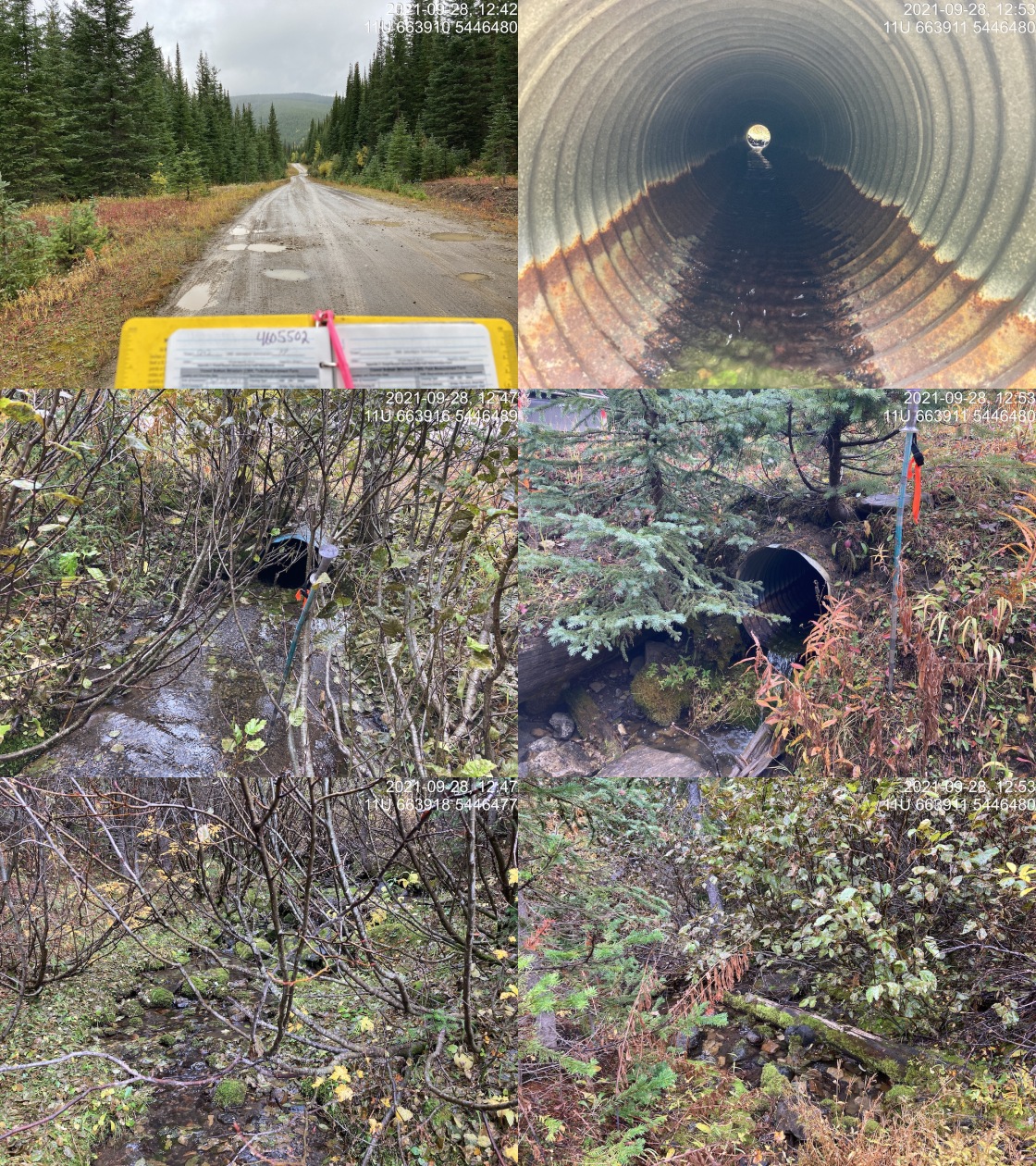
|
|||
| Comments: Inlet drop of 0.2m. Small stream, good flow. Steep downstream below pool. 12:42 |
| Location and Stream Data |
|
Crossing Characteristics | – |
|---|---|---|---|
| Date | 2021-09-28 | Crossing Sub Type | Round Culvert |
| PSCIS ID | 197844 | Diameter (m) | 1.2 |
| External ID | 4605514 | Length (m) | 12 |
| Crew | KP | Embedded | No |
| UTM Zone | 11 | Depth Embedded (m) | – |
| Easting | 657919.7 | Resemble Channel | No |
| Northing | 5452802 | Backwatered | No |
| Stream | Tributary to Bighorn Creek | Percent Backwatered | – |
| Road | Cabin FSR | Fill Depth (m) | 1 |
| Road Tenure | FLNR DRM 5466 | Outlet Drop (m) | 1.2 |
| Channel Width (m) | 2.2 | Outlet Pool Depth (m) | 0.93 |
| Stream Slope (%) | 5 | Inlet Drop | No |
| Beaver Activity | No | Slope (%) | 5 |
| Habitat Value | Medium | Valley Fill | Deep Fill |
| Final score | 36 | Barrier Result | Barrier |
| Fix type | Replace with New Open Bottom Structure | Fix Span / Diameter | 12 |
Photos: PSCIS ID 197844. From top left clockwise: Road/Site Card, Barrel, Outlet, Downstream, Upstream, Inlet.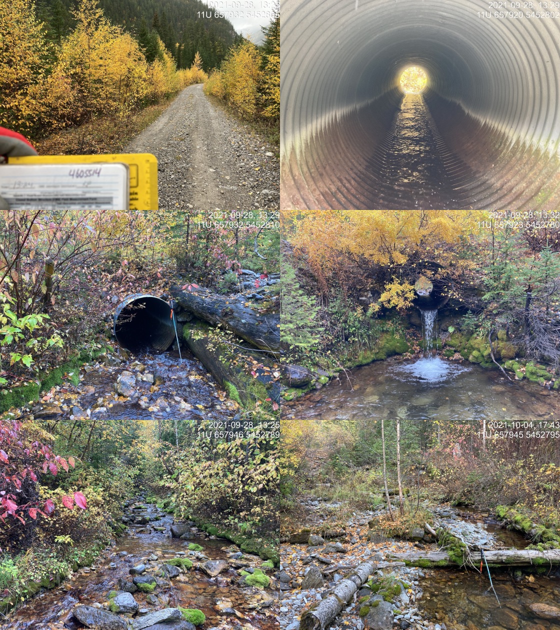
|
|||
| Comments: Cobble substrate and abundant overhanging vegetation. Decent sized stream. 13:24 |
| Location and Stream Data |
|
Crossing Characteristics | – |
|---|---|---|---|
| Date | 2021-09-28 | Crossing Sub Type | Round Culvert |
| PSCIS ID | 197845 | Diameter (m) | 0.6 |
| External ID | 4605531 | Length (m) | 11 |
| Crew | KP | Embedded | No |
| UTM Zone | 11 | Depth Embedded (m) | – |
| Easting | 655961.7 | Resemble Channel | No |
| Northing | 5453504 | Backwatered | No |
| Stream | Tributary to Bighorn Creek | Percent Backwatered | – |
| Road | Cabin FSR | Fill Depth (m) | 0.3 |
| Road Tenure | FLNR DRM 5466 | Outlet Drop (m) | 0.6 |
| Channel Width (m) | 2.5 | Outlet Pool Depth (m) | 0.5 |
| Stream Slope (%) | 13 | Inlet Drop | Yes |
| Beaver Activity | No | Slope (%) | 4 |
| Habitat Value | Low | Valley Fill | Deep Fill |
| Final score | 36 | Barrier Result | Barrier |
| Fix type | Replace with New Open Bottom Structure | Fix Span / Diameter | 12 |
Photos: PSCIS ID 197845. From top left clockwise: Road/Site Card, Barrel, Outlet, Downstream, Upstream, Inlet.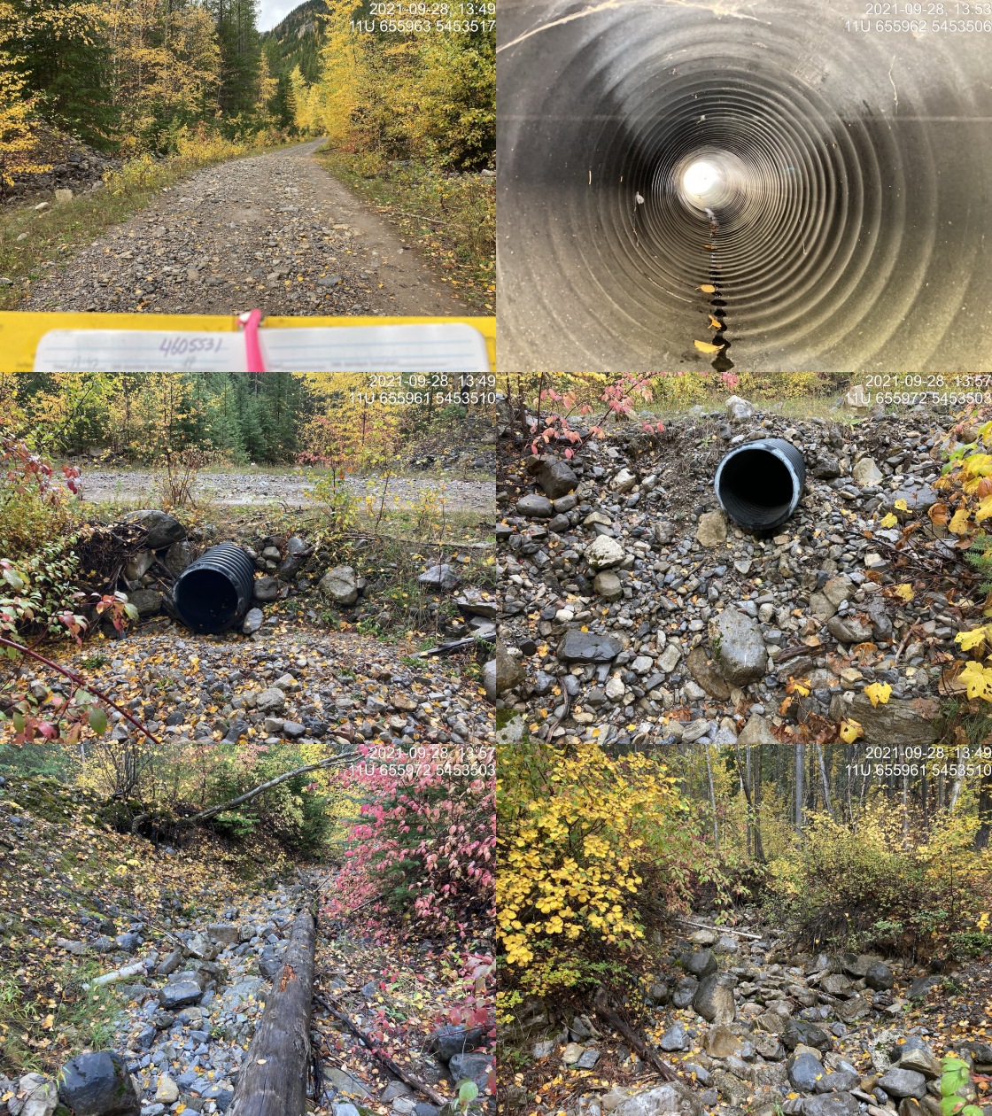
|
|||
| Comments: New PVC culvert. Creek appears to have been dredged often. Channel dry. Inlet drop of ~0.15m. 13:47 |
| Location and Stream Data |
|
Crossing Characteristics | – |
|---|---|---|---|
| Date | 2021-09-29 | Crossing Sub Type | Ford |
| PSCIS ID | 197846 | Diameter (m) | – |
| External ID | 4607449 | Length (m) | – |
| Crew | KP | Embedded | – |
| UTM Zone | 11 | Depth Embedded (m) | – |
| Easting | 659283.9 | Resemble Channel | – |
| Northing | 5547544 | Backwatered | – |
| Stream | Tributary to Ewin Creek | Percent Backwatered | – |
| Road | Spur | Fill Depth (m) | – |
| Road Tenure | Resource | Outlet Drop (m) | – |
| Channel Width (m) | – | Outlet Pool Depth (m) | – |
| Stream Slope (%) | – | Inlet Drop | – |
| Beaver Activity | – | Slope (%) | – |
| Habitat Value | – | Valley Fill | – |
| Final score | 0 | Barrier Result | Unknown |
| Fix type | – | Fix Span / Diameter | – |
Photos: PSCIS ID 197846. From top left clockwise: Road/Site Card, Barrel, Outlet, Downstream, Upstream, Inlet.
|
|||
| Comments: Deactivated road. 10:43 |
| Location and Stream Data |
|
Crossing Characteristics | – |
|---|---|---|---|
| Date | 2021-09-29 | Crossing Sub Type | Ford |
| PSCIS ID | 197847 | Diameter (m) | – |
| External ID | 4600533 | Length (m) | – |
| Crew | KP AI | Embedded | – |
| UTM Zone | 11 | Depth Embedded (m) | – |
| Easting | 656890 | Resemble Channel | – |
| Northing | 5554160 | Backwatered | – |
| Stream | Chauncey Creek | Percent Backwatered | – |
| Road | Spur | Fill Depth (m) | – |
| Road Tenure | Unclassified | Outlet Drop (m) | – |
| Channel Width (m) | – | Outlet Pool Depth (m) | – |
| Stream Slope (%) | – | Inlet Drop | – |
| Beaver Activity | – | Slope (%) | – |
| Habitat Value | – | Valley Fill | – |
| Final score | 0 | Barrier Result | Unknown |
| Fix type | – | Fix Span / Diameter | – |
Photos: PSCIS ID 197847. From top left clockwise: Road/Site Card, Barrel, Outlet, Downstream, Upstream, Inlet.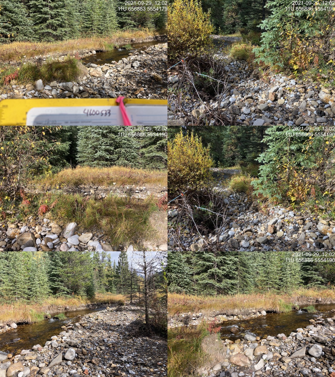
|
|||
| Comments: Old road but possible ford site not actually on road and road mapped on other side of creek. Access management area. Restoration site downstream. 12:00 |
| Location and Stream Data |
|
Crossing Characteristics | – |
|---|---|---|---|
| Date | 2021-09-29 | Crossing Sub Type | Bridge |
| PSCIS ID | 197848 | Diameter (m) | 20 |
| External ID | 2021092950 | Length (m) | 2 |
| Crew | KP AI | Embedded | – |
| UTM Zone | 11 | Depth Embedded (m) | – |
| Easting | 649364 | Resemble Channel | – |
| Northing | 5515290 | Backwatered | – |
| Stream | Cummings Creek | Percent Backwatered | – |
| Road | Cummings FSR | Fill Depth (m) | – |
| Road Tenure | FLNR DRM 0142 | Outlet Drop (m) | – |
| Channel Width (m) | – | Outlet Pool Depth (m) | – |
| Stream Slope (%) | – | Inlet Drop | – |
| Beaver Activity | – | Slope (%) | – |
| Habitat Value | – | Valley Fill | – |
| Final score | 0 | Barrier Result | Passable |
| Fix type | – | Fix Span / Diameter | – |
Photos: PSCIS ID 197848. From top left clockwise: Road/Site Card, Barrel, Outlet, Downstream, Upstream, Inlet.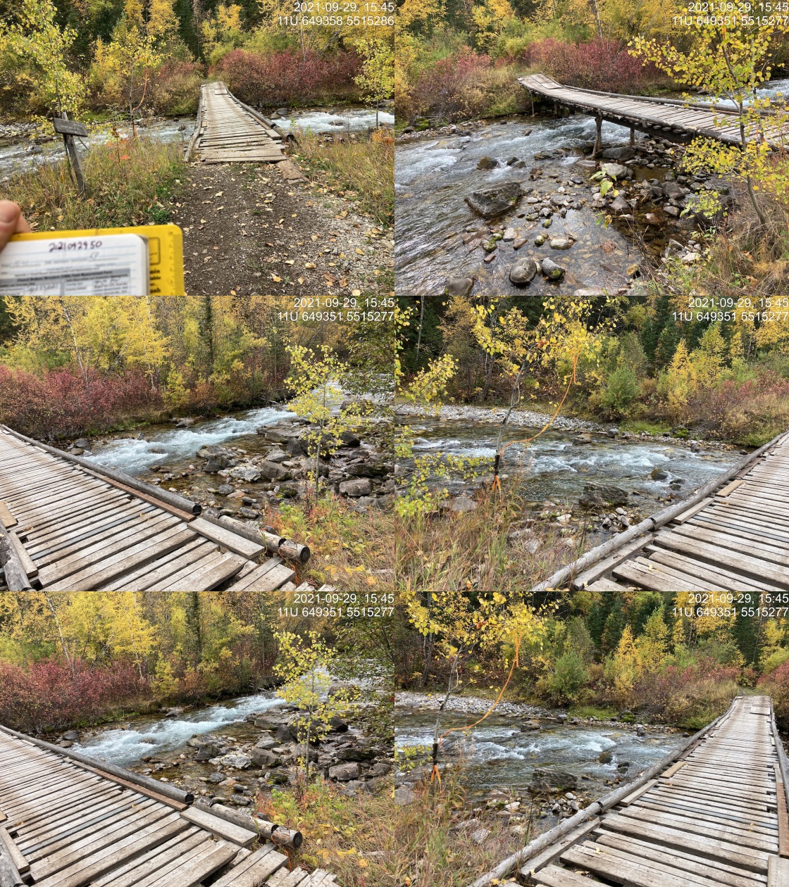
|
|||
| Comments: Homemade ATV bridge built with logs and slats. 15:41 |
| Location and Stream Data |
|
Crossing Characteristics | – |
|---|---|---|---|
| Date | 2021-10-01 | Crossing Sub Type | Round Culvert |
| PSCIS ID | 197849 | Diameter (m) | 0.5 |
| External ID | 4605585 | Length (m) | 10 |
| Crew | KP | Embedded | No |
| UTM Zone | 11 | Depth Embedded (m) | – |
| Easting | 687464 | Resemble Channel | No |
| Northing | 5432111 | Backwatered | No |
| Stream | Tributary to Sage Creek | Percent Backwatered | – |
| Road | Flathead-Nettie FSR | Fill Depth (m) | 2 |
| Road Tenure | FLNR DRM 0030 | Outlet Drop (m) | 0 |
| Channel Width (m) | 1.7 | Outlet Pool Depth (m) | 0 |
| Stream Slope (%) | 4 | Inlet Drop | Yes |
| Beaver Activity | No | Slope (%) | 2.5 |
| Habitat Value | Low | Valley Fill | Deep Fill |
| Final score | 21 | Barrier Result | Barrier |
| Fix type | Replace Structure with Streambed Simulation CBS | Fix Span / Diameter | 3 |
Photos: PSCIS ID 197849. From top left clockwise: Road/Site Card, Barrel, Outlet, Downstream, Upstream, Inlet.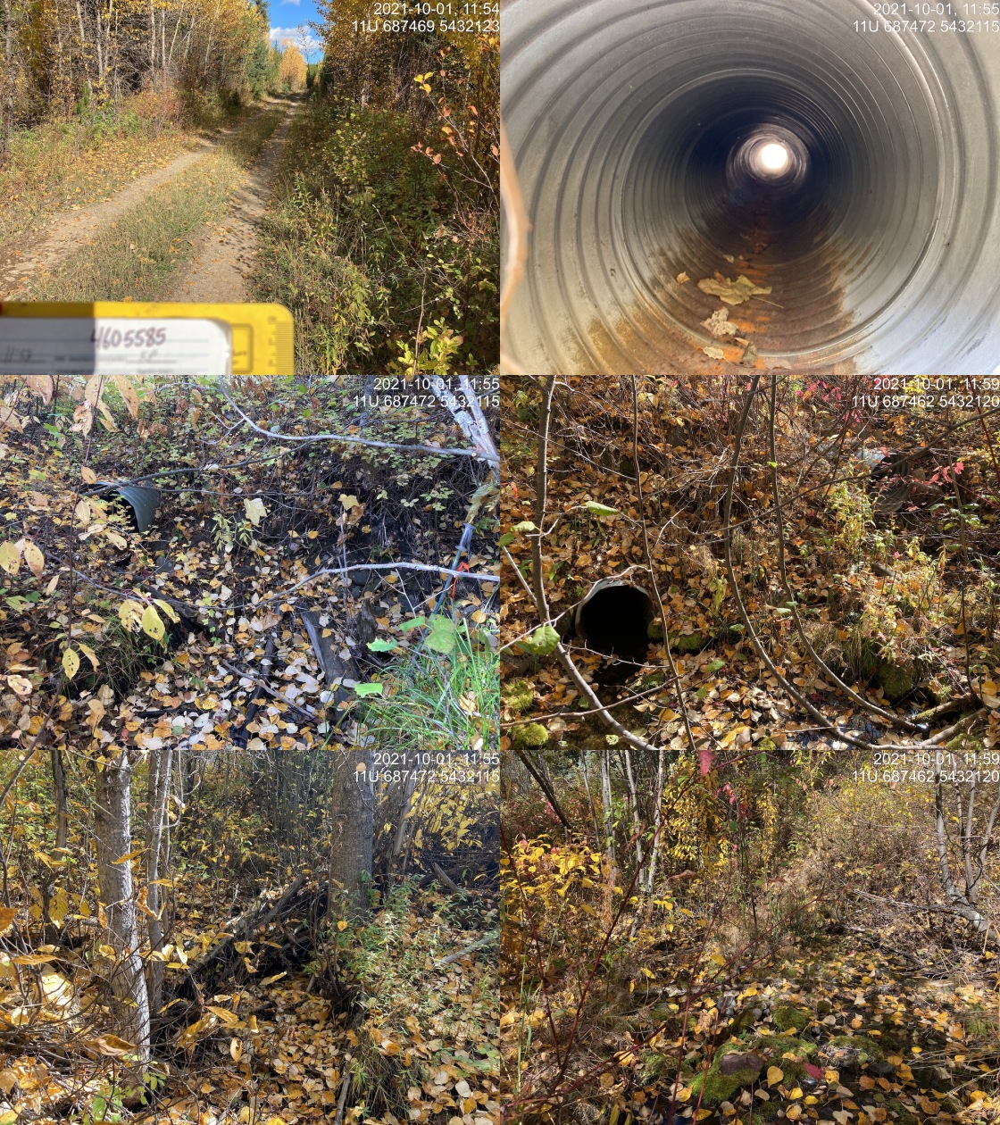
|
|||
| Comments: Overflow culvert is 0.12m and 2%. Almost backwatered buy slowly tricklying. Inlet is almost fullly clogged and has inlet drop of 0.4m. Slope of primary culvert estimated as very difficult to measure. 11:41 |
| Location and Stream Data |
|
Crossing Characteristics | – |
|---|---|---|---|
| Date | 2021-10-01 | Crossing Sub Type | Round Culvert |
| PSCIS ID | 197850 | Diameter (m) | 0.6 |
| External ID | 4605584 | Length (m) | 11 |
| Crew | KP | Embedded | No |
| UTM Zone | 11 | Depth Embedded (m) | – |
| Easting | 686674 | Resemble Channel | No |
| Northing | 5434139 | Backwatered | No |
| Stream | Tributary to Sage Creek | Percent Backwatered | – |
| Road | Flathead-Nettie FSR | Fill Depth (m) | 2 |
| Road Tenure | FLNR DRM 0030 | Outlet Drop (m) | 0.13 |
| Channel Width (m) | 2.1 | Outlet Pool Depth (m) | 0.33 |
| Stream Slope (%) | 3.5 | Inlet Drop | No |
| Beaver Activity | No | Slope (%) | 4.5 |
| Habitat Value | Low | Valley Fill | Deep Fill |
| Final score | 26 | Barrier Result | Barrier |
| Fix type | Replace with New Open Bottom Structure | Fix Span / Diameter | 12 |
Photos: PSCIS ID 197850. From top left clockwise: Road/Site Card, Barrel, Outlet, Downstream, Upstream, Inlet.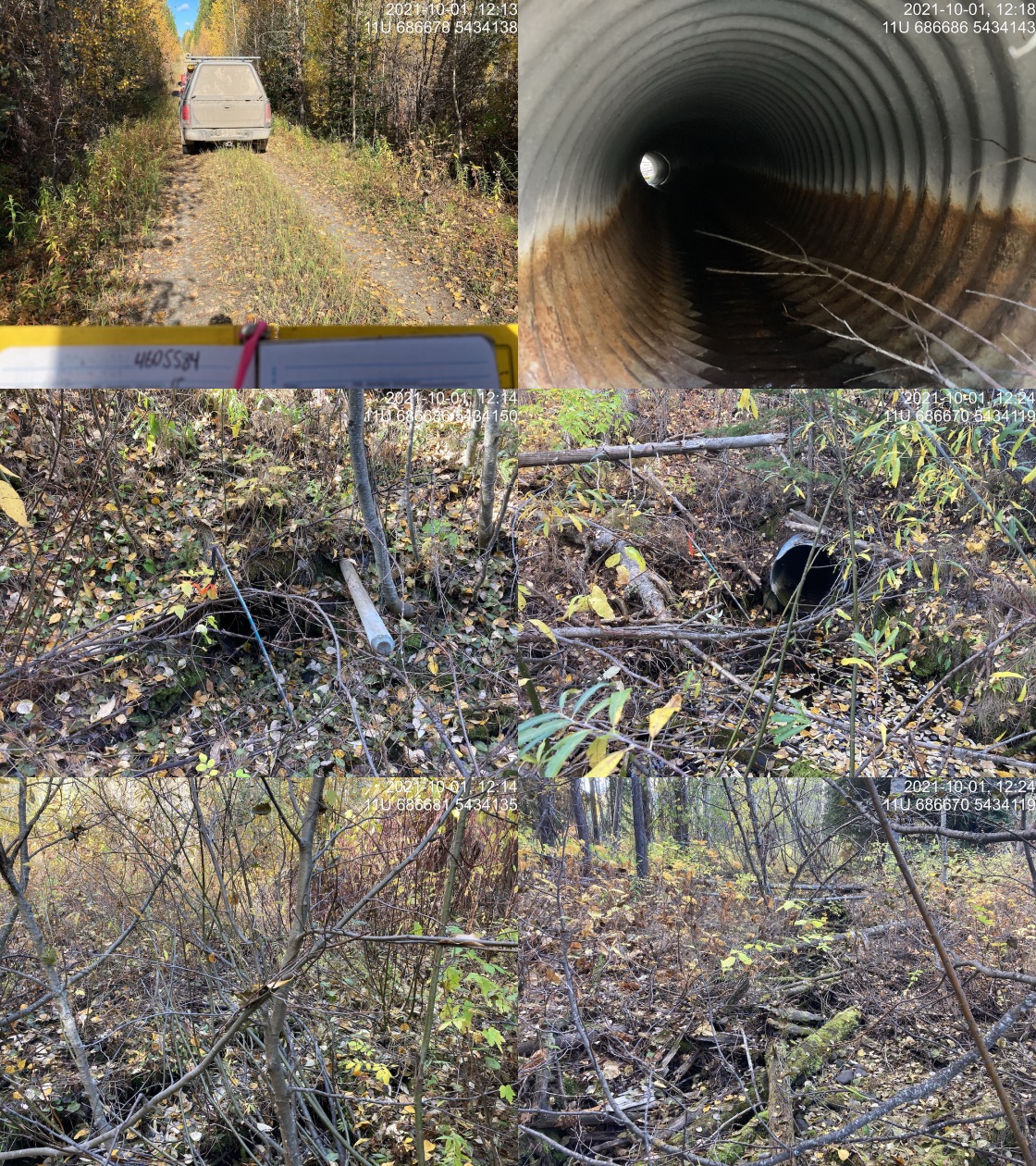
|
|||
| Comments: Channel heavily vegetated with moss indicating it flows intermittently. Very low flow at time of assessment. 12:12 |
| Location and Stream Data |
|
Crossing Characteristics | – |
|---|---|---|---|
| Date | 2021-10-01 | Crossing Sub Type | Round Culvert |
| PSCIS ID | 197851 | Diameter (m) | 0.6 |
| External ID | 4605462 | Length (m) | 29 |
| Crew | KP | Embedded | No |
| UTM Zone | 11 | Depth Embedded (m) | – |
| Easting | 682932.9 | Resemble Channel | No |
| Northing | 5442156 | Backwatered | No |
| Stream | Tributary to Flathead River | Percent Backwatered | – |
| Road | Kishinea FSR | Fill Depth (m) | 7 |
| Road Tenure | FLNR DRM 0030 | Outlet Drop (m) | 0.09 |
| Channel Width (m) | 1.2 | Outlet Pool Depth (m) | 0.17 |
| Stream Slope (%) | 2 | Inlet Drop | No |
| Beaver Activity | No | Slope (%) | 3.5 |
| Habitat Value | Low | Valley Fill | Deep Fill |
| Final score | 29 | Barrier Result | Barrier |
| Fix type | Replace Structure with Streambed Simulation CBS | Fix Span / Diameter | 3 |
Photos: PSCIS ID 197851. From top left clockwise: Road/Site Card, Barrel, Outlet, Downstream, Upstream, Inlet.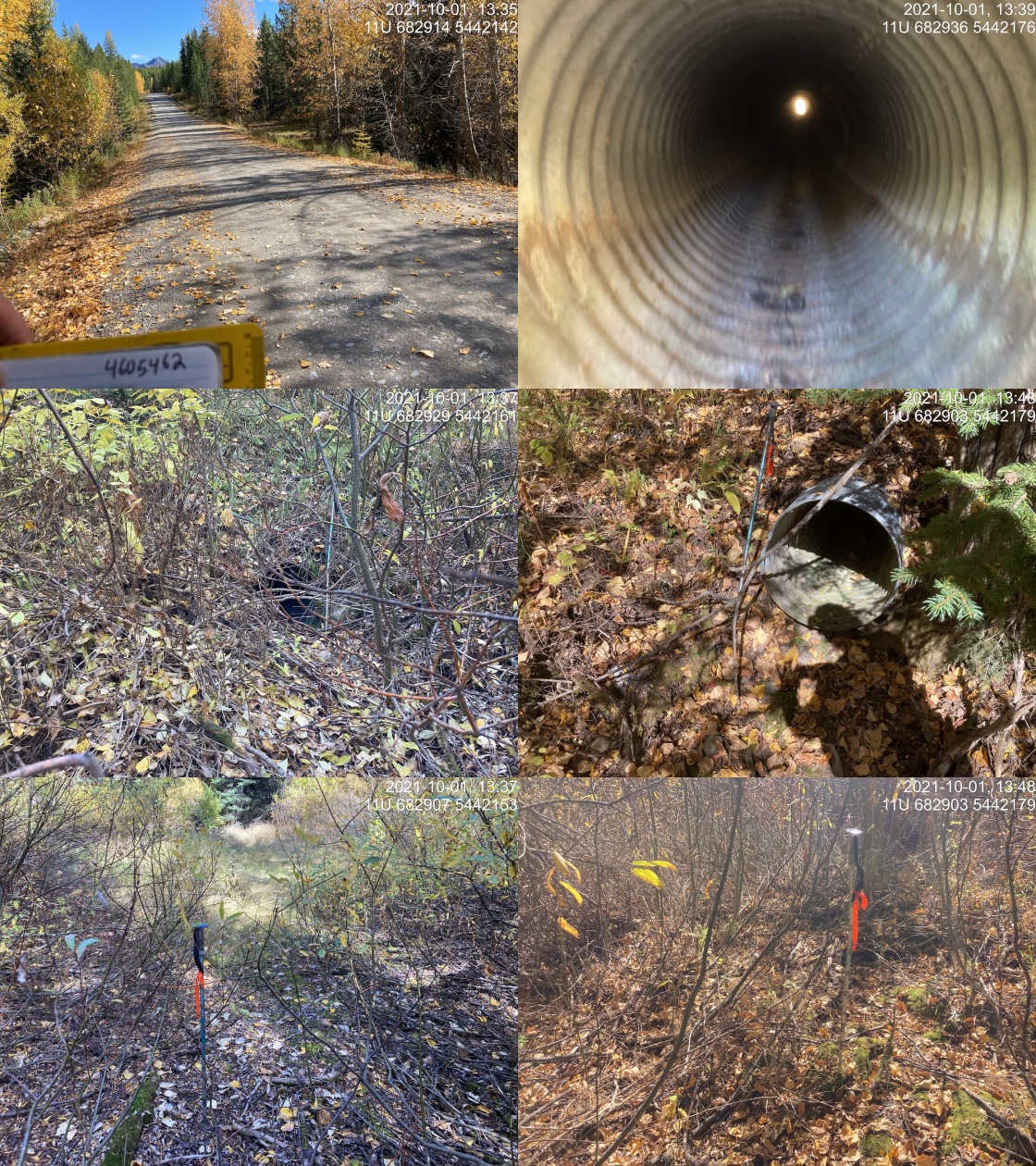
|
|||
| Comments: Upstream channel is wet meadow with grass, moss and willow. Inlet appears to be above where the channel would be. Downstream is willow area with poorly defined channel. Dry at time of survey. 13:36 |
| Location and Stream Data |
|
Crossing Characteristics | – |
|---|---|---|---|
| Date | 2021-10-03 | Crossing Sub Type | Bridge |
| PSCIS ID | 197852 | Diameter (m) | 16 |
| External ID | 4606241 | Length (m) | 5 |
| Crew | KP | Embedded | – |
| UTM Zone | 11 | Depth Embedded (m) | – |
| Easting | 679965 | Resemble Channel | – |
| Northing | 5434092 | Backwatered | – |
| Stream | Tributary to Calder Creek | Percent Backwatered | – |
| Road | Calder Creek Main | Fill Depth (m) | – |
| Road Tenure | Unknown | Outlet Drop (m) | – |
| Channel Width (m) | – | Outlet Pool Depth (m) | – |
| Stream Slope (%) | – | Inlet Drop | – |
| Beaver Activity | – | Slope (%) | – |
| Habitat Value | – | Valley Fill | – |
| Final score | 0 | Barrier Result | Passable |
| Fix type | – | Fix Span / Diameter | – |
Photos: PSCIS ID 197852. From top left clockwise: Road/Site Card, Barrel, Outlet, Downstream, Upstream, Inlet.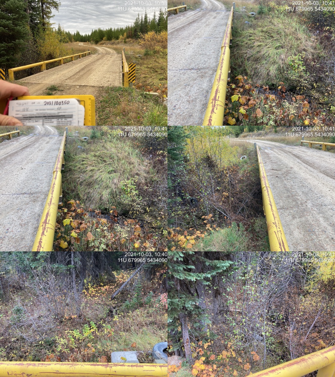
|
|||
| Comments: Crossing is in slightly different location that mapped. 10:35 |
| Location and Stream Data |
|
Crossing Characteristics | – |
|---|---|---|---|
| Date | 2021-10-03 | Crossing Sub Type | Bridge |
| PSCIS ID | 197853 | Diameter (m) | 6 |
| External ID | 4605203 | Length (m) | 4 |
| Crew | KP | Embedded | – |
| UTM Zone | 11 | Depth Embedded (m) | – |
| Easting | 680152.1 | Resemble Channel | – |
| Northing | 5433553 | Backwatered | – |
| Stream | Calder Creek | Percent Backwatered | – |
| Road | Spur 1000 | Fill Depth (m) | – |
| Road Tenure | FLNR DRM 0030 | Outlet Drop (m) | – |
| Channel Width (m) | – | Outlet Pool Depth (m) | – |
| Stream Slope (%) | – | Inlet Drop | – |
| Beaver Activity | – | Slope (%) | – |
| Habitat Value | – | Valley Fill | – |
| Final score | 0 | Barrier Result | Passable |
| Fix type | – | Fix Span / Diameter | – |
Photos: PSCIS ID 197853. From top left clockwise: Road/Site Card, Barrel, Outlet, Downstream, Upstream, Inlet.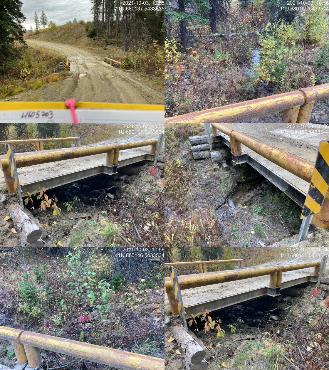
|
|||
| Comments: Bridge. 10:54 |
| Location and Stream Data |
|
Crossing Characteristics | – |
|---|---|---|---|
| Date | 2021-10-03 | Crossing Sub Type | Pipe Arch |
| PSCIS ID | 197854 | Diameter (m) | 2 |
| External ID | 24740602 | Length (m) | 10 |
| Crew | KP | Embedded | – |
| UTM Zone | 11 | Depth Embedded (m) | – |
| Easting | 680543.7 | Resemble Channel | – |
| Northing | 5432522 | Backwatered | – |
| Stream | Tributary to Calder Creek | Percent Backwatered | – |
| Road | Spur 1000 | Fill Depth (m) | – |
| Road Tenure | Unknown | Outlet Drop (m) | – |
| Channel Width (m) | – | Outlet Pool Depth (m) | – |
| Stream Slope (%) | – | Inlet Drop | – |
| Beaver Activity | – | Slope (%) | – |
| Habitat Value | – | Valley Fill | – |
| Final score | 0 | Barrier Result | Passable |
| Fix type | – | Fix Span / Diameter | – |
Photos: PSCIS ID 197854. From top left clockwise: Road/Site Card, Barrel, Outlet, Downstream, Upstream, Inlet.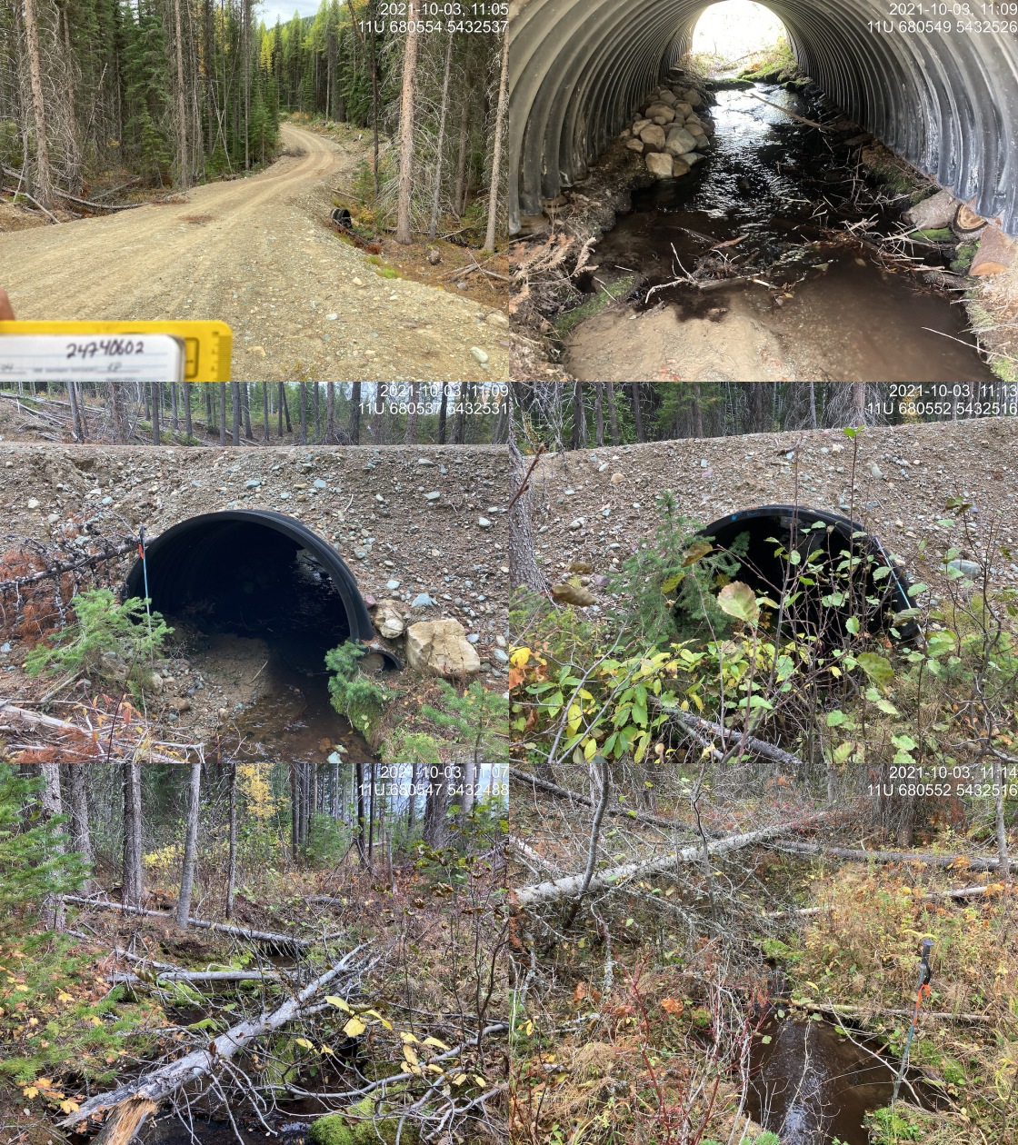
|
|||
| Comments: Black plastic arch. Strucure appears to be lifting off ground where placed. Bend in middle of pipe where road crosses. 11:04 |
| Location and Stream Data |
|
Crossing Characteristics | – |
|---|---|---|---|
| Date | 2021-10-03 | Crossing Sub Type | Round Culvert |
| PSCIS ID | 197855 | Diameter (m) | 0.8 |
| External ID | 24740603 | Length (m) | 10 |
| Crew | KP | Embedded | No |
| UTM Zone | 11 | Depth Embedded (m) | – |
| Easting | 680584.5 | Resemble Channel | No |
| Northing | 5432219 | Backwatered | No |
| Stream | Tributary to Calder Creek | Percent Backwatered | – |
| Road | Spur 1000 | Fill Depth (m) | 0.3 |
| Road Tenure | Unknown | Outlet Drop (m) | 0 |
| Channel Width (m) | 0.8 | Outlet Pool Depth (m) | 0 |
| Stream Slope (%) | 2.5 | Inlet Drop | Yes |
| Beaver Activity | No | Slope (%) | 4 |
| Habitat Value | Low | Valley Fill | Deep Fill |
| Final score | 23 | Barrier Result | Barrier |
| Fix type | Replace Structure with Streambed Simulation CBS | Fix Span / Diameter | 3 |
Photos: PSCIS ID 197855. From top left clockwise: Road/Site Card, Barrel, Outlet, Downstream, Upstream, Inlet.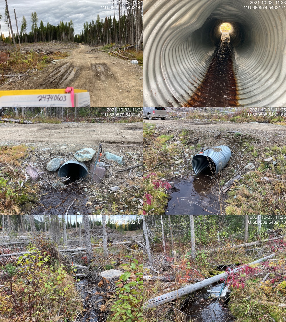
|
|||
| Comments: Inlet drop from debris ~0.35m. Heavily logged to stream upstream. Culvert is steeper for first 1/2 on upstream side. Slightly embedded on outlet but unlikely to hold due to small size of substrate. 11:20 |
| Location and Stream Data |
|
Crossing Characteristics | – |
|---|---|---|---|
| Date | 2021-10-03 | Crossing Sub Type | Ford |
| PSCIS ID | 197856 | Diameter (m) | – |
| External ID | 4602869 | Length (m) | – |
| Crew | KP | Embedded | – |
| UTM Zone | 11 | Depth Embedded (m) | – |
| Easting | 667844 | Resemble Channel | – |
| Northing | 5434398 | Backwatered | – |
| Stream | Couldrey Creek | Percent Backwatered | – |
| Road | Spur | Fill Depth (m) | – |
| Road Tenure | Unclassified | Outlet Drop (m) | – |
| Channel Width (m) | – | Outlet Pool Depth (m) | – |
| Stream Slope (%) | – | Inlet Drop | – |
| Beaver Activity | – | Slope (%) | – |
| Habitat Value | – | Valley Fill | – |
| Final score | 0 | Barrier Result | Unknown |
| Fix type | – | Fix Span / Diameter | – |
Photos: PSCIS ID 197856. From top left clockwise: Road/Site Card, Barrel, Outlet, Downstream, Upstream, Inlet.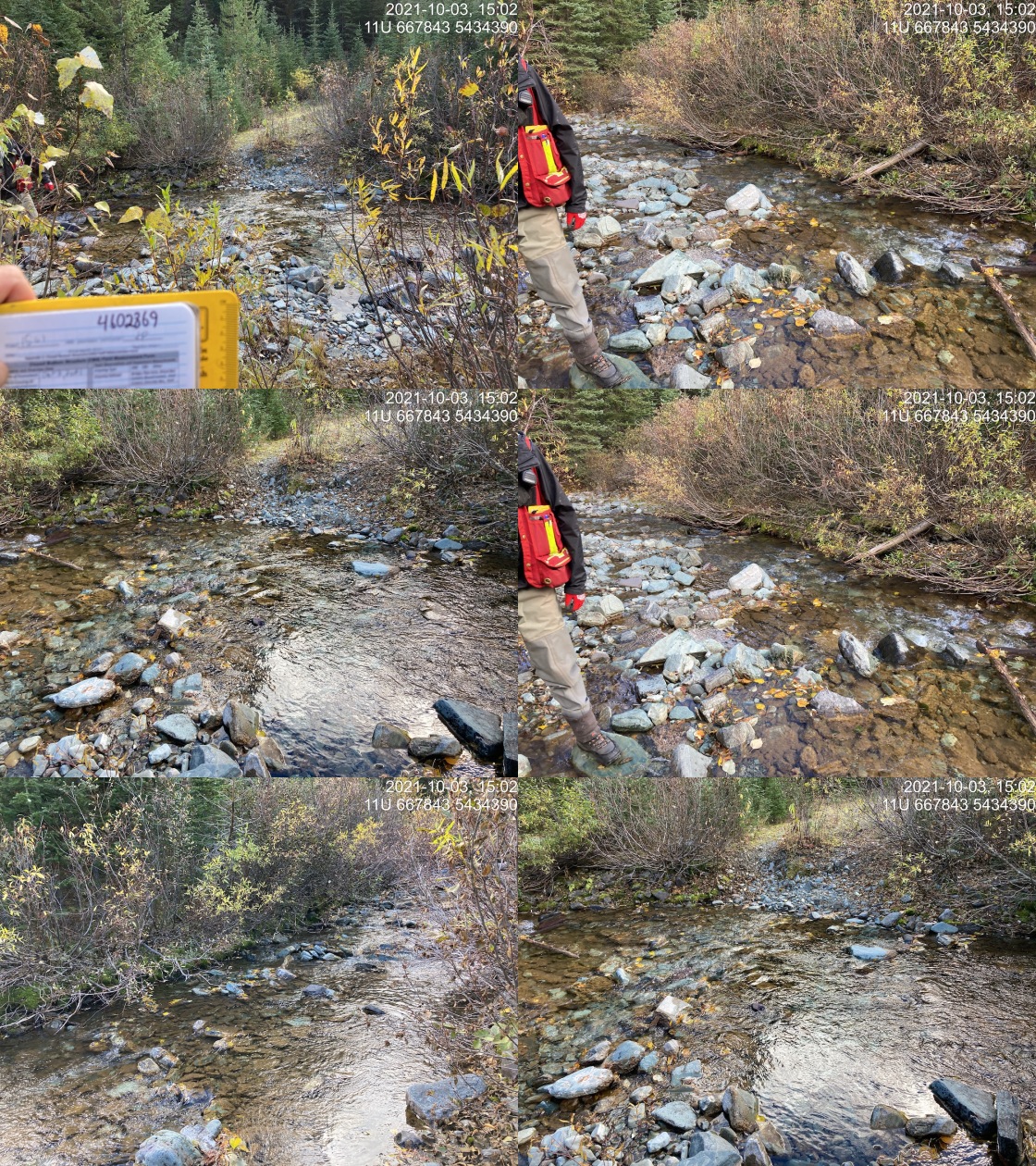
|
|||
| Comments: Ford. Adjacent stream channel dry. 15:01 |
| Location and Stream Data |
|
Crossing Characteristics | – |
|---|---|---|---|
| Date | 2021-10-03 | Crossing Sub Type | Ford |
| PSCIS ID | 197857 | Diameter (m) | – |
| External ID | 4605874 | Length (m) | – |
| Crew | KP | Embedded | – |
| UTM Zone | 11 | Depth Embedded (m) | – |
| Easting | 668597.1 | Resemble Channel | – |
| Northing | 5434527 | Backwatered | – |
| Stream | Couldrey Creek | Percent Backwatered | – |
| Road | Spur | Fill Depth (m) | – |
| Road Tenure | FLNR DRM 0030 | Outlet Drop (m) | – |
| Channel Width (m) | – | Outlet Pool Depth (m) | – |
| Stream Slope (%) | – | Inlet Drop | – |
| Beaver Activity | – | Slope (%) | – |
| Habitat Value | – | Valley Fill | – |
| Final score | 0 | Barrier Result | Unknown |
| Fix type | – | Fix Span / Diameter | – |
Photos: PSCIS ID 197857. From top left clockwise: Road/Site Card, Barrel, Outlet, Downstream, Upstream, Inlet.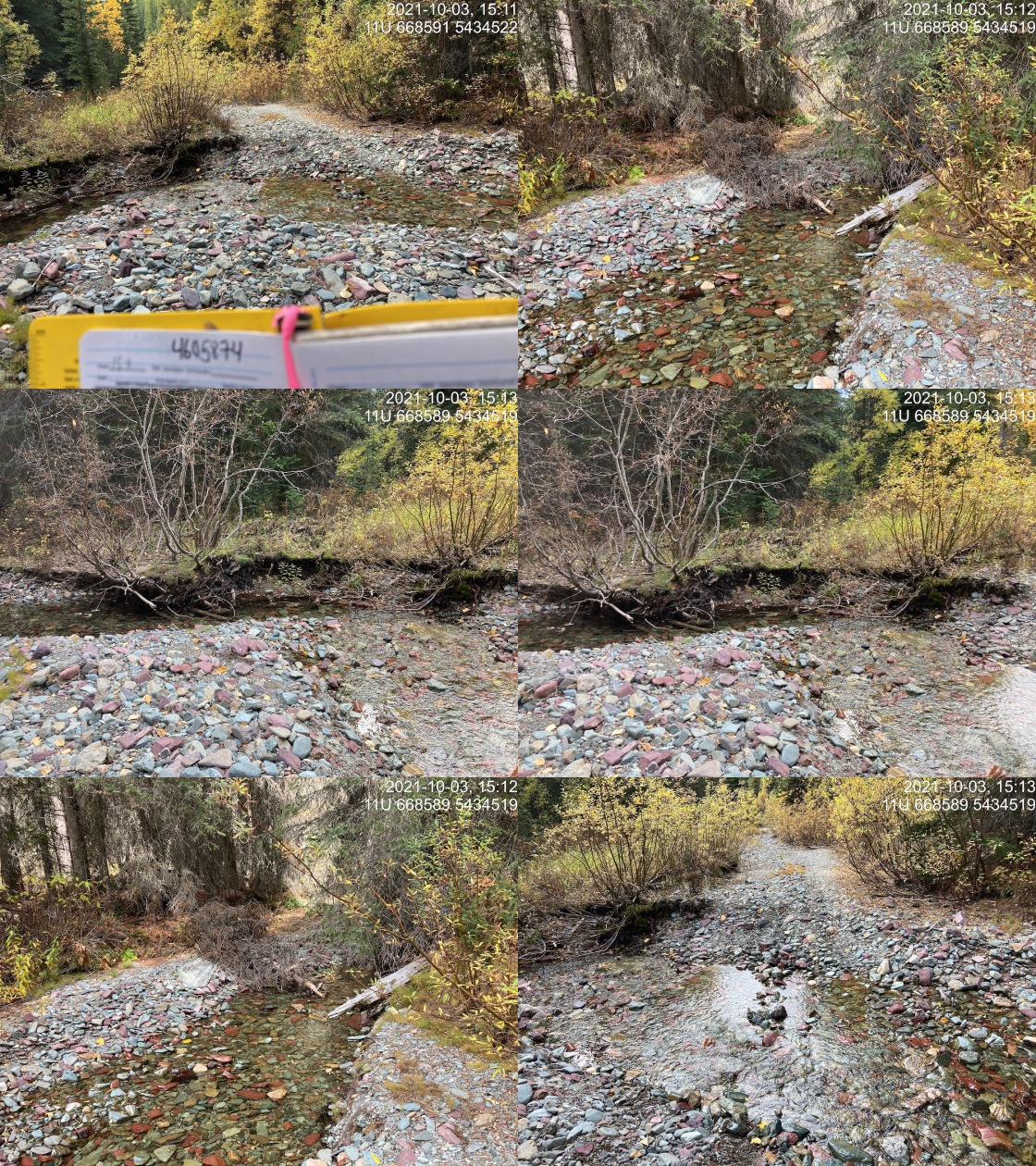
|
|||
| Comments: Ford. 15:11 |
| Location and Stream Data |
|
Crossing Characteristics | – |
|---|---|---|---|
| Date | 2021-10-03 | Crossing Sub Type | Ford |
| PSCIS ID | 197858 | Diameter (m) | – |
| External ID | 4605863 | Length (m) | – |
| Crew | KP | Embedded | – |
| UTM Zone | 11 | Depth Embedded (m) | – |
| Easting | 673247.1 | Resemble Channel | – |
| Northing | 5432618 | Backwatered | – |
| Stream | Tributary to Cauldrey Creek | Percent Backwatered | – |
| Road | Couldrey FSR | Fill Depth (m) | – |
| Road Tenure | FLNR DRM 0030 | Outlet Drop (m) | – |
| Channel Width (m) | – | Outlet Pool Depth (m) | – |
| Stream Slope (%) | – | Inlet Drop | – |
| Beaver Activity | – | Slope (%) | – |
| Habitat Value | – | Valley Fill | – |
| Final score | 0 | Barrier Result | Unknown |
| Fix type | – | Fix Span / Diameter | – |
Photos: PSCIS ID 197858. From top left clockwise: Road/Site Card, Barrel, Outlet, Downstream, Upstream, Inlet.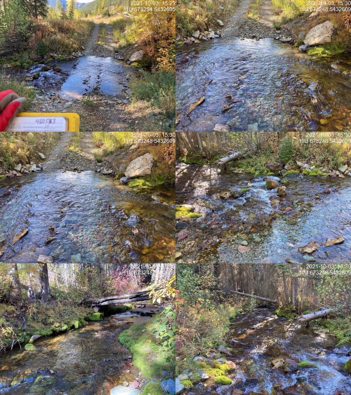
|
|||
| Comments: Good flow. 15:28 |
| Location and Stream Data |
|
Crossing Characteristics | – |
|---|---|---|---|
| Date | 2021-10-03 | Crossing Sub Type | Bridge |
| PSCIS ID | 197859 | Diameter (m) | 12.5 |
| External ID | 4605748 | Length (m) | 4 |
| Crew | KP | Embedded | – |
| UTM Zone | 11 | Depth Embedded (m) | – |
| Easting | 673297 | Resemble Channel | – |
| Northing | 5432419 | Backwatered | – |
| Stream | Cauldrey Creek | Percent Backwatered | – |
| Road | Frozen Lake | Fill Depth (m) | – |
| Road Tenure | FLNR DRM 0030 | Outlet Drop (m) | – |
| Channel Width (m) | – | Outlet Pool Depth (m) | – |
| Stream Slope (%) | – | Inlet Drop | – |
| Beaver Activity | – | Slope (%) | – |
| Habitat Value | – | Valley Fill | – |
| Final score | 0 | Barrier Result | Passable |
| Fix type | – | Fix Span / Diameter | – |
Photos: PSCIS ID 197859. From top left clockwise: Road/Site Card, Barrel, Outlet, Downstream, Upstream, Inlet.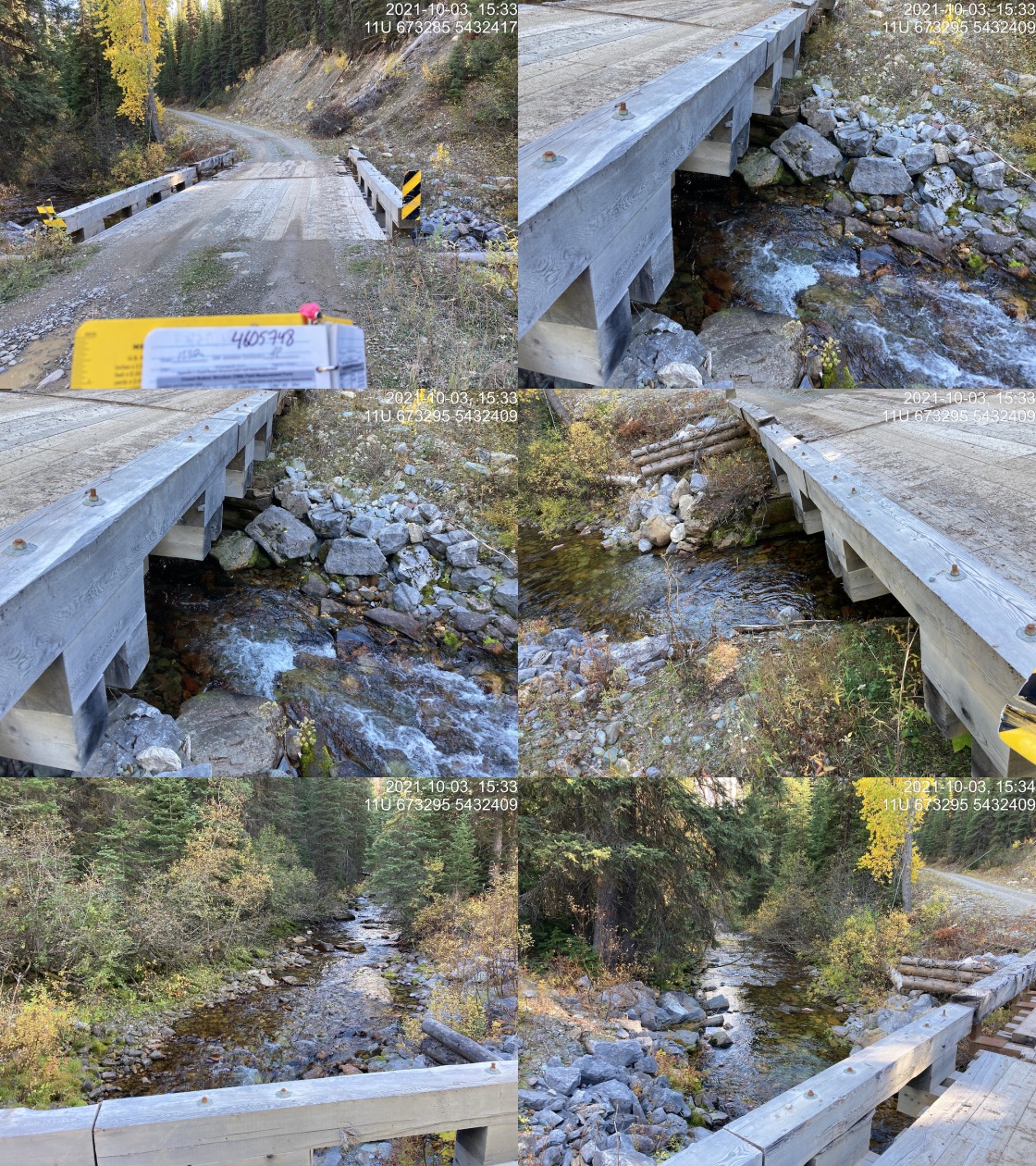
|
|||
| Comments: Bridge. 15:32 |
| Location and Stream Data |
|
Crossing Characteristics | – |
|---|---|---|---|
| Date | 2021-07-27 | Crossing Sub Type | Ford |
| PSCIS ID | 197860 | Diameter (m) | – |
| External ID | 4605826 | Length (m) | – |
| Crew | AI TS | Embedded | – |
| UTM Zone | 11 | Depth Embedded (m) | – |
| Easting | 658807 | Resemble Channel | – |
| Northing | 5431373 | Backwatered | – |
| Stream | Rabbit Creek | Percent Backwatered | – |
| Road | Phillips Creek Main | Fill Depth (m) | – |
| Road Tenure | FLNR DRM 0064 | Outlet Drop (m) | – |
| Channel Width (m) | – | Outlet Pool Depth (m) | – |
| Stream Slope (%) | – | Inlet Drop | – |
| Beaver Activity | – | Slope (%) | – |
| Habitat Value | – | Valley Fill | – |
| Final score | 0 | Barrier Result | Unknown |
| Fix type | – | Fix Span / Diameter | – |
Photos: PSCIS ID 197860. From top left clockwise: Road/Site Card, Barrel, Outlet, Downstream, Upstream, Inlet.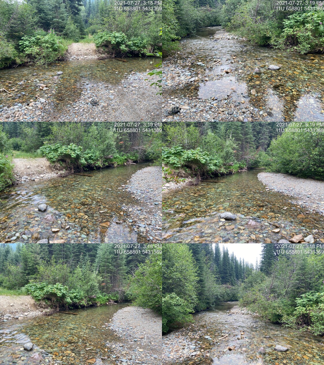
|
|||
| Comments: Ford. No card filled out. 15:17 |
| Location and Stream Data |
|
Crossing Characteristics | – |
|---|---|---|---|
| Date | 2021-07-28 | Crossing Sub Type | Ford |
| PSCIS ID | 197861 | Diameter (m) | – |
| External ID | 4602646 | Length (m) | – |
| Crew | AI TS | Embedded | – |
| UTM Zone | 11 | Depth Embedded (m) | – |
| Easting | 647364 | Resemble Channel | – |
| Northing | 5452095 | Backwatered | – |
| Stream | Tributary to Wigwam River | Percent Backwatered | – |
| Road | Wigwam Lookout Trail | Fill Depth (m) | – |
| Road Tenure | Unknown | Outlet Drop (m) | – |
| Channel Width (m) | – | Outlet Pool Depth (m) | – |
| Stream Slope (%) | – | Inlet Drop | – |
| Beaver Activity | – | Slope (%) | – |
| Habitat Value | – | Valley Fill | – |
| Final score | 0 | Barrier Result | Unknown |
| Fix type | – | Fix Span / Diameter | – |
Photos: PSCIS ID 197861. From top left clockwise: Road/Site Card, Barrel, Outlet, Downstream, Upstream, Inlet.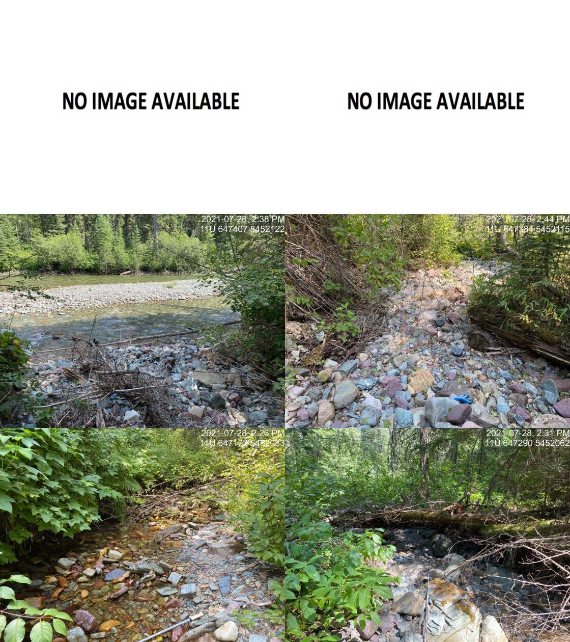
|
|||
| Comments: No crossing present. 14:20 |
| Location and Stream Data |
|
Crossing Characteristics | – |
|---|---|---|---|
| Date | 2021-10-13 | Crossing Sub Type | Bridge |
| PSCIS ID | 197862 | Diameter (m) | 10 |
| External ID | 2021101301 | Length (m) | 2 |
| Crew | AI BK SS | Embedded | – |
| UTM Zone | 11 | Depth Embedded (m) | – |
| Easting | 636963 | Resemble Channel | – |
| Northing | 5483993 | Backwatered | – |
| Stream | Tributary to Lizard Creek | Percent Backwatered | – |
| Road | Lazy Lizard Lower Trail | Fill Depth (m) | – |
| Road Tenure | Unknown | Outlet Drop (m) | – |
| Channel Width (m) | – | Outlet Pool Depth (m) | – |
| Stream Slope (%) | – | Inlet Drop | – |
| Beaver Activity | – | Slope (%) | – |
| Habitat Value | – | Valley Fill | – |
| Final score | 0 | Barrier Result | Passable |
| Fix type | – | Fix Span / Diameter | – |
Photos: PSCIS ID 197862. From top left clockwise: Road/Site Card, Barrel, Outlet, Downstream, Upstream, Inlet.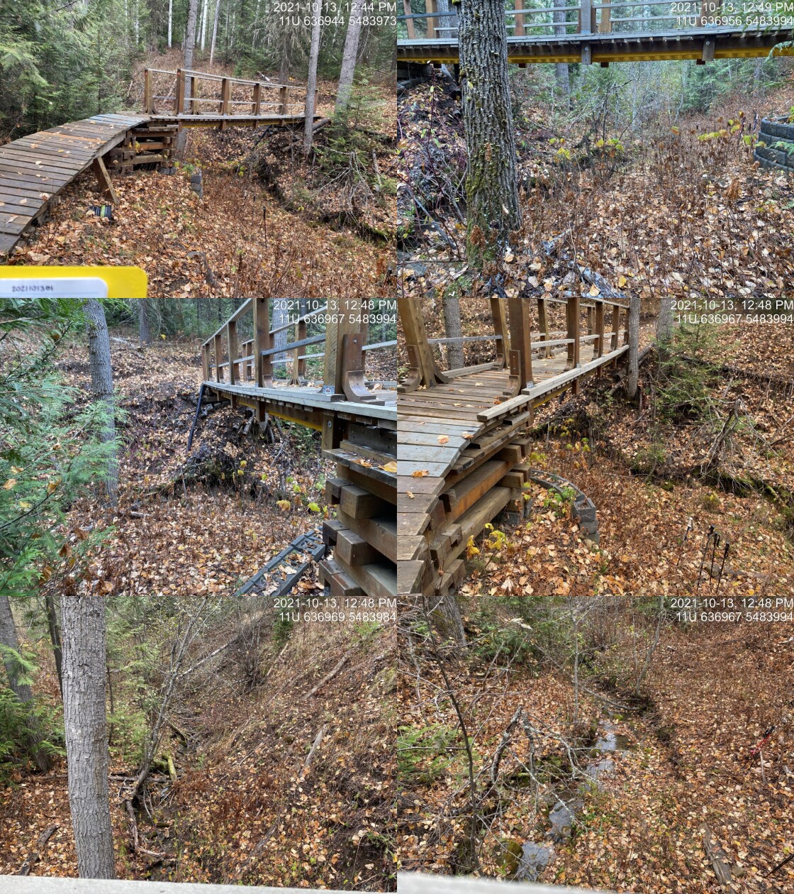
|
|||
| Comments: Bridge on walking/bike trail. 12:44 |
| Location and Stream Data |
|
Crossing Characteristics | – |
|---|---|---|---|
| Date | 2021-10-13 | Crossing Sub Type | Round Culvert |
| PSCIS ID | 197863 | Diameter (m) | 0.9 |
| External ID | 4600761 | Length (m) | 8 |
| Crew | AI BK SS | Embedded | No |
| UTM Zone | 11 | Depth Embedded (m) | – |
| Easting | 637007 | Resemble Channel | No |
| Northing | 5484415 | Backwatered | No |
| Stream | Tributary to Lizard Creek | Percent Backwatered | – |
| Road | Unnamed | Fill Depth (m) | 1 |
| Road Tenure | Unknown | Outlet Drop (m) | 0.5 |
| Channel Width (m) | 2 | Outlet Pool Depth (m) | 0.28 |
| Stream Slope (%) | 12.6 | Inlet Drop | Yes |
| Beaver Activity | No | Slope (%) | 6 |
| Habitat Value | Low | Valley Fill | Deep Fill |
| Final score | 36 | Barrier Result | Barrier |
| Fix type | Replace with New Open Bottom Structure | Fix Span / Diameter | 12 |
Photos: PSCIS ID 197863. From top left clockwise: Road/Site Card, Barrel, Outlet, Downstream, Upstream, Inlet.
|
|||
| Comments: Very steep immediately upstream of crossing. 13:33 |
| Location and Stream Data |
|
Crossing Characteristics | – |
|---|---|---|---|
| Date | 2021-10-13 | Crossing Sub Type | Round Culvert |
| PSCIS ID | 197864 | Diameter (m) | 0.6 |
| External ID | 2021101302 | Length (m) | 9 |
| Crew | AI BK SS | Embedded | No |
| UTM Zone | 11 | Depth Embedded (m) | – |
| Easting | 636912 | Resemble Channel | No |
| Northing | 5484249 | Backwatered | No |
| Stream | Tributary to Lizard Creek | Percent Backwatered | – |
| Road | Unnamed | Fill Depth (m) | 1 |
| Road Tenure | Unknown | Outlet Drop (m) | 0.29 |
| Channel Width (m) | 0.5 | Outlet Pool Depth (m) | 0.21 |
| Stream Slope (%) | 11 | Inlet Drop | Yes |
| Beaver Activity | No | Slope (%) | 2 |
| Habitat Value | Low | Valley Fill | Deep Fill |
| Final score | 20 | Barrier Result | Barrier |
| Fix type | Replace Structure with Streambed Simulation CBS | Fix Span / Diameter | 3 |
Photos: PSCIS ID 197864. From top left clockwise: Road/Site Card, Barrel, Outlet, Downstream, Upstream, Inlet.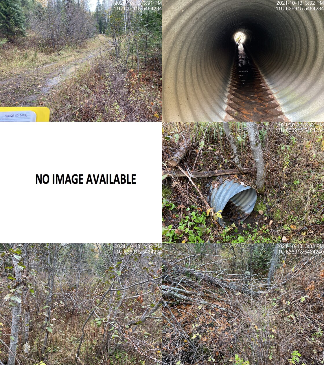
|
|||
| Comments: Drop of 1.1m just below outlet. Very unlikley to be fish habitat. Stream mapped incorrectly. Main channel is S and crosses road approximately 200m up the road. 15:30 |
| Location and Stream Data |
|
Crossing Characteristics | – |
|---|---|---|---|
| Date | 2021-10-14 | Crossing Sub Type | Round Culvert |
| PSCIS ID | 197865 | Diameter (m) | 0.3 |
| External ID | 4605652 | Length (m) | 1 |
| Crew | AI BK SS RA | Embedded | No |
| UTM Zone | 11 | Depth Embedded (m) | – |
| Easting | 647282 | Resemble Channel | No |
| Northing | 5574968 | Backwatered | No |
| Stream | Tributary to Elk River | Percent Backwatered | – |
| Road | Elk River Main FSR | Fill Depth (m) | 0.25 |
| Road Tenure | FLNR DRM 0103 | Outlet Drop (m) | 0.2 |
| Channel Width (m) | 1 | Outlet Pool Depth (m) | 0.06 |
| Stream Slope (%) | 26 | Inlet Drop | No |
| Beaver Activity | No | Slope (%) | 2 |
| Habitat Value | Low | Valley Fill | Deep Fill |
| Final score | 26 | Barrier Result | Barrier |
| Fix type | Replace Structure with Streambed Simulation CBS | Fix Span / Diameter | 3 |
Photos: PSCIS ID 197865. From top left clockwise: Road/Site Card, Barrel, Outlet, Downstream, Upstream, Inlet.
|
|||
| Comments: Very steep stream. Culvert failing just downstream of inlet. Stream braids upstream. 13:15 |
| Location and Stream Data |
|
Crossing Characteristics | – |
|---|---|---|---|
| Date | 2021-10-15 | Crossing Sub Type | Round Culvert |
| PSCIS ID | 197866 | Diameter (m) | 2.3 |
| External ID | 4600992 | Length (m) | 13 |
| Crew | AI BK | Embedded | No |
| UTM Zone | 11 | Depth Embedded (m) | – |
| Easting | 647734 | Resemble Channel | No |
| Northing | 5494404 | Backwatered | No |
| Stream | Hosmer Creek | Percent Backwatered | – |
| Road | Unnamed | Fill Depth (m) | 0.5 |
| Road Tenure | Resource | Outlet Drop (m) | 0.25 |
| Channel Width (m) | 4.1 | Outlet Pool Depth (m) | 0.57 |
| Stream Slope (%) | 11 | Inlet Drop | No |
| Beaver Activity | No | Slope (%) | 2 |
| Habitat Value | High | Valley Fill | Deep Fill |
| Final score | 26 | Barrier Result | Barrier |
| Fix type | Replace with New Open Bottom Structure | Fix Span / Diameter | 12 |
Photos: PSCIS ID 197866. From top left clockwise: Road/Site Card, Barrel, Outlet, Downstream, Upstream, Inlet.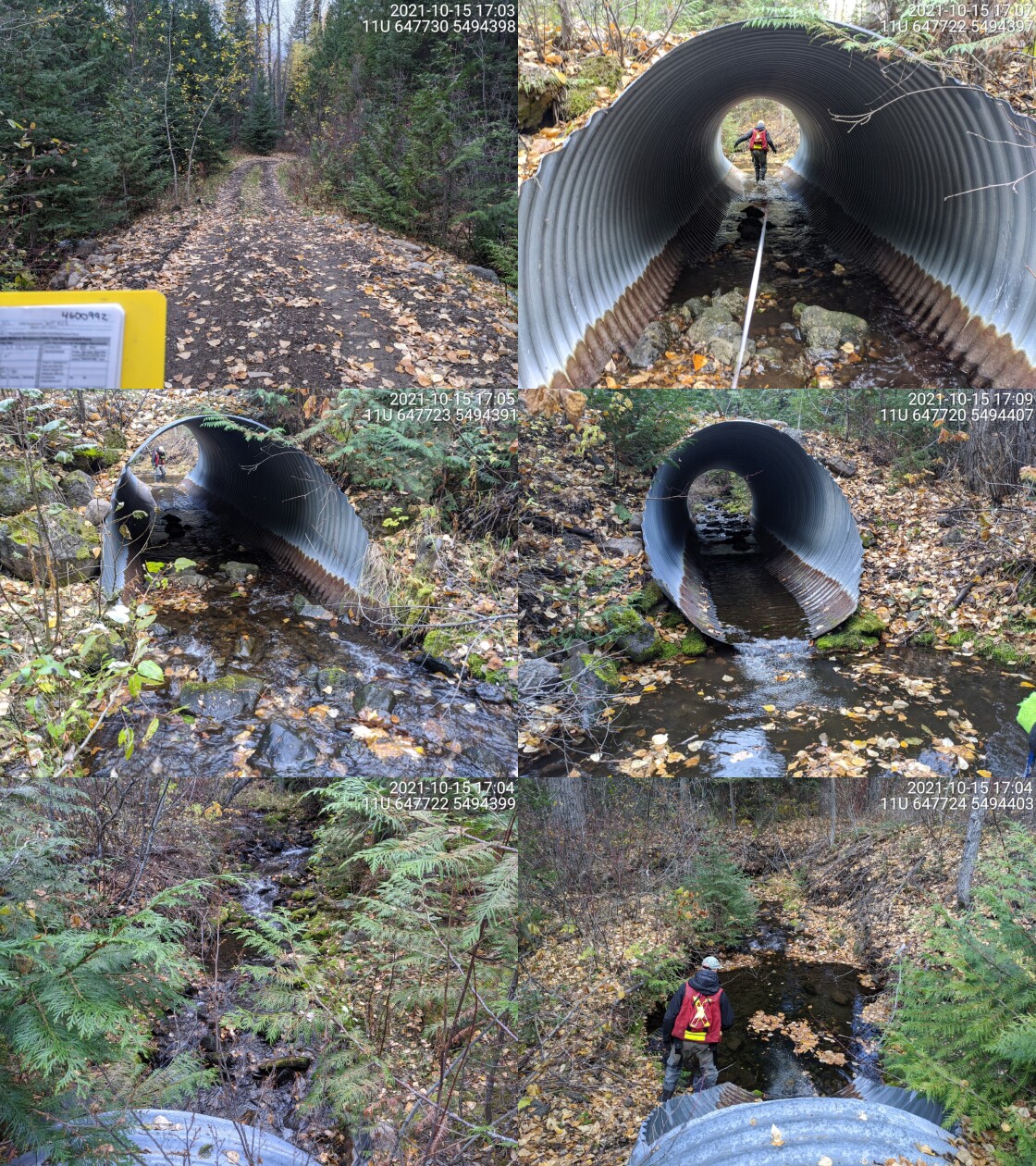
|
|||
| Comments: Embedded for approxmately 8m from the inlet. Small water supply dam located upstream of culvert ~45m. Structure is ~1m high. 17:00 |
| Location and Stream Data |
|
Crossing Characteristics | – |
|---|---|---|---|
| Date | 2021-09-28 | Crossing Sub Type | Ford |
| PSCIS ID | 197867 | Diameter (m) | – |
| External ID | 4603553 | Length (m) | – |
| Crew | KP | Embedded | – |
| UTM Zone | 11 | Depth Embedded (m) | – |
| Easting | 664112 | Resemble Channel | – |
| Northing | 5445241 | Backwatered | – |
| Stream | Tributary to Bighorn Creek | Percent Backwatered | – |
| Road | Spur | Fill Depth (m) | – |
| Road Tenure | Unknown | Outlet Drop (m) | – |
| Channel Width (m) | – | Outlet Pool Depth (m) | – |
| Stream Slope (%) | – | Inlet Drop | – |
| Beaver Activity | – | Slope (%) | – |
| Habitat Value | – | Valley Fill | – |
| Final score | 0 | Barrier Result | Unknown |
| Fix type | – | Fix Span / Diameter | – |
Photos: PSCIS ID 197867. From top left clockwise: Road/Site Card, Barrel, Outlet, Downstream, Upstream, Inlet.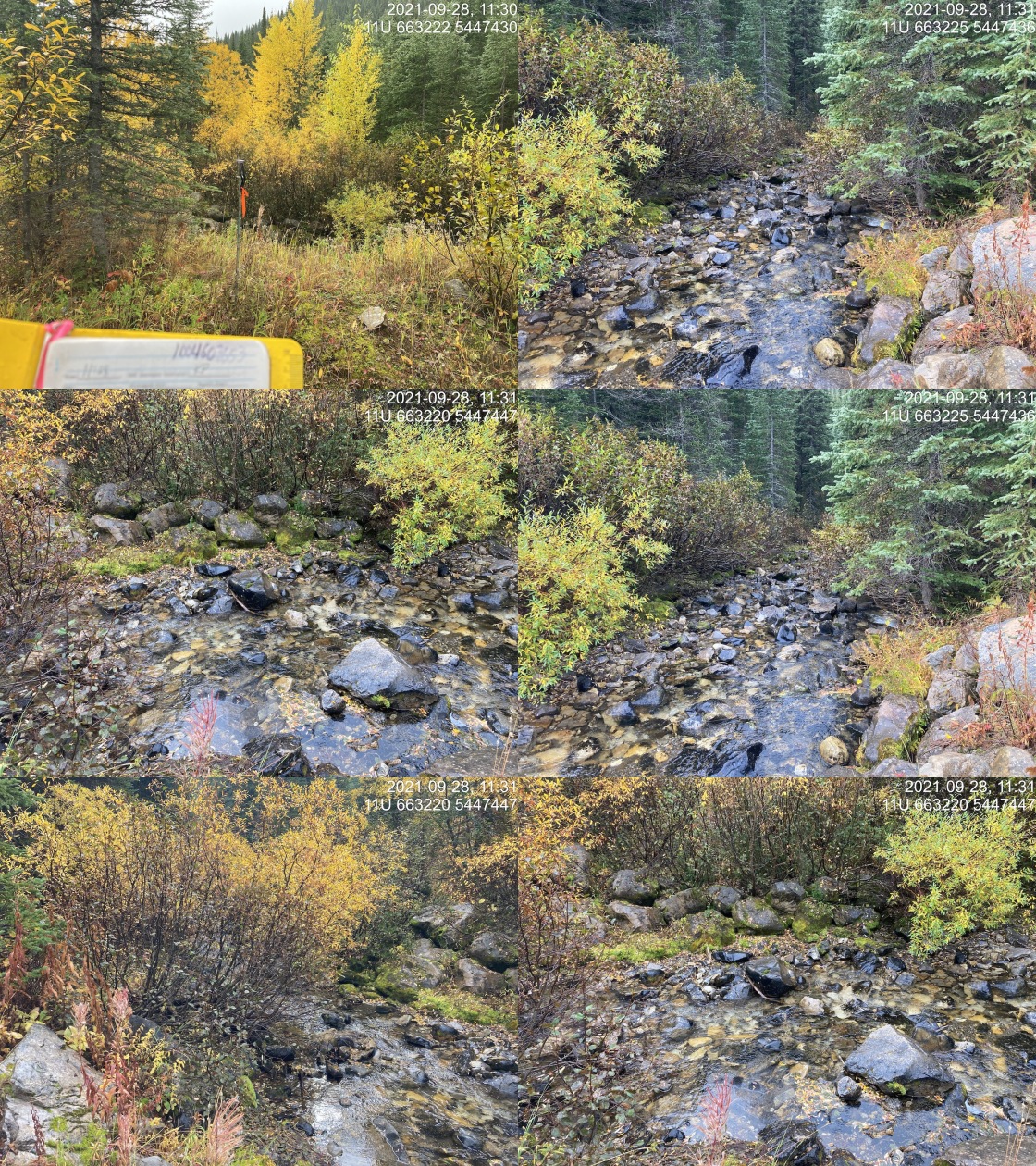
|
|||
| Comments: Inactive road. Thick alders. Walked in from Cabin FSR. 11:28 |
| Location and Stream Data |
|
Crossing Characteristics | – |
|---|---|---|---|
| Date | 2021-10-03 | Crossing Sub Type | Ford |
| PSCIS ID | 197868 | Diameter (m) | – |
| External ID | 4602849 | Length (m) | – |
| Crew | KP | Embedded | – |
| UTM Zone | 11 | Depth Embedded (m) | – |
| Easting | 681898 | Resemble Channel | – |
| Northing | 5430912 | Backwatered | – |
| Stream | Tributary to Calder Creek | Percent Backwatered | – |
| Road | Spur | Fill Depth (m) | – |
| Road Tenure | Unknown | Outlet Drop (m) | – |
| Channel Width (m) | – | Outlet Pool Depth (m) | – |
| Stream Slope (%) | – | Inlet Drop | – |
| Beaver Activity | – | Slope (%) | – |
| Habitat Value | – | Valley Fill | – |
| Final score | 0 | Barrier Result | Unknown |
| Fix type | – | Fix Span / Diameter | – |
Photos: PSCIS ID 197868. From top left clockwise: Road/Site Card, Barrel, Outlet, Downstream, Upstream, Inlet.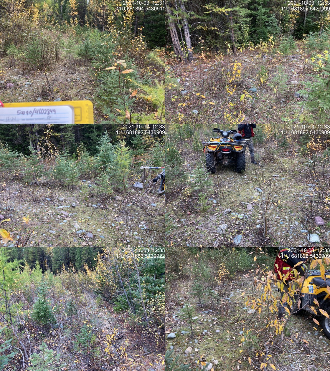
|
|||
| Comments: Inactive road. Site was assessed because of good flows upstream at PSCIS crossing 50092 and documentation of culvert at 50090. However, no culvert or evidence of stream channel located in area. 12:24 |
##this is just here so we can clear our environment for tests
knitr::opts_chunk$set(echo=FALSE, message=FALSE, warning=FALSE)
source('R/packages.R')
source('R/functions.R')
source('R/tables.R')
my_site <- 61504