42 Mile Creek - 198687 - Appendix
Site Location
PSCIS crossing 198687 is located on 42 Mile Creek approximately 23km south of the community of McLeod Lake. This site is located on Highway 97, approximately 1km upstream from the confluence with the Crooked River.
Background
At crossing 198687, 42 Mile Creek is a fourth order stream with a watershed area upstream of the crossing of approximately 9.8km2. The elevation of the watershed ranges from a maximum of 1066m to 692m at the crossing (Table 5.19). Upstream of crossing 198687, rainbow trout have previously been recorded (Norris [2018] 2024).
A summary of habitat modelling outputs is presented in Table 5.20. A map of the watershed is provided in map attachment 093J.118.
fpr::fpr_table_wshd_sum(site_id = my_site) %>%
  fpr::fpr_kable(caption_text = paste0('Summary of derived upstream watershed statistics for PSCIS crossing ', my_site, '.'),
           footnote_text = 'Elev P60 = Elevation at which 60% of the watershed area is above',
scroll = F)| Site | Area Km | Elev Site | Elev Max | Elev Median | Elev P60 | Aspect |
|---|---|---|---|---|---|---|
| 198687 | 9.8 | 692 | 1066 | 909 | 892 | SSW |
| * Elev P60 = Elevation at which 60% of the watershed area is above |
| Habitat | Potential | Remediation Gain | Remediation Gain (%) |
|---|---|---|---|
| BT Rearing (km) | 4.3 | 2.9 | 67 |
| BT Spawning (km) | 2.9 | 1.6 | 55 |
| BT Network (km) | 27.9 | 11.2 | 40 |
| BT Stream (km) | 26.6 | 10.8 | 41 |
| BT Lake Reservoir (ha) | 1.5 | 0.1 | 7 |
| BT Wetland (ha) | 6.9 | 3.4 | 49 |
| BT Slopeclass03 (km) | 2.0 | 0.4 | 20 |
| BT Slopeclass05 (km) | 4.9 | 1.1 | 22 |
| BT Slopeclass08 (km) | 7.9 | 4.2 | 53 |
| BT Slopeclass15 (km) | 10.5 | 4.6 | 44 |
| * Model data is preliminary and subject to adjustments. |
Stream Characteristics at Crossing
At the time of the survey, PSCIS crossing 198687 was backwatered and embedded - ranking as a passable - according to the provincial protocol (MoE 2011) (Table 5.21). Water temperature was 7.4\(^\circ\)C, pH was 6.8 and conductivity was 411uS/cm.
Although the crossing appeared to be passable at the time of assessment it was noted that recent work had been completed to dredge out the stream channel upstream and downstream of the highway. This indicated that the structure currently in place was not appropriate for the site and that replacement of the crossing could be beneficial from a highway maintenance perspective as well as for reducing impacts on the potentially higher value habitat located immediately adjacent to the road (extensive gravels suitable for spawning). For this reason, a habitat confirmation assessment was completed to gatehr data on the value of the habitat upstream and downstream of the crossing.
| Location and Stream Data |
|
Crossing Characteristics | – |
|---|---|---|---|
| Date | 2023-08-26 | Crossing Sub Type | Round Culvert |
| PSCIS ID | 198687 | Diameter (m) | 2 |
| External ID | – | Length (m) | 26 |
| Crew | AI | Embedded | Yes |
| UTM Zone | 10 | Depth Embedded (m) | 0.25 |
| Easting | 510950.3 | Resemble Channel | Yes |
| Northing | 6072479 | Backwatered | Yes |
| Stream | 42 Mile Creek | Percent Backwatered | 100 |
| Road | Highway 97 | Fill Depth (m) | 1.5 |
| Road Tenure | MOTI | Outlet Drop (m) | 0 |
| Channel Width (m) | 2.5 | Outlet Pool Depth (m) | 0.3 |
| Stream Slope (%) | 1.5 | Inlet Drop | No |
| Beaver Activity | No | Slope (%) | 0.5 |
| Habitat Value | High | Valley Fill | Deep Fill |
| Final score | 11 | Barrier Result | Passable |
| Fix type | – | Fix Span / Diameter | – |
Photos: From top left clockwise: Road/Site Card, Barrel, Outlet, Downstream, Upstream, Inlet.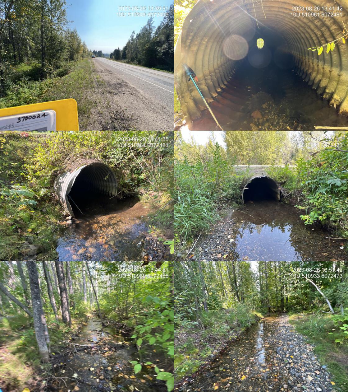
|
|||
| Comments: Nice stream with good flow and abundant gravel, suitably sized for spawning. Culvert is 100% backwatered and fully embedded. It appears as though there have been some very high flow events that have moved significant amounts of gravel, substrate, upstream and downstream. See photos. Channel seems overly straight and deep so suspect machine work has been done to dredge out the crossing, upstream and downstream. Ministry of Transportation chris_culvert_id: 1997302. 13:37:33 |
Stream Characteristics Downstream
The stream was surveyed downstream from crossing 198687 for 200m (Figures 5.30 - 5.31). Total cover amount was rated as abundant with overhanging vegetation dominant. Cover was also present as large woody debris.The average channel width was 2.9m, the average wetted width was 1.6m, and the average gradient was 2.2%.The dominant substrate was gravels with cobbles sub-dominant. Throughout the area surveyed there were signs of beaver activity and patches of gravel present suitable for rainbow trout spawning. The habitat was rated as NA value for salmonid rearing and spawning.
Stream Characteristics Upstream
The stream was surveyed upstream from crossing 198687 for 600m (Figures 5.32 - 5.35). The dominant substrate was cobbles with gravels sub-dominant.Total cover amount was rated as moderate with large woody debris dominant. Cover was also present as undercut banks and overhanging vegetation.The average channel width was 3.1m, the average wetted width was 1.7m, and the average gradient was 2.8%. Survey notes indicate patches of gravel suitable for rainbow trout spawning, few deep pools suitable for overwintering and generallly moderate flow volume. Fry were spotted near culvert and ~450m upstream of the highway. It was noted that the stream flowed subsurface at a point approximately 550m upstream of culvert. The habitat was rated as medium value as an important migration corridor containing suitable rearing and spawning habitat.
Structure Remediation and Cost Estimate
Should restoration/maintenance activities proceed, replacement of PSCIS crossing 198687 with a bridge (15m span) is recommended. The cost of the work is estimated at $11,250,000.
Conclusion
There was 3.9km of habitat modelled upstream of crossing 198687 with areas surveyed rated as medium value for salmonid rearing and spawning.
Although the fish passage assessment metrics indicated the crossing to be passable at the time of assessment it was noted that it appeared as though recent work may have been completed to dredge out the stream channel upstream and downstream of the highway. This indicated that the structure currently in place was not appropriate for the site and that replacement of the crossing could be beneficial from a highway maintenance perspective as well as for reducing impacts on the potentially higher value habitat located immediately adjacent to the road (extensive gravels suitable for spawning). For this reason, a habitat confirmation assessment was completed to gather data on the value of the habitat upstream and downstream of the crossing.
PSCIS crossing 198687 on 42 Mile Creek was ranked as a moderate priority for proceeding to design for replacement. The project team plans to follow up with the Ministry of Transportation and Infrastructure to discuss the potential for replacement of the structure and to provide the necessary data to support the replacement if it is deemed helpful.
tab_hab_summary %>%
  filter(Site  == my_site) %>%
  # select(-Site) %>%
  fpr::fpr_kable(caption_text = paste0('Summary of habitat details for PSCIS crossing ', my_site, '.'),
scroll = F) | Site | Location | Length Surveyed (m) | Channel Width (m) | Wetted Width (m) | Pool Depth (m) | Gradient (%) | Total Cover | Habitat Value |
|---|---|---|---|---|---|---|---|---|
| 198687 | Downstream | 200 | 2.9 | 1.6 | 0.6 | 2.2 | abundant | – |
| 198687 | Upstream | 600 | 3.1 | 1.7 | 0.3 | 2.8 | moderate | medium |
my_photo1 = fpr::fpr_photo_pull_by_str(str_to_pull = '_ds_typical1')

my_caption1 = paste0('Typical habitat downstream of PSCIS crossing ', my_site, '.')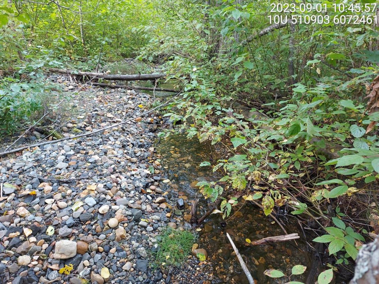
Figure 5.30: Typical habitat downstream of PSCIS crossing 198687.
my_photo2 = fpr::fpr_photo_pull_by_str(str_to_pull = '_ds_typical2')

my_caption2 = paste0('Typical habitat downstream of PSCIS crossing ', my_site, '.')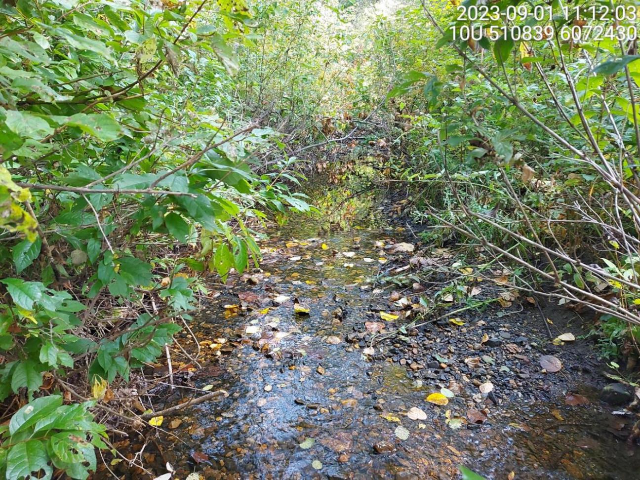
Figure 5.31: Typical habitat downstream of PSCIS crossing 198687.
my_caption <- paste0('Left: ', my_caption1, ' Right: ', my_caption2)

knitr::include_graphics(my_photo1)
knitr::include_graphics("fig/pixel.png")
knitr::include_graphics(my_photo2)
my_photo1 = fpr::fpr_photo_pull_by_str(str_to_pull = '_us_typical1')
my_caption1 = paste0('Typical habitat upstream of PSCIS crossing ', my_site, '.')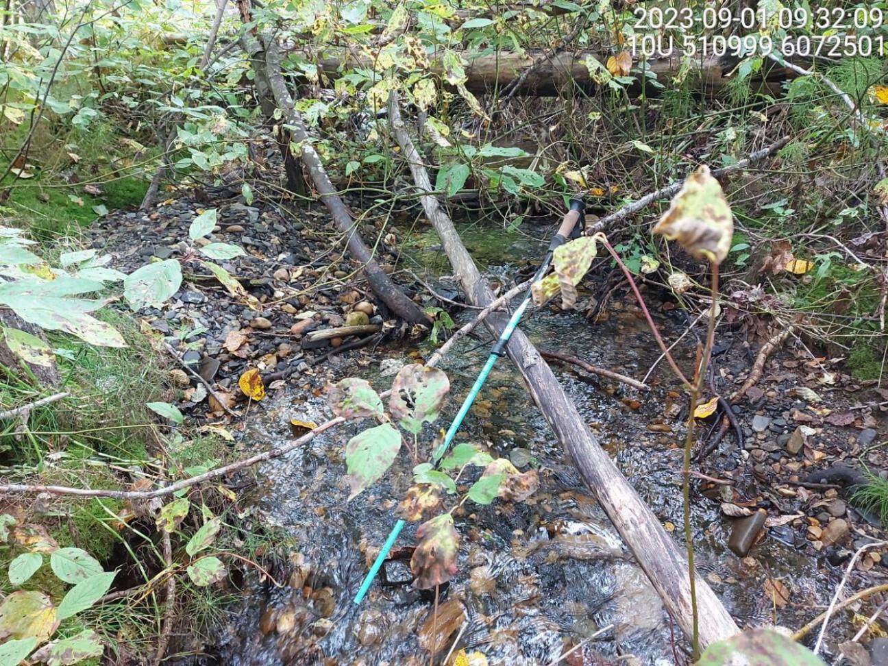
Figure 5.32: Typical habitat upstream of PSCIS crossing 198687.
my_photo2 = fpr::fpr_photo_pull_by_str(str_to_pull = '_us_typical2')

my_caption2 = paste0('Typical habitat upstream of PSCIS crossing ', my_site, '.')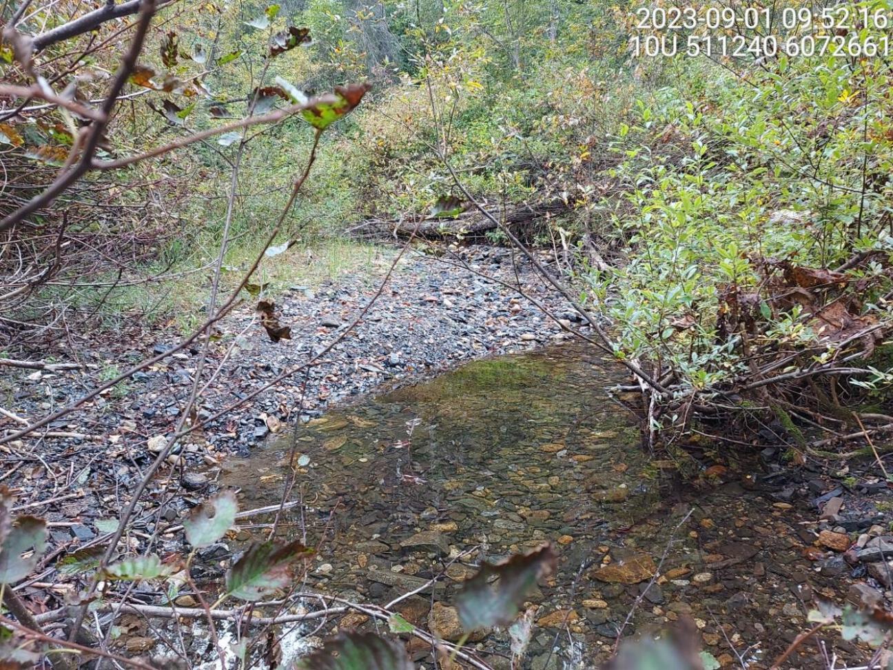
Figure 5.33: Typical habitat upstream of PSCIS crossing 198687.
my_caption <- paste0('Left: ', my_caption1, ' Right: ', my_caption2)

knitr::include_graphics(my_photo1)
knitr::include_graphics("fig/pixel.png")
knitr::include_graphics(my_photo2)
my_photo1 = fpr::fpr_photo_pull_by_str(str_to_pull = '_u3_')
my_caption1 = paste0('Typical habitat upstream of PSCIS crossing ', my_site, '.')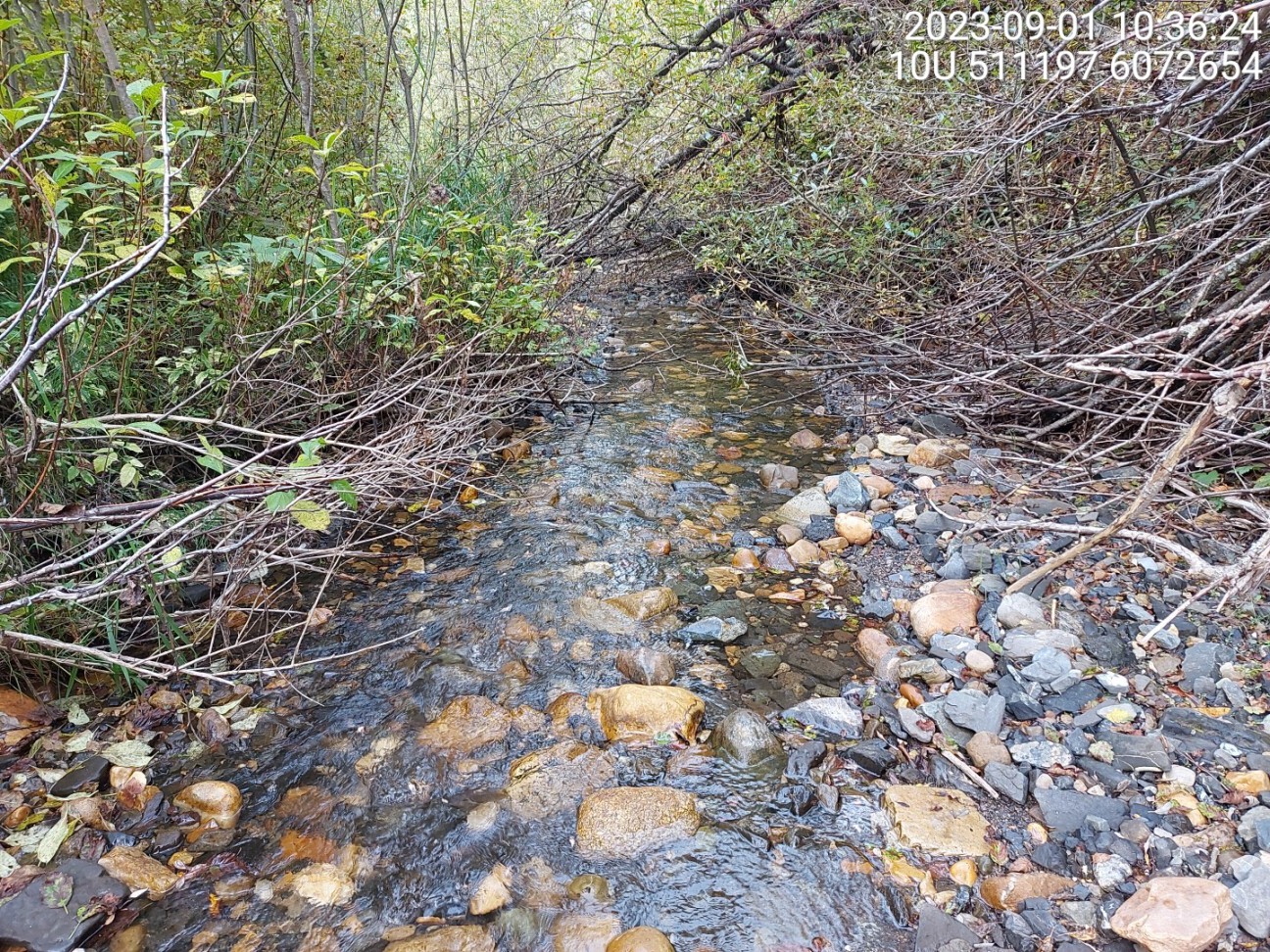
Figure 5.34: Typical habitat upstream of PSCIS crossing 198687.
my_photo2 = fpr::fpr_photo_pull_by_str(str_to_pull = '_u4_')

my_caption2 = paste0('Typical habitat upstream of PSCIS crossing ', my_site, '.')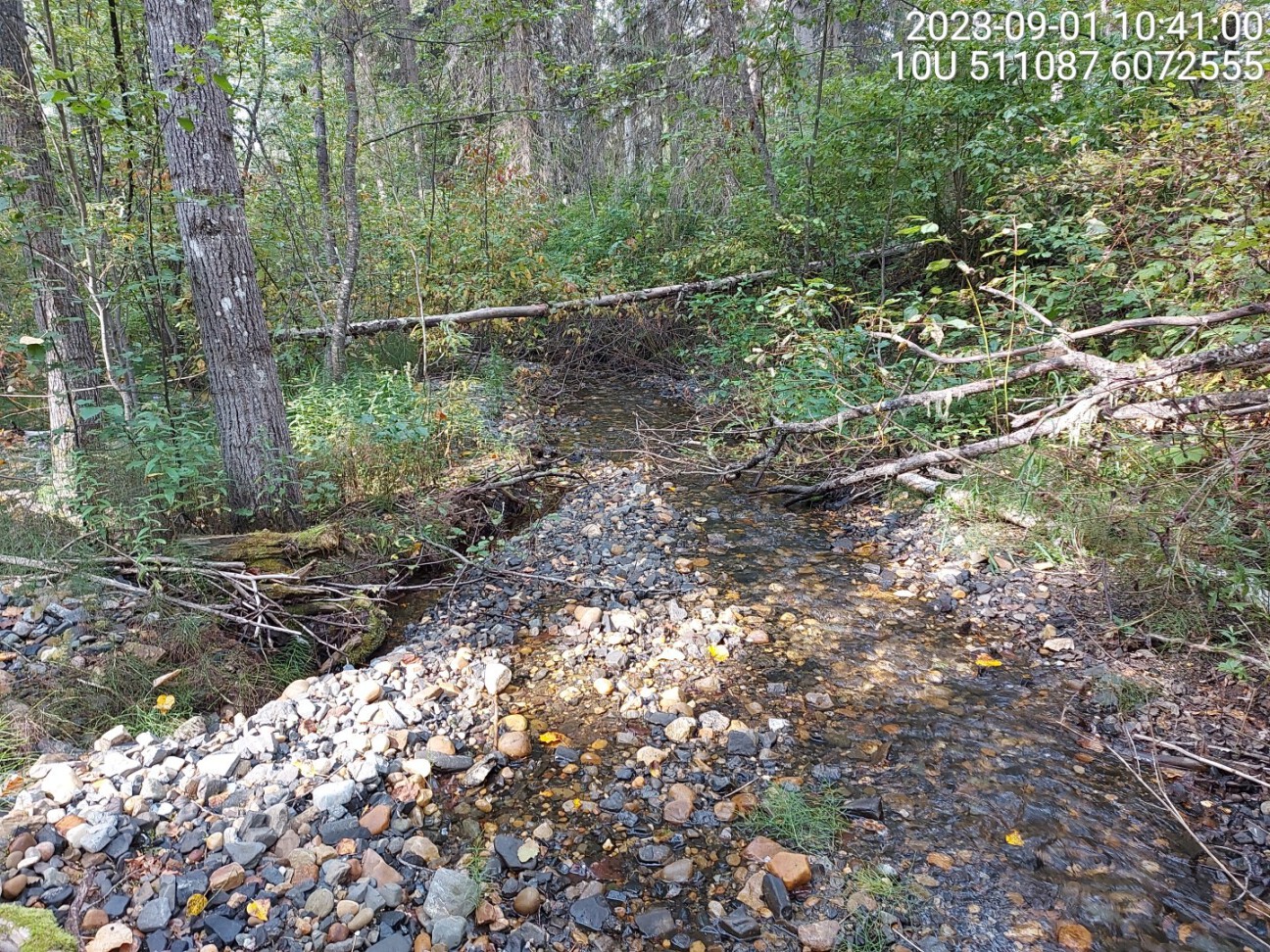
Figure 5.35: Typical habitat upstream of PSCIS crossing 198687.
my_caption <- paste0('Left: ', my_caption1, ' Right: ', my_caption2)

knitr::include_graphics(my_photo1)
knitr::include_graphics("fig/pixel.png")
knitr::include_graphics(my_photo2)