Tributary to Coal Creek - 8525 - Appendix
Site Location
PSCIS crossing 8525 on a Tributary to Coal Creek is located on McDonell FSR approximately 7.5km west of the downstream end of McDonnell Lake. The road at the crossing location is the responsibility of the Ministry of Forests.
Background
At crossing 8525, Tributary to Coal Creek is a second order stream with an upstream watershed area of approximately 1.6km2. The elevation of the watershed ranges from a maximum of 1177m to 850m near the crossing (Table 5.21). The stream flows in a south-west direction into Coal Creek approximately 0.8km downstream of McDonell FSR.
The crossing was originally assessed with a fish passage assessment by Viveiros (2011) in 2010. The site was re-assessed in 2022 and ranked as a moderate priority for follow up in A. Irvine and Wintersheidt (2023) due to relatively low mapped gradients, the crossing’s proximity to Coal Creek, and relatively good flow volumes. Upstream of the crossing, dolly varden have been documented in the past (Norris [2018] 2024; MoE 2024b). In 2022, minnow traps were set at crossing 8525 to scope for coho presence with only dolly varden captured. Revisited in 2023, surveyors conducted a habitat confirmation assessment and electrofishing with results included in this memo.
fpr::fpr_table_wshd_sum(site_id = my_site) %>%
  fpr::fpr_kable(caption_text = paste0('Summary of derived upstream watershed statistics for PSCIS crossing ', my_site, '.'),
           footnote_text = 'Elev P60 = Elevation at which 60% of the watershed area is above',
scroll = F)| Site | Area Km | Elev Site | Elev Max | Elev Median | Elev P60 | Aspect |
|---|---|---|---|---|---|---|
| 8525 | 1.6 | 850 | 1177 | 1052 | 1028 | SSW |
| * Elev P60 = Elevation at which 60% of the watershed area is above |
A summary of habitat modelling outputs is presented in Table 5.22. A map of the watershed is provided in map attachment 093L.121.
| Habitat | Potential | Remediation Gain | Remediation Gain (%) |
|---|---|---|---|
| ST Network (km) | 5.0 | 5.0 | 100 |
| ST Lake Reservoir (ha) | 1.2 | 1.2 | 100 |
| ST Wetland (ha) | 0.0 | 0.0 | – |
| ST Slopeclass03 Waterbodies (km) | 0.0 | 0.0 | – |
| ST Slopeclass03 (km) | 1.2 | 1.2 | 100 |
| ST Slopeclass05 (km) | 1.4 | 1.4 | 100 |
| ST Slopeclass08 (km) | 1.1 | 1.1 | 100 |
| ST Spawning (km) | 0.0 | 0.0 | – |
| ST Rearing (km) | 0.9 | 0.9 | 100 |
| CH Spawning (km) | 0.0 | 0.0 | – |
| CH Rearing (km) | 0.0 | 0.0 | – |
| CO Spawning (km) | 0.0 | 0.0 | – |
| CO Rearing (km) | 0.0 | 0.0 | – |
| CO Rearing (ha) | 0.0 | 0.0 | – |
| SK Spawning (km) | 0.0 | 0.0 | – |
| SK Rearing (km) | 0.0 | 0.0 | – |
| SK Rearing (ha) | 0.0 | 0.0 | – |
| * Model data is preliminary and subject to adjustments. |
Stream Characteristics at Crossing 8525
At the time of the survey in 2023, PSCIS crossing 8525 was un-embedded, non-backwatered and ranked as a barrier to upstream fish passage according to the provincial protocol (MoE 2011) (Table 5.23). There was a small blockage at the inlet and a 0.5m outlet drop. Water temperature was 6.7\(^\circ\)C, pH was 7.7 and conductivity was 133uS/cm.
| Location and Stream Data |
|
Crossing Characteristics | – |
|---|---|---|---|
| Date | 2023-09-18 | Crossing Sub Type | Round Culvert |
| PSCIS ID | 8525 | Diameter (m) | 0.9 |
| External ID | – | Length (m) | 28 |
| Crew | MW TP VJ | Embedded | No |
| UTM Zone | 9 | Depth Embedded (m) | – |
| Easting | 580998 | Resemble Channel | No |
| Northing | 6074681 | Backwatered | No |
| Stream | Tributary to Coal Creek | Percent Backwatered | – |
| Road | McDonell FSR | Fill Depth (m) | 2 |
| Road Tenure | MOF 7552 | Outlet Drop (m) | 0.5 |
| Channel Width (m) | 1.9 | Outlet Pool Depth (m) | 0.2 |
| Stream Slope (%) | 4 | Inlet Drop | No |
| Beaver Activity | No | Slope (%) | 1 |
| Habitat Value | Medium | Valley Fill | Deep Fill |
| Final score | 34 | Barrier Result | Barrier |
| Fix type | Replace Structure with Streambed Simulation CBS | Fix Span / Diameter | 3 |
Photos: From top left clockwise: Road/Site Card, Barrel, Outlet, Downstream, Upstream, Inlet.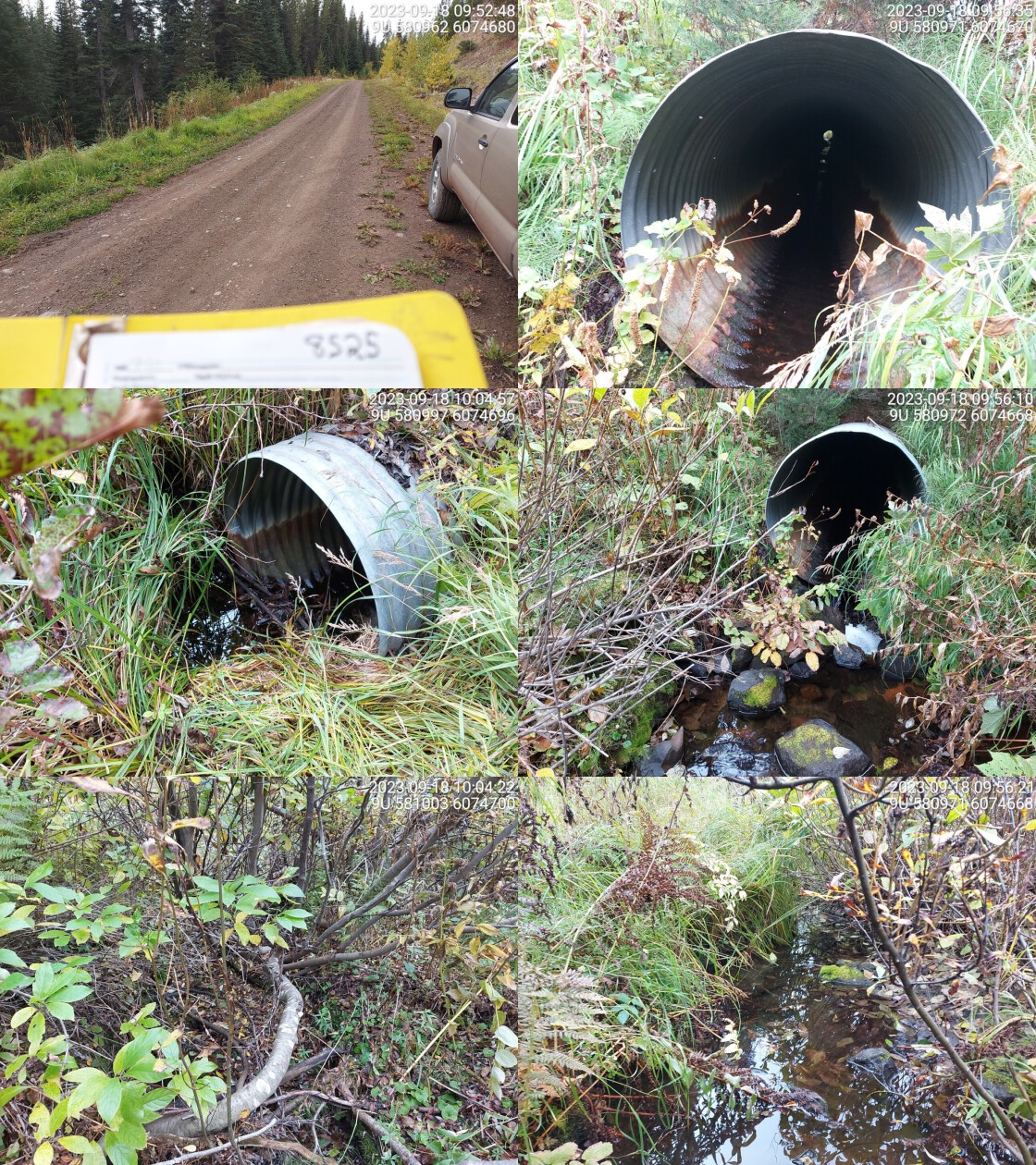
|
|||
| Comments: Small flowing stream. Fish captured in minnow traps in 2022.. 09:57:03 |
Stream Characteristics Downstream
The stream was surveyed downstream from crossing 8525 for 400m . The stream was noted to have intermittent dewatering, but good flow relative to other streams in the area given it was a very dry year. Water was noted as relatively turbid (Figure 5.18). There were few deep pools and abundant small gravels present throughout the area surveyed. Total cover amount was rated as moderate with undercut banks dominant. Cover was also present as small woody debris, large woody debris, and overhanging vegetation.The dominant substrate was gravels with cobbles sub-dominant.The average channel width was 1.8m, the average wetted width was 1.5m, and the average gradient was 6.2%. The habitat was rated as medium value for salmonid rearing and spawning.
Stream Characteristics Upstream
The stream was surveyed upstream from crossing 8525 for 600m (Figure 5.19). The average channel width was 1.9m, the average wetted width was 1.7m, and the average gradient was 1.4%.The dominant substrate was gravels with fines sub-dominant.Total cover amount was rated as moderate with undercut banks dominant. Cover was also present as small woody debris, large woody debris, and overhanging vegetation. There were isolated pools every 30 to 50m that were up to 55cm in depth, and abundant gravel throughout. The habitat was wetland in character dominated by fern, alder and mature spruce. The habitat was rated as medium for salmonid rearing and spawning.
Approximately 1.7km upstream of crossing 8525, PSCIS crossing 8529 was previously documented as a wooden box culvert. This site was reassessed in 2023 and the habitat adjacent to the structure assessed. The wooden box culvert had recently been replaced with a bridge. The stream was surveyed upstream from crossing 8529 for approximately 100m and was noted as having good flow for a small system on a dry year. The average channel width was 2m, the average wetted width was 1.5m, and the average gradient was 2.5%.Total cover amount was rated as moderate with undercut banks dominant. Cover was also present as small woody debris and overhanging vegetation.The dominant substrate was gravels with cobbles sub-dominant. (Figure 5.20 - 5.21). The dominant substrate was gravels with cobbles sub-dominant.The average channel width was 2m, the average wetted width was 1.5m, and the average gradient was 2.5%.Total cover amount was rated as moderate with undercut banks dominant. Cover was also present as small woody debris and overhanging vegetation. The habitat was rated as medium value for salmonid rearing and spawning.
Fish Sampling
As noted, in 2022, minnow traps were set at 8525 to scope for coho presence. Dolly varden were captured both above and below the crossing, with fish sampling data here
During the 2023 survey, electrofishing was conducted at three sites above and three sites below crossing 8525, with results summarised in Tables 5.25 - 5.26 and Figure 5.17. A total of 9 dolly varden were captured upstream, and 19 fish were captured downstream, including dolly varden and rainbow trout (Figures 5.22 - 5.23). All fish captured with a fork length greater than 60mm were tagged with Passive Integrated Transponders (PIT tags) with data stored here.
Structure Remediation and Cost Estimate
Should restoration/maintenance activities proceed, replacement of PSCIS crossing 8525 with a streambed simulation (embedded culvert) recommended (3m span). Although preliminary - a rough cost of the work is estimated at $100,000.
Conclusion
There was 0.9km of steelhead rearing habitat modelled upstream of crossing 8525. Electrofishing surveys in 2023 captured dolly varden upstream of the FSR and rainbow trout and dolly varden downstream. Although no coho were captured during assessments in 2022 or 2023, these species may have populated the system in the past as it is connected to Coal Creek ~800m downstream, where historic presence of coho has been confirmed [Norris ([2018] 2024); ; MoE (2024b)]. Electrofishing results from the site indicate the stream is a productive for dolly varden providing flows suitable for rearing and spawning. The site was rated as a moderate priority for replacement containing medium value for salmonid rearing and spawning.
tab_hab_summary %>%
  filter(Site  == my_site) %>%
  # select(-Site) %>%
  fpr::fpr_kable(caption_text = paste0('Summary of habitat details for PSCIS crossing ', my_site, '.'),
scroll = F) | Site | Location | Length Surveyed (m) | Channel Width (m) | Wetted Width (m) | Pool Depth (m) | Gradient (%) | Total Cover | Habitat Value |
|---|---|---|---|---|---|---|---|---|
| 8525 | Downstream | 400 | 1.8 | 1.5 | 0.2 | 6.2 | moderate | Medium |
| 8525 | Upstream | 600 | 1.9 | 1.7 | 0.4 | 1.4 | moderate | Medium |
| 8525 | Upstream2 | 105 | 2.0 | 1.5 | 0.2 | 2.5 | moderate | Medium |
| site | passes | ef_length_m | ef_width_m | area_m2 | enclosure |
|---|---|---|---|---|---|
| 8525_ds_ef1 | 1 | 8 | 1.80 | 14.4 | Open |
| 8525_ds_ef2 | 1 | 11 | 1.47 | 16.2 | Open |
| 8525_ds_ef3 | 1 | 13 | 1.13 | 14.7 | Open |
| 8525_us_ef1 | 1 | 8 | 1.50 | 12.0 | Open |
| 8525_us_ef2 | 1 | 40 | 1.35 | 54.0 | Open |
| 8525_us_ef3 | 1 | 1 | 1.63 | 1.6 | Open |
| local_name | species_code | life_stage | catch | density_100m2 | nfc_pass |
|---|---|---|---|---|---|
| 8525_ds_ef1 | DV | parr | 2 | 13.9 | FALSE |
| 8525_ds_ef1 | RB | fry | 12 | 83.3 | FALSE |
| 8525_ds_ef2 | DV | parr | 3 | 18.5 | FALSE |
| 8525_ds_ef3 | DV | parr | 2 | 13.6 | FALSE |
| 8525_us_ef1 | DV | parr | 3 | 25.0 | FALSE |
| 8525_us_ef2 | DV | parr | 2 | 3.7 | FALSE |
| 8525_us_ef2 | DV | juvenile | 1 | 1.9 | FALSE |
| 8525_us_ef3 | DV | parr | 3 | 187.5 | FALSE |
|
* nfc_pass FALSE means fish were captured in final pass indicating more fish of this species/lifestage may have remained in site. Mark-recaptured required to reduce uncertainties. |
my_caption <- paste0('Densites of fish (fish/100m2) captured upstream and downstream of PSCIS crossing ', my_site, '.')

fpr_plot_fish_box() 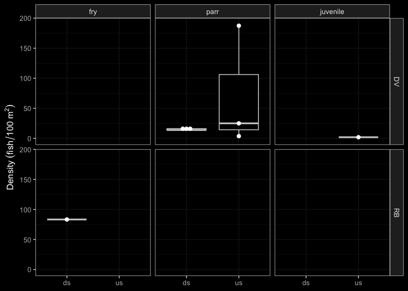
Figure 5.17: Densites of fish (fish/100m2) captured upstream and downstream of PSCIS crossing 8525.
my_photo1 = fpr::fpr_photo_pull_by_str(str_to_pull = 'ds_typical_1_')

my_caption1 = paste0('Typical habitat downstream of PSCIS crossing ', my_site, '.')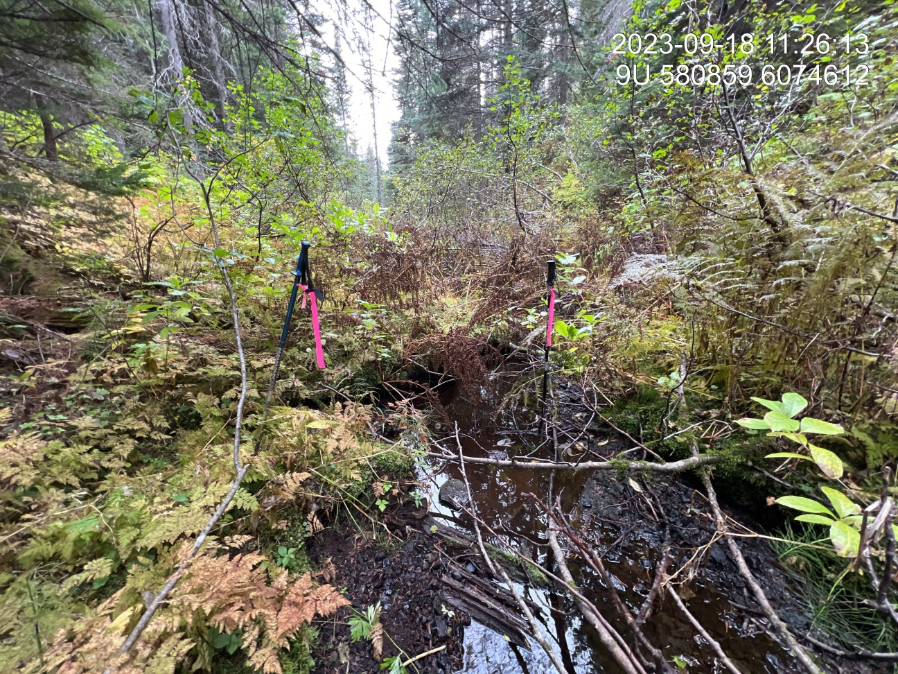
Figure 5.18: Typical habitat downstream of PSCIS crossing 8525.
my_photo2 = fpr::fpr_photo_pull_by_str(str_to_pull = 'us_typical_2')

my_caption2 = paste0('Typical habitat upstream of PSCIS crossing ', my_site, '.')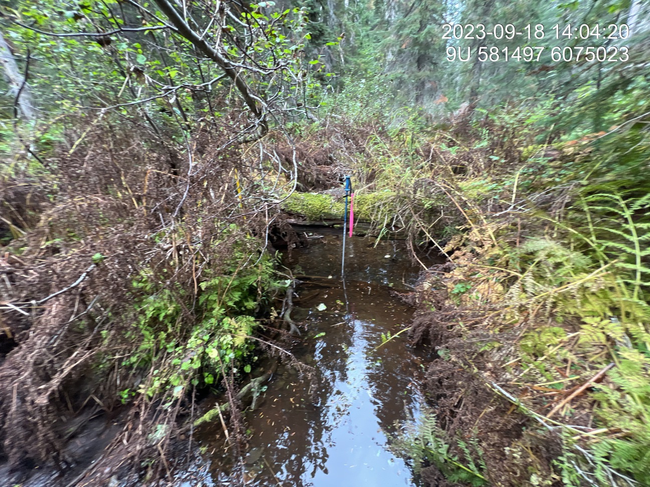
Figure 5.19: Typical habitat upstream of PSCIS crossing 8525.
my_caption <- paste0('Left: ', my_caption1, ' Right: ', my_caption2)

knitr::include_graphics(my_photo1)
knitr::include_graphics("fig/pixel.png")
knitr::include_graphics(my_photo2)
my_photo1 = fpr::fpr_photo_pull_by_str(str_to_pull = 'us2_typical_2')
my_caption1 = paste0('Typical habitat upstream of PSCIS crossing ', my_site2, '.')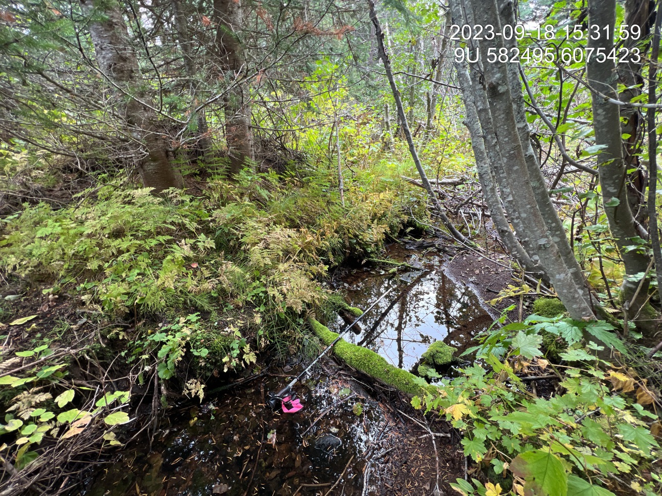
Figure 5.20: Typical habitat upstream of PSCIS crossing 8529.
my_photo2 = fpr::fpr_photo_pull_by_str(str_to_pull = '_us2_pool')

my_caption2 = paste0('Typical pool habitat at PSCIS crossing ', my_site2, '.')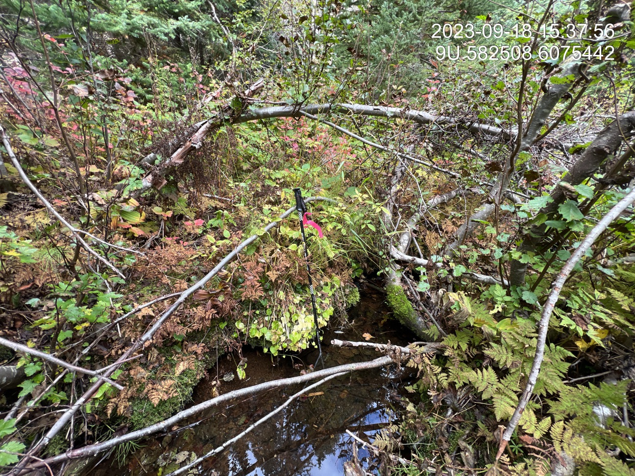
Figure 5.21: Typical pool habitat at PSCIS crossing 8529.
my_caption <- paste0('Left: ', my_caption1, ' Right: ', my_caption2)

knitr::include_graphics(my_photo1)
knitr::include_graphics("fig/pixel.png")
knitr::include_graphics(my_photo2)
my_photo1 = fpr::fpr_photo_pull_by_str(str_to_pull = 'fish1')
my_caption1 = paste0('Rainbow trout captured downstream of crossing ', my_site, '.')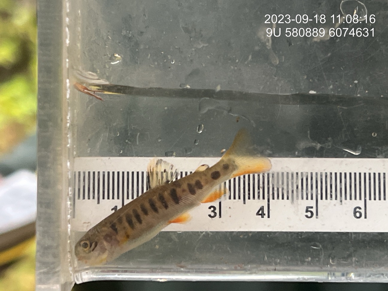
Figure 5.22: Rainbow trout captured downstream of crossing 8525.
my_photo2 = fpr::fpr_photo_pull_by_str(str_to_pull = 'fish2')

my_caption2 = paste0('Dolly varden captured upstream of crossing ', my_site, '.')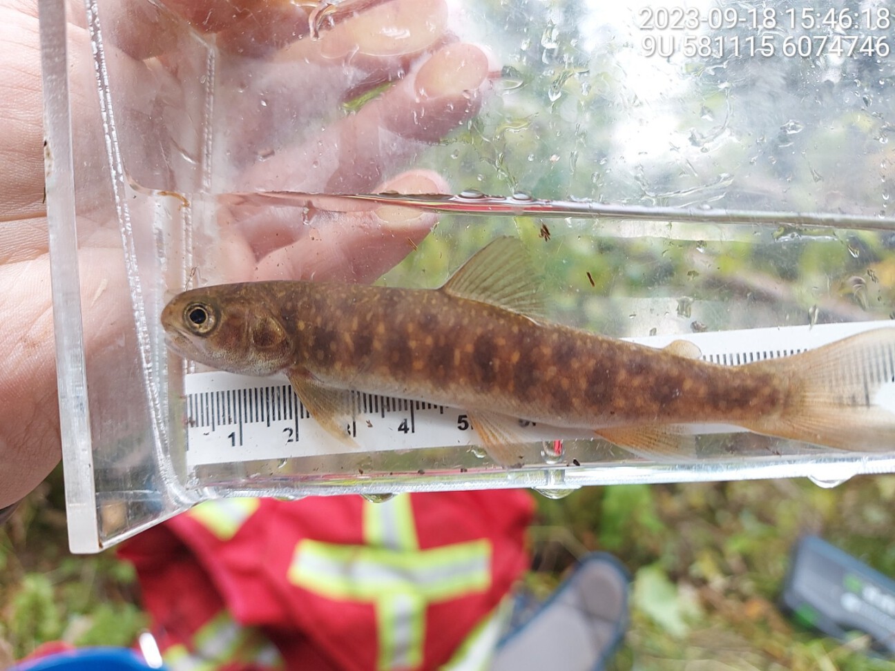
Figure 5.23: Dolly varden captured upstream of crossing 8525.
my_caption <- paste0('Left: ', my_caption1, ' Right: ', my_caption2)

knitr::include_graphics(my_photo1)
knitr::include_graphics("fig/pixel.png")
knitr::include_graphics(my_photo2)